14207+1210 HO 541
14h 20m 41.13s +12° 09' 59.6" P.A. 89.00 sep 2.6 mag 11.00,11.90 Sp F2
| Coord 2000 |
14207+1210 |
|
Discov num |
HO 541 |
|
Comp |
|
|
Coord arcsec 2000 |
14 20 41.13 +12 09 59.6 |
|
| Date first |
1896 |
|
Date last |
2017 |
|
Obs |
22 |
|
| Pa first |
87 |
|
Pa last |
88.9 |
|
P.A. Now (θ) |
88.9° |
|
| Sep first |
1.9 |
|
Sep last |
2.622 |
|
Sep. Now (ρ) |
2.622" |
|
| Mag pri |
11.00 |
|
Mag sec |
11.90 |
|
delta mag (ΔM) |
0.9 |
|
Spectral class |
F2 (yellow-white) |
|
| Pri motion ra |
-011 |
|
Sec motion ra |
|
|
| Pri motion dec |
+012 |
|
Sec motion dec |
|
|
| Notes |
|
|
Nature of this double is uncertain.
OTHER CATALOGS AND DESIGNATIONS
| Constellation |
Bootes |
|
Tycho2 |
0912-00688-1 |
|
Gaia DR2 |
1225967838771623424 |
|
WDS 14207+1210 HO 541 : NOTES
No records found.
REFERENCES
| refcode |
metd |
author |
reference |
| Ho_1883 |
Ma j |
Hough, G.W. |
1883MNRAS..43..371H |
| Ho_1883 |
|
MNRAS 43, 371, 1883 (data also in Ho_1890) |
1890AN....125....1H |
| Ho_1884 |
Ma j |
Hough, G.W. |
1884MNRAS..44..365H |
| Ho_1884 |
|
MNRAS 44, 365, 1884 (data also in Ho_1890) |
1890AN....125....1H |
| Ho_1885 |
Ma j |
Hough, G.W. |
1885MNRAS..45..417H |
| Ho_1885 |
|
MNRAS 45, 417, 1885 (data also in Ho_1890) |
1890AN....125....1H |
| Ho_1886 |
Ma j |
Hough, G.W. |
1886MNRAS..46..393H |
| Ho_1886 |
|
MNRAS 46, 393, 1886 (data also in Ho_1890) |
1890AN....125....1H |
| Ho_1887 |
Ma j |
Hough, G.W. |
1887AN....116..273H |
| Ho_1887 |
|
AN 116, 273, 1887 |
|
| Ho_1890 |
Ma j |
Hough, G.W. |
1890AN....125....1H |
| Ho_1890 |
|
AN 125, 1, 1890 |
|
| Ho_1890b |
Ma j |
Hough, G.W. |
1890AJ......9..177H |
| Ho_1890b |
|
AJ 9, 177, 1890 (some data also in Ho_1890 or Ho_1894b) |
1890AN....125....1H |
| Ho_1894a |
Ma - |
Hough, G.W. |
1894MNRAS..54..251H |
| Ho_1894a |
|
MNRAS 54, 251, 1894 |
|
| Ho_1894b |
Ma j |
Hough, G.W. (HO 304 - 490) |
1894AN....135..281H |
| Ho_1894b |
|
AN 135, 281, 1894 |
|
| Ho_1894c |
Ma - |
Hough, G.W. (measure by Dembowski, H.) |
1894AN....135..281H |
| Ho_1894c |
|
AN 135, 281, 1894 |
|
| Ho_1899a |
Ma j |
Hough, G.W. |
1899AN....149..65H |
| Ho_1899a |
|
AN 149, 65, 1899 |
|
| Ho_1899b |
Ma - |
Hough, G.W. (measure by Burnham, S.W.) |
1899AN....149..65H |
| Ho_1899b |
|
AN 149, 65, 1899 |
|
| Ho_1907 |
Ma - |
Hough, G.W. |
1907PFAO....3c...1D |
| Ho_1907 |
|
Pub. Univ. Penn. 3, Pt. 3, 1907 (measures sent to Doolittle) |
|
| Ho_1932A |
Ma - |
Hough, G.W. |
1932QB821.A43...... |
| Ho_1932A |
|
cited in ADS, 1932 (unpublished measures sent to Aitken in manuscript by Fox) |
|
WDS HISTORIC DATA
| coord_2000 |
discov_num |
comp |
epoch |
obs |
pa |
sep |
mag_pri |
mag_sec |
spectr |
notes |
coord_arcsec_2000 |
| 14207+1210 |
HO 541 |
|
2002 |
18 |
90 |
2.6 |
11.00 |
11.90 |
F2 |
|
142041.13+120959.6 |
| 14207+1210 |
HO 541 |
|
2017 |
21 |
89 |
2.6 |
11.00 |
11.90 |
F2 |
|
142041.13+120959.6 |
If you need more information about this double, apply for a
data request form to the WDS.
WDS 14207+1210 HO 541 : VISUAL OBSERVATIONS REPORTS
No records found.
WDS 14207+1210 HO 541 : MEASURES
No records found.
WDS 14207+1210 : VIRTUAL EYEPIECE

Click on the map to see the double of your interest.
Pass over with the mouse cursor to display the catalog designation.
|
|
WDS 14207+1210 : ALADIN DSS IMAGE @ 14h 20m 41.13s +12° 09' 59.6"
WDS 14207+1210 HO 541 : NEIGHBORHOODS
|
|
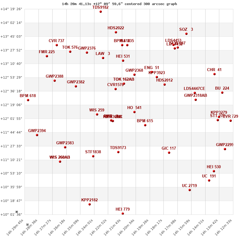
Click on the map to see the double of your interest.
Pass over with the mouse cursor to display the catalog designation.
|
| Show |
name |
coord_2000 |
discov# |
comp |
pa |
sep |
dist(') |
| Show |
|
14207+1210 |
HO 541 |
|
89 |
2.6 |
|
| Show |
|
14198+1154 |
BPM 615 |
|
150 |
110.5 |
21 |
| Show |
|
14226+1159 |
FMR 2 |
BC |
107 |
8.3 |
29 |
| Show |
|
14226+1159 |
HJ 236 |
AB |
285 |
23.1 |
29 |
| Show |
|
14226+1200 |
FMR 1 |
|
179 |
19.2 |
30 |
| Show |
|
14222+1239 |
CVR1576 |
|
257 |
3.6 |
37 |
| Show |
|
14215+1246 |
TOK 162 |
AB |
350 |
4.2 |
39 |
| Show |
|
14215+1246 |
TOK 162 |
AC |
345 |
16.4 |
39 |
| Show |
|
14238+1207 |
WIS 259 |
|
252 |
289.8 |
46 |
| Show |
|
14207+1257 |
GWP2368 |
|
108 |
15.9 |
48 |
| Show |
|
14182+1244 |
HDS2012 |
|
304 |
4.4 |
51 |
| Show |
|
14189+1254 |
KPP3923 |
|
8 |
1.9 |
52 |
| Show |
|
14220+1120 |
TDS9173 |
|
302 |
0.5 |
54 |
| Show |
|
14193+1300 |
ENG 51 |
|
219 |
164.2 |
55 |
| Show |
|
14179+1118 |
GIC 117 |
|
306 |
11.6 |
66 |
| Show |
|
14216+1315 |
HEI 531 |
|
261 |
1.4 |
67 |
| Show |
|
14241+1115 |
STF1838 |
|
335 |
9.4 |
75 |
| Show |
|
14156+1226 |
GWP2318 |
AB |
22 |
36.0 |
76 |
| Show |
|
14157+1234 |
LDS4447 |
CE |
259 |
17.2 |
77 |
| Show |
|
14255+1243 |
GWP2382 |
|
40 |
168.9 |
78 |
| Show |
|
14233+1318 |
LAW 3 |
|
276 |
0.6 |
79 |
| Show |
|
14214+1335 |
HJ 235 |
|
258 |
11.2 |
85 |
| Show |
|
14217+1334 |
BPM 616 |
|
169 |
34.2 |
86 |
| Show |
|
14174+1330 |
LDS4452 |
|
55 |
10.5 |
94 |
| Show |
|
14246+1325 |
GWP2376 |
|
22 |
546.8 |
95 |
| Show |
|
14264+1126 |
GWP2383 |
|
301 |
591.8 |
95 |
| Show |
|
14171+1331 |
SLW 987 |
|
85 |
9.5 |
97 |
| Show |
|
14175+1334 |
LDS4453 |
|
85 |
19.9 |
97 |
| Show |
|
14138+1200 |
STT 279 |
|
257 |
2.2 |
102 |
| Show |
|
14137+1204 |
KPP3279 |
|
41 |
3.0 |
103 |
| Show |
|
14222+1350 |
HDS2022 |
|
54 |
0.3 |
103 |
| Show |
|
14273+1249 |
GWP2388 |
|
158 |
149.7 |
105 |
| Show |
|
14141+1258 |
CHR 41 |
|
132 |
0.2 |
108 |
| Show |
|
14260+1326 |
TOK 576 |
|
121 |
999.9 |
109 |
| Show |
|
14135+1234 |
BU 224 |
|
101 |
0.6 |
109 |
| Show |
|
14268+1108 |
WIS 260 |
AB |
349 |
999.9 |
110 |
| Show |
|
14268+1108 |
WIS 260 |
AC |
341 |
999.9 |
110 |
| Show |
|
14268+1108 |
WIS 260 |
AD |
322 |
999.9 |
110 |
| Show |
|
14164+1348 |
SOZ 3 |
|
344 |
8.8 |
117 |
| Show |
|
14128+1159 |
CVR 729 |
|
200 |
10.2 |
117 |
| Show |
|
14161+1032 |
UC 2719 |
|
247 |
36.1 |
119 |
| Show |
|
14132+1124 |
GWP2299 |
|
264 |
462.0 |
119 |
| Show |
|
14287+1141 |
GWP2394 |
|
338 |
229.2 |
122 |
| Show |
|
14141+1056 |
HEI 530 |
|
353 |
0.5 |
122 |
| Show |
|
14145+1044 |
UC 191 |
|
85 |
13.3 |
125 |
| Show |
|
14271+1334 |
CVR 737 |
|
182 |
7.7 |
126 |
| Show |
|
14279+1320 |
FMR 225 |
|
92 |
3.9 |
127 |
| Show |
|
14217+1003 |
HEI 779 |
|
104 |
2.8 |
128 |
| Show |
|
14244+1014 |
KPP2182 |
|
85 |
17.9 |
129 |
| Show |
|
14295+1225 |
BPM 618 |
|
154 |
26.7 |
130 |
| Show |
|
14235+1416 |
TDS9182 |
|
120 |
0.4 |
133 |
|
|
WDS 14207+1210 : COMPONENTS
14207+1210 A
| Componente originario normalizzato |
AB |
|
Coord arcsec 2000 |
142041.13+120959.6 |
|
Mag |
11 |
|
Spectral class |
F2 (yellow-white) |
|
| PmRA |
-11.00 |
|
PmDE |
12.0 |
|
Tycho2 |
0912-00688-1 |
|
| Tycho2 |
0912-00688-1 |
|
Pflag |
|
|
RAmdeg |
215.17140294 |
|
DEmdeg |
12.16656897 |
|
| PmRA |
-14.4 |
|
PmDE |
13.1 |
|
E RAmdeg |
22 |
|
E DEmdeg |
27 |
|
| E pmRA |
1.6 |
|
E pmDE |
1.5 |
|
EpRAm |
1986.94 |
|
EpDEm |
1983.41 |
|
| Num |
5 |
|
Q RAmdeg |
5.5 |
|
Q DEmdeg |
0.6 |
|
Q pmRA |
5.2 |
|
| Q pmDE |
0.5 |
|
BTmag |
11.059 |
|
E BTmag |
0.050 |
|
VTmag |
10.643 |
|
| E VTmag |
0.049 |
|
Prox |
999 |
|
TYC |
T |
|
HIP |
|
|
| CCDM |
|
|
RAdeg |
215.17140806 |
|
DEdeg |
12.16653556 |
|
EpRA 1990 |
1.74 |
|
| EpDE 1990 |
1.44 |
|
E RAdeg |
26.4 |
|
E DEdeg |
35.6 |
|
Posflg |
|
|
| Corr |
0.1 |
|
| Ccdm |
14207+1210 |
|
RComp |
|
|
Comp |
A |
|
Note1 |
|
|
| Note2 |
|
|
Discov num |
|
|
DRAs |
-0.85 |
|
DDEs |
-0.8 |
|
| R dRAs |
10 |
|
Year |
|
|
Theta |
|
|
Rho |
|
|
| Obs |
2 |
|
Vmag |
11.0 |
|
Sp |
F2 |
|
PmNote |
* |
|
| PmRA |
-14 |
|
PmDE |
2 |
|
Dm number |
+12 2683 |
|
Cat1 |
BD |
|
| Name2 |
+12 1555 |
|
Cat2 |
AGK2/3 |
|
HD |
|
|
M HD |
|
|
| ADS BDS |
A 9228 |
|
M ADS BDS |
|
|
N IDS |
|
|
IDS |
14158N1237A |
|
| HIC |
|
|
14207+1210 B
| Componente originario normalizzato |
AB |
|
Coord arcsec 2000 |
142041.30+120959.7 |
|
Mag |
11.9 |
|
Calc delta mag |
0.9 |
|
| Calc coord |
yes |
|
| Ccdm |
14207+1210 |
|
RComp |
|
|
Comp |
B |
|
Note1 |
|
|
| Note2 |
|
|
Discov num |
HO 541 |
|
DRAs |
|
|
DDEs |
|
|
| R dRAs |
|
|
Year |
1896 |
|
Theta |
089 |
|
Rho |
2.2 |
|
| Obs |
10 |
|
Vmag |
11.9 |
|
Sp |
|
|
PmNote |
|
|
| PmRA |
|
|
PmDE |
|
|
Dm number |
|
|
Cat1 |
|
|
| Name2 |
|
|
Cat2 |
|
|
HD |
|
|
M HD |
|
|
| ADS BDS |
A 9228 |
|
M ADS BDS |
|
|
N IDS |
|
|
IDS |
14158N1237B |
|
| HIC |
|
|