13239-0809 RST 3836
13h 23m 51.86s -08° 08' 45.8" P.A. 74.00 sep 0.3 mag 11.50,11.50
| Coord 2000 |
13239-0809 |
|
Discov num |
RST3836 |
|
Comp |
|
|
Coord arcsec 2000 |
13 23 51.86 -08 08 45.8 |
|
| Date first |
1938 |
|
Date last |
2016 |
|
Obs |
5 |
|
| Pa first |
44 |
|
Pa last |
73.6 |
|
P.A. Now (θ) |
73.6° |
|
| Sep first |
0.3 |
|
Sep last |
0.303 |
|
Sep. Now (ρ) |
0.303" |
|
| Mag pri |
11.50 |
|
Mag sec |
11.50 |
|
delta mag (ΔM) |
0 |
|
Spectral class |
|
|
| Pri motion ra |
+015 |
|
Sec motion ra |
|
|
| Pri motion dec |
+009 |
|
Sec motion dec |
|
|
| Notes |
|
|
Nature of this double is uncertain.
OTHER CATALOGS AND DESIGNATIONS
| Constellation |
Virgo |
|
Tycho2 |
5544-00663-1 |
|
Gaia DR2 |
3631045758121958784 |
|
WDS 13239-0809 RST 3836 : NOTES
No records found.
REFERENCES
| refcode |
metd |
author |
reference |
| Rst1933 |
T - |
Rossiter, R.A. |
1933MmRAS..65...27R |
| Rst1933 |
|
MemRAS 65, 27, 1933 |
|
| Rst1937 |
Ma - |
Rossiter, R.A. |
1937MmRAS..65...51R |
| Rst1937 |
|
MemRAS 65, 51, 1937 |
|
| Rst1943 |
Ma - |
Rossiter, R.A. |
1943POMic...8..133R |
| Rst1943 |
|
Pub. Univ. Michigan Obs. 8, 133, 1943 |
|
| Rst1944 |
- |
Rossiter, R.A. |
1944POMic...9....1R |
| Rst1944 |
|
Pub. Univ. Michigan Obs. 9, 1, 1944 |
|
| Rst1947 |
Ma - |
Rossiter, R.A. |
1947POMic...9....7R |
| Rst1947 |
|
Pub. Univ. Michigan Obs. 9, 7, 1947 |
|
| Rst1955 |
Ma j |
Rossiter, R.A. |
1955POMic..11....1R |
| Rst1955 |
+P+ |
Pub. Univ. Michigan Obs. 11, 1, 1955 |
|
| Rst1964 |
Ma - |
Rossiter, R.A. |
1964POMic...9...73R |
| Rst1964 |
|
Pub. Univ. Michigan Obs. 9, 73, 1964 |
|
WDS HISTORIC DATA
| coord_2000 |
discov_num |
comp |
epoch |
obs |
pa |
sep |
mag_pri |
mag_sec |
spectr |
notes |
coord_arcsec_2000 |
| 13239-0809 |
RST3836 |
|
1991 |
4 |
66 |
0.2 |
11.50 |
11.50 |
|
|
132351.86-080845.8 |
| 13239-0809 |
RST3836 |
|
2016 |
5 |
74 |
0.3 |
11.50 |
11.50 |
|
|
132351.86-080845.8 |
If you need more information about this double, apply for a
data request form to the WDS.
WDS 13239-0809 RST 3836 : VISUAL OBSERVATIONS REPORTS
No records found.
WDS 13239-0809 RST 3836 : MEASURES
No records found.
WDS 13239-0809 : VIRTUAL EYEPIECE
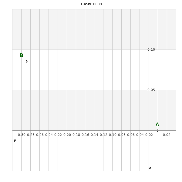
Click on the map to see the double of your interest.
Pass over with the mouse cursor to display the catalog designation.
|
|
WDS 13239-0809 : ALADIN DSS IMAGE @ 13h 23m 51.86s -08° 08' 45.8"
WDS 13239-0809 RST 3836 : NEIGHBORHOODS
|
|

Click on the map to see the double of your interest.
Pass over with the mouse cursor to display the catalog designation.
|
| Show |
name |
coord_2000 |
discov# |
comp |
pa |
sep |
dist(') |
| Show |
|
13239-0809 |
RST3836 |
|
74 |
0.3 |
|
| Show |
|
13234-0759 |
GWP2004 |
AB |
175 |
51.8 |
12 |
| Show |
|
13249-0810 |
MRA 20 |
|
307 |
0.2 |
17 |
| Show |
|
13228-0754 |
GWP1997 |
|
41 |
4.6 |
22 |
| Show |
|
13240-0833 |
GWP2010 |
|
119 |
154.3 |
25 |
| Show |
|
13253-0745 |
LDS4358 |
|
303 |
10.9 |
32 |
| Show |
|
13235-0841 |
BRT 550 |
|
99 |
3.9 |
33 |
| Show |
|
13254-0735 |
STF1743 |
|
78 |
6.1 |
41 |
| Show |
|
13224-0733 |
OCC 571 |
|
-1 |
0.1 |
43 |
| Show |
|
13208-0814 |
RST3834 |
|
326 |
0.9 |
46 |
| Show |
|
13204-0751 |
GWP1981 |
|
327 |
572.2 |
55 |
| Show |
|
13257-0900 |
GWP2020 |
|
252 |
8.0 |
59 |
| Show |
|
13269-0846 |
MRA 18 |
|
30 |
1.2 |
59 |
| Show |
|
13223-0706 |
LDS4350 |
|
123 |
28.3 |
67 |
| Show |
|
13205-0708 |
GWP1982 |
|
340 |
15.6 |
79 |
| Show |
|
13207-0700 |
GWP1984 |
AB |
70 |
288.4 |
83 |
| Show |
|
13207-0700 |
GWP1985 |
AC |
224 |
223.6 |
83 |
| Show |
|
13216-0926 |
BRT 447 |
|
54 |
7.9 |
85 |
| Show |
|
13216-0641 |
OCC 5 |
|
-1 |
0.1 |
95 |
| Show |
|
13300-0842 |
WNO 46 |
AB |
161 |
11.6 |
98 |
| Show |
|
13300-0842 |
MRA 19 |
Ba,Bb |
339 |
0.1 |
98 |
| Show |
|
13303-0834 |
LDS 448 |
|
199 |
502.4 |
98 |
| Show |
|
13302-0734 |
GWP2034 |
|
241 |
294.3 |
101 |
| Show |
|
13168-0838 |
UC 2514 |
|
327 |
22.5 |
109 |
| Show |
|
13311-0834 |
GWP2037 |
|
150 |
8.3 |
112 |
| Show |
|
13194-0939 |
LDS4344 |
|
104 |
20.0 |
113 |
| Show |
|
13315-0800 |
LDS4371 |
|
31 |
31.4 |
114 |
| Show |
|
13197-0632 |
HDS1867 |
|
115 |
0.3 |
115 |
| Show |
|
13212-0957 |
MRA 17 |
|
162 |
1.3 |
116 |
| Show |
|
13212-1000 |
OCC 141 |
|
-1 |
0.1 |
118 |
| Show |
|
13225-0612 |
KPP2745 |
|
355 |
9.6 |
119 |
| Show |
|
13279-0627 |
GWP2027 |
|
165 |
13.9 |
119 |
| Show |
|
13210-0617 |
GWP1988 |
|
329 |
593.2 |
121 |
| Show |
|
13198-0953 |
GWP1979 |
|
85 |
90.6 |
121 |
| Show |
|
13279-0621 |
GWP2026 |
|
12 |
139.6 |
124 |
| Show |
|
13184-0631 |
GWP1970 |
|
85 |
4.1 |
128 |
| Show |
|
13155-0841 |
GWP1957 |
|
359 |
107.7 |
129 |
| Show |
|
13254-0601 |
GWP2018 |
AB |
239 |
12.0 |
130 |
| Show |
|
13254-0601 |
GWP2019 |
AC |
256 |
224.6 |
130 |
| Show |
|
13211-0558 |
GWP1989 |
|
160 |
288.7 |
137 |
| Show |
|
13244-1026 |
RST3837 |
|
160 |
0.4 |
138 |
| Show |
|
13304-0628 |
STF1750 |
|
17 |
30.1 |
141 |
| Show |
|
13192-0601 |
TDS8781 |
|
101 |
0.5 |
146 |
| Show |
|
13141-0802 |
GWP1947 |
|
92 |
372.4 |
146 |
| Show |
|
13260-1032 |
KPP3895 |
|
191 |
2.9 |
147 |
| Show |
|
13290-0557 |
GWP2030 |
|
316 |
49.6 |
153 |
| Show |
|
13343-0837 |
BU 114 |
|
172 |
1.3 |
158 |
| Show |
|
13133-0756 |
HDS1851 |
|
4 |
0.4 |
158 |
| Show |
|
13278-1036 |
GWP2024 |
|
257 |
230.2 |
159 |
| Show |
|
13229-1047 |
LDS4352 |
AB |
7 |
15.3 |
160 |
| Show |
|
13229-1047 |
LDS4352 |
Aa,Ab |
358 |
1.9 |
160 |
|
|
WDS 13239-0809 : COMPONENTS
13239-0809 A
| Componente originario normalizzato |
AB |
|
Coord arcsec 2000 |
132351.86-080845.8 |
|
Mag |
11.5 |
|
PmRA |
15.00 |
|
| PmDE |
9.0 |
|
Tycho2 |
5544-00663-1 |
|
| Tycho2 |
5544-00663-1 |
|
Pflag |
|
|
RAmdeg |
200.96609790 |
|
DEmdeg |
-8.14607562 |
|
| PmRA |
13.8 |
|
PmDE |
6.8 |
|
E RAmdeg |
33 |
|
E DEmdeg |
33 |
|
| E pmRA |
2.5 |
|
E pmDE |
2.6 |
|
EpRAm |
1987.21 |
|
EpDEm |
1983.15 |
|
| Num |
5 |
|
Q RAmdeg |
0.5 |
|
Q DEmdeg |
0.6 |
|
Q pmRA |
0.5 |
|
| Q pmDE |
0.6 |
|
BTmag |
11.320 |
|
E BTmag |
0.078 |
|
VTmag |
10.749 |
|
| E VTmag |
0.074 |
|
Prox |
999 |
|
TYC |
T |
|
HIP |
|
|
| CCDM |
|
|
RAdeg |
200.96606444 |
|
DEdeg |
-8.14609250 |
|
EpRA 1990 |
1.63 |
|
| EpDE 1990 |
1.21 |
|
E RAdeg |
38.7 |
|
E DEdeg |
55.3 |
|
Posflg |
|
|
| Corr |
0.2 |
|
| Ccdm |
13239-0809 |
|
RComp |
|
|
Comp |
A |
|
Note1 |
|
|
| Note2 |
|
|
Discov num |
|
|
DRAs |
-2.15 |
|
DDEs |
14.1 |
|
| R dRAs |
66 |
|
Year |
|
|
Theta |
|
|
Rho |
|
|
| Obs |
2 |
|
Vmag |
10.7 |
|
Sp |
|
|
PmNote |
|
|
| PmRA |
|
|
PmDE |
|
|
Dm number |
-07 3608 |
|
Cat1 |
BD |
|
| Name2 |
|
|
Cat2 |
|
|
HD |
|
|
M HD |
|
|
| ADS BDS |
|
|
M ADS BDS |
|
|
N IDS |
|
|
IDS |
13186S0738A |
|
| HIC |
|
|
13239-0809 B
| Componente originario normalizzato |
AB |
|
Coord arcsec 2000 |
132351.88-080845.7 |
|
Mag |
11.5 |
|
Calc coord |
yes |
|
| Ccdm |
13239-0809 |
|
RComp |
|
|
Comp |
B |
|
Note1 |
|
|
| Note2 |
|
|
Discov num |
RST3836 |
|
DRAs |
|
|
DDEs |
|
|
| R dRAs |
|
|
Year |
1951 |
|
Theta |
040 |
|
Rho |
0.3 |
|
| Obs |
3 |
|
Vmag |
10.7 |
|
Sp |
|
|
PmNote |
|
|
| PmRA |
|
|
PmDE |
|
|
Dm number |
|
|
Cat1 |
|
|
| Name2 |
|
|
Cat2 |
|
|
HD |
|
|
M HD |
|
|
| ADS BDS |
|
|
M ADS BDS |
|
|
N IDS |
|
|
IDS |
13186S0738B |
|
| HIC |
|
|