00066-1101 RST 3341 AB
00h 06m 37.28s -11° 01' 07.4" P.A. 95.00 sep 0.4 mag 11.00,11.80
| Coord 2000 |
00066-1101 |
|
Discov num |
RST3341 |
|
Comp |
AB |
|
Coord arcsec 2000 |
00 06 37.28 -11 01 07.4 |
|
| Date first |
1938 |
|
Date last |
1950 |
|
Obs |
3 |
|
| Pa first |
101 |
|
Pa last |
95.2 |
|
P.A. Now (θ) |
95.2° |
|
| Sep first |
0.4 |
|
Sep last |
0.4 |
|
Sep. Now (ρ) |
0.4" |
|
| Mag pri |
11.00 |
|
Mag sec |
11.80 |
|
delta mag (ΔM) |
0.8 |
|
Spectral class |
|
|
| Pri motion ra |
+006 |
|
Sec motion ra |
|
|
| Pri motion dec |
+017 |
|
Sec motion dec |
|
|
| Notes |
|
|
Nature of this double is uncertain.
00066-1101 SYSTEM COMPONENTS
| Show |
name |
SAO |
coord |
wds_name |
last |
obs |
pa |
sep |
mag1 |
mag2 |
d_mag |
orb |
current |
| Show |
|
|
00 06 37 -11 01 07 |
RST 3341 AB |
1950 |
3 |
95 |
0.4 |
11.00 |
11.80 |
0.80 |
|
<=== |
| Show |
|
|
00 06 37 -11 01 07 |
GAL 3 AB,C |
2016 |
11 |
13 |
7.2 |
10.56 |
10.80 |
0.24 |
|
|
Triple system
4 estimated visually detectable stars in this system
OTHER CATALOGS AND DESIGNATIONS
WDS 00066-1101 RST 3341 AB : NOTES
No records found.
REFERENCES
| refcode |
metd |
author |
reference |
| Gal1912a |
Pa j |
Gallo, J. |
. |
| Gal1912a |
|
Bol. Tacubaya #2, 1912 |
|
| Gal1912b |
Pa j |
Gallo, J. |
. |
| Gal1912b |
|
Bol. Tacubaya #3, 1912 |
|
| Gal1914 |
Pa j |
Gallo, J. |
. |
| Gal1914 |
|
Bol. Tacubaya #4, 1914 |
|
| Rst1933 |
T - |
Rossiter, R.A. |
1933MmRAS..65...27R |
| Rst1933 |
|
MemRAS 65, 27, 1933 |
|
| Rst1937 |
Ma - |
Rossiter, R.A. |
1937MmRAS..65...51R |
| Rst1937 |
|
MemRAS 65, 51, 1937 |
|
| Rst1943 |
Ma - |
Rossiter, R.A. |
1943POMic...8..133R |
| Rst1943 |
|
Pub. Univ. Michigan Obs. 8, 133, 1943 |
|
| Rst1944 |
- |
Rossiter, R.A. |
1944POMic...9....1R |
| Rst1944 |
|
Pub. Univ. Michigan Obs. 9, 1, 1944 |
|
| Rst1947 |
Ma - |
Rossiter, R.A. |
1947POMic...9....7R |
| Rst1947 |
|
Pub. Univ. Michigan Obs. 9, 7, 1947 |
|
| Rst1955 |
Ma j |
Rossiter, R.A. |
1955POMic..11....1R |
| Rst1955 |
+P+ |
Pub. Univ. Michigan Obs. 11, 1, 1955 |
|
| Rst1964 |
Ma - |
Rossiter, R.A. |
1964POMic...9...73R |
| Rst1964 |
|
Pub. Univ. Michigan Obs. 9, 73, 1964 |
|
WDS HISTORIC DATA
| coord_2000 |
discov_num |
comp |
epoch |
obs |
pa |
sep |
mag_pri |
mag_sec |
spectr |
notes |
coord_arcsec_2000 |
| 00066-1101 |
RST3341 |
AB |
1950 |
3 |
95 |
0.4 |
11.00 |
11.80 |
|
|
000637.28-110107.4 |
If you need more information about this double, apply for a
data request form to the WDS.
WDS 00066-1101 RST 3341 AB : VISUAL OBSERVATIONS REPORTS
No records found.
WDS 00066-1101 RST 3341 AB : MEASURES
No records found.
WDS 00066-1101 : VIRTUAL EYEPIECE
Click on the map to see the double of your interest.
Pass over with the mouse cursor to display the catalog designation.
|
|
WDS 00066-1101 : ALADIN DSS IMAGE @ 00h 06m 37.28s -11° 01' 07.4"
WDS 00066-1101 RST 3341 AB : NEIGHBORHOODS
|
|

Click on the map to see the double of your interest.
Pass over with the mouse cursor to display the catalog designation.
|
| Show |
name |
coord_2000 |
discov# |
comp |
pa |
sep |
dist(') |
| Show |
|
00066-1101 |
RST3341 |
AB |
95 |
0.4 |
1 |
| Show |
|
00066-1101 |
GAL 3 |
AB,C |
13 |
7.2 |
1 |
| Show |
|
00074-1102 |
HDS 14 |
|
178 |
1.1 |
12 |
| Show |
|
00074-1125 |
GWP 16 |
|
358 |
6.9 |
27 |
| Show |
|
00083-1124 |
HU 2 |
|
69 |
3.7 |
34 |
| Show |
|
00089-1107 |
RST3342 |
|
302 |
1.6 |
35 |
| Show |
|
00077-1020 |
SLW 8 |
|
75 |
27.6 |
44 |
| Show |
|
00033-1100 |
RST4139 |
|
40 |
0.7 |
50 |
| Show |
|
00045-1019 |
SLW 2 |
|
316 |
135.9 |
53 |
| Show |
|
00030-1106 |
CVR1027 |
AB |
236 |
4.5 |
55 |
| Show |
|
00042-1008 |
LDS3116 |
|
302 |
22.4 |
64 |
| Show |
|
00023-1042 |
RST4138 |
|
336 |
1.1 |
67 |
| Show |
|
00068-1210 |
HU 1 |
|
113 |
0.9 |
69 |
| Show |
|
00048-0952 |
HU 100 |
|
344 |
4.0 |
75 |
| Show |
|
00110-1207 |
WZ 1 |
|
291 |
7.3 |
92 |
| Show |
|
00004-1052 |
SKF 496 |
|
16 |
16.1 |
93 |
| Show |
|
00126-1142 |
RST3343 |
|
269 |
0.3 |
97 |
| Show |
|
00019-0952 |
LDS5157 |
|
71 |
2.8 |
98 |
| Show |
|
00133-1055 |
BRT2622 |
|
55 |
3.8 |
99 |
| Show |
|
00119-1212 |
BRT2621 |
|
247 |
3.2 |
105 |
| Show |
|
00019-0943 |
SLW9011 |
|
237 |
4.6 |
105 |
| Show |
|
00117-0942 |
HDS 26 |
|
76 |
0.7 |
109 |
| Show |
|
00140-1109 |
SKF1657 |
|
77 |
1.5 |
109 |
| Show |
|
00139-1130 |
HJ 1945 |
|
298 |
19.9 |
114 |
| Show |
|
00135-1155 |
KPP2679 |
|
330 |
1.2 |
115 |
| Show |
|
00007-1216 |
SKF 137 |
|
355 |
2.7 |
116 |
| Show |
|
00003-0941 |
RST4137 |
|
43 |
1.0 |
123 |
| Show |
|
00014-0920 |
TDS1251 |
|
106 |
0.8 |
127 |
| Show |
|
00068-0853 |
BUG 15 |
AB |
113 |
27.5 |
129 |
| Show |
|
00154-1134 |
GAL 297 |
|
194 |
21.1 |
132 |
| Show |
|
00017-0911 |
RST4737 |
|
115 |
0.8 |
133 |
| Show |
|
00151-1014 |
GWP 29 |
|
32 |
10.7 |
134 |
| Show |
|
00005-0916 |
GWP 1 |
|
63 |
7.4 |
140 |
| Show |
|
00049-1320 |
GAL 295 |
|
19 |
39.1 |
141 |
| Show |
|
00009-0908 |
GRV1157 |
|
276 |
19.2 |
142 |
| Show |
|
00127-1251 |
LDS5264 |
|
308 |
27.1 |
143 |
| Show |
|
00038-1317 |
XMI 1 |
|
271 |
29.2 |
143 |
| Show |
|
00156-1156 |
WSP 44 |
AB |
356 |
11.8 |
144 |
| Show |
|
00156-1156 |
WSP 44 |
AC |
241 |
13.8 |
144 |
| Show |
|
00055-1325 |
LDS5259 |
|
87 |
167.0 |
145 |
| Show |
|
00112-0853 |
RST4140 |
|
143 |
0.9 |
146 |
| Show |
|
00158-1159 |
STF 14 |
|
237 |
14.5 |
148 |
| Show |
|
00004-0902 |
LDS6080 |
|
261 |
16.0 |
150 |
| Show |
|
00122-0854 |
KPP 596 |
|
133 |
5.5 |
152 |
| Show |
|
00059-0827 |
LDS5260 |
|
158 |
78.4 |
155 |
| Show |
|
00165-1156 |
CBL 201 |
|
60 |
10.8 |
155 |
| Show |
|
00023-1324 |
GAA 22 |
Aa,Ab |
314 |
0.0 |
157 |
| Show |
|
00147-1245 |
HDO 7 |
|
6 |
6.5 |
158 |
| Show |
|
00170-1020 |
HU 3 |
|
288 |
1.5 |
159 |
| Show |
|
00171-1027 |
MRI 1 |
|
326 |
2.7 |
159 |
| Show |
|
00078-1342 |
KPP 967 |
|
112 |
7.9 |
162 |
|
|
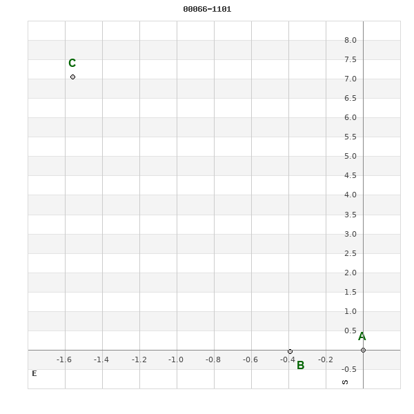
WDS 00066-1101 : COMPONENTS
| |
A |
B |
| B |
pa=95.3°
sep=0.39"
| |
| C |
pa=12.5°
sep=7.23"
| pa=9.4°
sep=7.19"
|
00066-1101 A
| Coord arcsec 2000 |
000637.28-110107.4 |
|
Mag |
11 |
|
PmRA |
6.00 |
|
PmDE |
17.0 |
|
00066-1101 B
| Coord arcsec 2000 |
000637.31-110107.4 |
|
Mag |
11.8 |
|
Calc delta mag |
0.8 |
|
Calc coord |
yes |
|
00066-1101 C
| Coord arcsec 2000 |
000637.39-110100.3 |
|
Mag |
10.8 |
|
PmRA |
7.00 |
|
PmDE |
7.0 |
|
| Tycho2 |
5263-00583-1 |
|
Calc delta mag |
0.2 |
|
Calc coord |
yes |
|
| Tycho2 |
5263-00583-1 |
|
Pflag |
|
|
RAmdeg |
1.65535677 |
|
DEmdeg |
-11.01872324 |
|
| PmRA |
2.8 |
|
PmDE |
8.3 |
|
E RAmdeg |
24 |
|
E DEmdeg |
34 |
|
| E pmRA |
1.8 |
|
E pmDE |
1.8 |
|
EpRAm |
1989.34 |
|
EpDEm |
1986.98 |
|
| Num |
4 |
|
Q RAmdeg |
1.5 |
|
Q DEmdeg |
1.3 |
|
Q pmRA |
1.4 |
|
| Q pmDE |
1.3 |
|
BTmag |
11.139 |
|
E BTmag |
0.051 |
|
VTmag |
10.556 |
|
| E VTmag |
0.044 |
|
Prox |
999 |
|
TYC |
T |
|
HIP |
|
|
| CCDM |
|
|
RAdeg |
1.65535222 |
|
DEdeg |
-11.01874722 |
|
EpRA 1990 |
1.81 |
|
| EpDE 1990 |
1.69 |
|
E RAdeg |
25.3 |
|
E DEdeg |
36.2 |
|
Posflg |
P |
|
| Corr |
-0.3 |
|