21517+2852 SHN 256
21h 51m 40.82s +28° 51' 32.2" P.A. -1.00 sep 0.6 mag 12.50,14.20
| Coord 2000 |
21517+2852 |
|
Discov num |
SHN 256 |
|
Comp |
|
|
Coord arcsec 2000 |
21 51 40.82 +28 51 32.2 |
|
| Date first |
1996 |
|
Date last |
1996 |
|
Obs |
0 |
|
| Pa first |
-1 |
|
Pa last |
-1 |
|
P.A. Now (θ) |
-1 |
|
| Sep first |
0.6 |
|
Sep last |
0.571 |
|
Sep. Now (ρ) |
0.571" |
|
| Mag pri |
12.50 |
|
Mag sec |
14.20 |
|
delta mag (ΔM) |
1.7 |
|
Spectral class |
|
|
| Pri motion ra |
-078 |
|
Sec motion ra |
|
|
| Pri motion dec |
-033 |
|
Sec motion dec |
|
|
| Notes |
|
|
Nature of this double is uncertain.
OTHER CATALOGS AND DESIGNATIONS
| Constellation |
Pegasus |
|
Gaia DR2 |
1896400139051275904 |
|
WDS 21517+2852 SHN 256 : NOTES
No records found.
REFERENCES
| refcode |
metd |
author |
reference |
| Shn1993 |
O j |
Schneider, G. & Anderson, C. |
1993PASP..105..367S |
| Shn1993 |
|
PASP 105, 367, 1993 |
|
| Shn1998 |
Hf j |
Schneider, G., Hershey, J.L., & Wenz, M.T. |
1998PASP..110.1012S |
| Shn1998 |
|
PASP 110, 1012, 1998 |
|
| Shn2004 |
Hn - |
Schneider, G., Song, I., Zuckerman, B., Becklin, E., Lowrance, P., Macintosh, B., |
2004AAS...205.1114S |
| Shn2004 |
|
Bessell, M., Dumas, C., & Chauvin, G. |
|
| Shn2004 |
|
BAAS 205, 1114, 2004 (all data also in Son2006) |
2006ApJ...652..724 |
WDS HISTORIC DATA
| coord_2000 |
discov_num |
comp |
epoch |
obs |
pa |
sep |
mag_pri |
mag_sec |
spectr |
notes |
coord_arcsec_2000 |
| 21517+2852 |
SHN 256 |
|
|
0 |
|
|
12.50 |
14.20 |
|
|
215140.82+285132.2 |
| 21517+2852 |
SHN 256 |
|
|
0 |
|
|
12.50 |
14.20 |
|
|
215140.82+285132.2 |
| 21517+2852 |
SHN 256 |
|
|
0 |
|
|
12.50 |
14.20 |
|
|
215140.82+285132.2 |
| 21517+2852 |
SHN 256 |
|
|
0 |
|
|
12.50 |
14.20 |
|
|
215140.82+285132.2 |
| 21517+2852 |
SHN 256 |
|
|
0 |
|
|
12.50 |
14.20 |
|
|
215140.82+285132.2 |
| 21517+2852 |
SHN 256 |
|
|
0 |
|
|
12.50 |
14.20 |
|
|
215140.82+285132.2 |
| 21517+2852 |
SHN 256 |
|
|
0 |
|
|
12.50 |
14.20 |
|
|
215140.82+285132.2 |
| 21517+2852 |
SHN 256 |
|
|
0 |
|
|
12.50 |
14.20 |
|
|
215140.82+285132.2 |
| 21517+2852 |
SHN 256 |
|
|
0 |
|
|
12.50 |
14.20 |
|
|
215140.82+285132.2 |
| 21517+2852 |
SHN 256 |
|
|
0 |
|
|
12.50 |
14.20 |
|
|
215140.82+285132.2 |
| 21517+2852 |
SHN 256 |
|
|
0 |
|
|
12.50 |
14.20 |
|
|
215140.82+285132.2 |
| 21517+2852 |
SHN 256 |
|
|
0 |
|
|
12.50 |
14.20 |
|
|
215140.82+285132.2 |
| 21517+2852 |
SHN 256 |
|
|
0 |
|
|
12.50 |
14.20 |
|
|
215140.82+285132.2 |
| 21517+2852 |
SHN 256 |
|
|
0 |
|
|
12.50 |
14.20 |
|
|
215140.82+285132.2 |
| 21517+2852 |
SHN 256 |
|
|
0 |
|
|
12.50 |
14.20 |
|
|
215140.82+285132.2 |
| 21517+2852 |
SHN 256 |
|
|
0 |
|
|
12.50 |
14.20 |
|
|
215140.82+285132.2 |
| 21517+2852 |
SHN 256 |
|
|
0 |
|
|
12.50 |
14.20 |
|
|
215140.82+285132.2 |
| 21517+2852 |
SHN 256 |
|
|
0 |
|
|
12.50 |
14.20 |
|
|
215140.82+285132.2 |
| 21517+2852 |
SHN 256 |
|
|
0 |
|
|
12.50 |
14.20 |
|
|
215140.82+285132.2 |
| 21517+2852 |
SHN 256 |
|
|
0 |
|
|
12.50 |
14.20 |
|
|
215140.82+285132.2 |
| 21517+2852 |
SHN 256 |
|
|
0 |
|
|
12.50 |
14.20 |
|
|
215140.82+285132.2 |
| 21517+2852 |
SHN 256 |
|
|
0 |
|
|
12.50 |
14.20 |
|
|
215140.82+285132.2 |
| 21517+2852 |
SHN 256 |
|
|
0 |
|
|
12.50 |
14.20 |
|
|
215140.82+285132.2 |
| 21517+2852 |
SHN 256 |
|
|
0 |
|
|
12.50 |
14.20 |
|
|
215140.82+285132.2 |
| 21517+2852 |
SHN 256 |
|
|
0 |
|
|
12.50 |
14.20 |
|
|
215140.82+285132.2 |
| 21517+2852 |
SHN 256 |
|
1996 |
0 |
-1 |
0.6 |
12.50 |
14.20 |
|
|
215140.82+285132.2 |
If you need more information about this double, apply for a
data request form to the WDS.
WDS 21517+2852 SHN 256 : VISUAL OBSERVATIONS REPORTS
No records found.
WDS 21517+2852 SHN 256 : MEASURES
No records found.
WDS 21517+2852 : VIRTUAL EYEPIECE
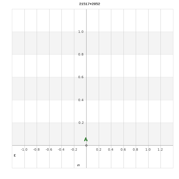
Click on the map to see the double of your interest.
Pass over with the mouse cursor to display the catalog designation.
|
|
WDS 21517+2852 : ALADIN DSS IMAGE @ 21h 51m 40.82s +28° 51' 32.2"
WDS 21517+2852 SHN 256 : NEIGHBORHOODS
|
|
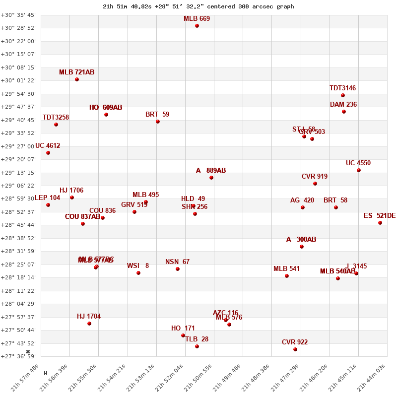
Click on the map to see the double of your interest.
Pass over with the mouse cursor to display the catalog designation.
|
| Show |
name |
coord_2000 |
discov# |
comp |
pa |
sep |
dist(') |
| Show |
|
21517+2852 |
SHN 256 |
|
-1 |
0.6 |
|
| Show |
|
21517+2856 |
HLD 49 |
|
341 |
2.1 |
5 |
| Show |
|
21510+2911 |
A 889 |
AB |
15 |
0.2 |
21 |
| Show |
|
21510+2911 |
A 889 |
Aa,Ab |
323 |
0.0 |
21 |
| Show |
|
21538+2856 |
MLB 495 |
|
134 |
4.8 |
27 |
| Show |
|
21524+2823 |
NSN 67 |
|
285 |
5.1 |
31 |
| Show |
|
21540+2852 |
GRV 519 |
|
318 |
22.1 |
32 |
| Show |
|
21539+2821 |
WSI 8 |
|
142 |
0.1 |
43 |
| Show |
|
21553+2850 |
COU 836 |
|
161 |
1.3 |
49 |
| Show |
|
21530+2939 |
BRT 59 |
|
355 |
4.4 |
53 |
| Show |
|
21474+2855 |
AG 420 |
|
145 |
7.5 |
57 |
| Show |
|
21505+2756 |
AZC 116 |
|
353 |
20.9 |
58 |
| Show |
|
21480+2819 |
MLB 541 |
|
340 |
9.9 |
58 |
| Show |
|
21556+2823 |
MLB 577 |
BC |
18 |
6.4 |
59 |
| Show |
|
21474+2834 |
A 300 |
AB |
252 |
2.3 |
59 |
| Show |
|
21474+2834 |
A 300 |
AC |
29 |
7.5 |
59 |
| Show |
|
21474+2834 |
A 300 |
AD |
170 |
8.4 |
59 |
| Show |
|
21561+2846 |
COU 837 |
AB |
150 |
1.2 |
59 |
| Show |
|
21561+2846 |
GII 104 |
AC |
105 |
1.9 |
59 |
| Show |
|
21556+2823 |
MLB 577 |
AB |
300 |
48.8 |
60 |
| Show |
|
21503+2754 |
MLB 576 |
|
267 |
13.1 |
61 |
| Show |
|
21521+2748 |
HO 171 |
|
342 |
0.8 |
64 |
| Show |
|
21469+2907 |
CVR 919 |
|
201 |
23.5 |
65 |
| Show |
|
21565+2900 |
HJ 1706 |
|
260 |
10.0 |
65 |
| Show |
|
21555+2942 |
HO 609 |
AB |
356 |
3.3 |
70 |
| Show |
|
21555+2942 |
HO 609 |
AC |
132 |
22.1 |
70 |
| Show |
|
21555+2942 |
HO 609 |
AD |
147 |
30.4 |
70 |
| Show |
|
21555+2942 |
HO 609 |
AE |
347 |
31.7 |
70 |
| Show |
|
21473+2932 |
STJ 58 |
|
193 |
1.8 |
70 |
| Show |
|
21470+2930 |
GRV 503 |
|
331 |
20.4 |
73 |
| Show |
|
21461+2855 |
BRT 58 |
|
165 |
4.4 |
74 |
| Show |
|
21575+2856 |
LEP 104 |
|
189 |
85.0 |
77 |
| Show |
|
21559+2753 |
HJ 1704 |
|
317 |
5.6 |
80 |
| Show |
|
21462+2817 |
MLB 540 |
AB |
256 |
4.1 |
82 |
| Show |
|
21462+2817 |
MLB 540 |
AC |
322 |
8.7 |
82 |
| Show |
|
21462+2817 |
ABH 152 |
AD |
68 |
41.8 |
82 |
| Show |
|
21462+2817 |
ABH 152 |
AE |
96 |
80.1 |
82 |
| Show |
|
21575+2923 |
UC 4612 |
|
23 |
64.1 |
83 |
| Show |
|
21572+2938 |
TDT3258 |
|
262 |
1.8 |
86 |
| Show |
|
21452+2914 |
UC 4550 |
|
15 |
42.5 |
89 |
| Show |
|
21477+2740 |
CVR 922 |
|
225 |
9.9 |
89 |
| Show |
|
21454+2819 |
J 3145 |
|
112 |
5.4 |
90 |
| Show |
|
21564+3001 |
MLB 721 |
AB |
15 |
1.6 |
94 |
| Show |
|
21564+3001 |
MLB 721 |
AC |
200 |
6.9 |
94 |
| Show |
|
21458+2945 |
DAM 236 |
|
143 |
5.9 |
95 |
| Show |
|
21441+2845 |
ES 521 |
DE |
286 |
17.5 |
97 |
| Show |
|
21441+2845 |
FYM 25 |
DG |
164 |
89.6 |
97 |
| Show |
|
21516+3030 |
MLB 669 |
|
309 |
3.2 |
99 |
| Show |
|
21458+2954 |
TDT3146 |
|
359 |
2.5 |
99 |
| Show |
|
21444+2824 |
KPP3373 |
|
242 |
2.1 |
100 |
| Show |
|
21441+2845 |
STF2822 |
AB |
325 |
1.6 |
100 |
|
|
WDS 21517+2852 : COMPONENTS
21517+2852 A
| Componente originario normalizzato |
AB |
|
Coord arcsec 2000 |
215140.82+285132.2 |
|
Mag |
12.5 |
|
PmRA |
-78.00 |
|
| PmDE |
-33.0 |
|
21517+2852 B
| Componente originario normalizzato |
AB |
|
Coord arcsec 2000 |
215140.82+285132.2 |
|
Mag |
14.2 |
|
Calc delta mag |
1.7 |
|
| Calc coord |
yes |
|