20486+3424 ES 249
20h 47m 36.47s +34° 23' 52.3" P.A. 26.00 sep 7.7 mag 10.73,11.80
| Coord 2000 |
20486+3424 |
|
Discov num |
ES 249 |
|
Comp |
|
|
Coord arcsec 2000 |
20 47 36.47 +34 23 52.3 |
|
| Date first |
1905 |
|
Date last |
2015 |
|
Obs |
9 |
|
| Pa first |
22 |
|
Pa last |
25.8 |
|
P.A. Now (θ) |
25.8° |
|
| Sep first |
5.4 |
|
Sep last |
7.744 |
|
Sep. Now (ρ) |
7.744" |
|
| Mag pri |
10.73 |
|
Mag sec |
11.80 |
|
delta mag (ΔM) |
1.07 |
|
Spectral class |
|
|
| Pri motion ra |
+006 |
|
Sec motion ra |
+028 |
|
| Pri motion dec |
-010 |
|
Sec motion dec |
+015 |
|
| Notes |
|
|
rPM=1.048
This double is not physical.
OTHER CATALOGS AND DESIGNATIONS
| Constellation |
Cygnus |
|
Gaia DR2 |
1869340333274508032 |
|
WDS 20486+3424 ES 249 : NOTES
No records found.
DISCOVERER
| discov |
author |
| ES |
Espin, T.E. |
WDS HISTORIC DATA
| coord_2000 |
discov_num |
comp |
epoch |
obs |
pa |
sep |
mag_pri |
mag_sec |
spectr |
dm_number |
notes |
coord_arcsec_2000 |
| 20486+3424 |
ES 249 |
|
1905 |
1 |
22 |
5.4 |
9.00 |
10.00 |
|
|
|
|
| 20486+3424 |
ES 249 |
|
2008 |
2 |
25 |
7.6 |
9.00 |
10.00 |
|
|
|
|
| 20486+3424 |
ES 249 |
|
2010 |
6 |
26 |
8.3 |
10.73 |
11.80 |
|
|
|
204736.47+342352.3 |
| 20486+3424 |
ES 249 |
|
2015 |
6 |
26 |
7.7 |
10.73 |
11.80 |
|
|
|
204736.47+342352.3 |
If you need more information about this double, apply for a
data request form to the WDS.
WDS 20486+3424 ES 249 : VISUAL OBSERVATIONS REPORTS
No records found.
WDS 20486+3424 ES 249 : MEASURES
No records found.
WDS 20486+3424 : VIRTUAL EYEPIECE
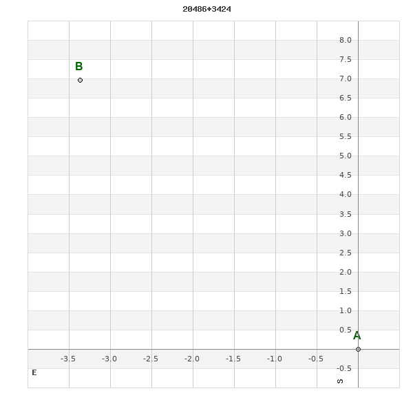
Click on the map to see the double of your interest.
Pass over with the mouse cursor to display the catalog designation.
|
|
WDS 20486+3424 : ALADIN DSS IMAGE @ 20h 47m 36.47s +34° 23' 52.3"
WDS 20486+3424 ES 249 : NEIGHBORHOODS
|
|

Click on the map to see the double of your interest.
Pass over with the mouse cursor to display the catalog designation.
|
| Show |
name |
coord_2000 |
discov# |
comp |
pa |
sep |
dist(') |
| Show |
|
20486+3424 |
ES 249 |
|
26 |
7.7 |
0 |
| Show |
|
20472+3422 |
BU 677 |
AB |
120 |
10.0 |
6 |
| Show |
|
20472+3422 |
BU 677 |
AC |
211 |
16.8 |
6 |
| Show |
|
20488+3426 |
SEI1256 |
|
279 |
26.3 |
15 |
| Show |
|
20481+3403 |
LDS1047 |
|
7 |
110.2 |
21 |
| Show |
|
20493+3430 |
POP 51 |
|
347 |
6.6 |
23 |
| Show |
|
20489+3449 |
SEI1258 |
|
351 |
25.1 |
30 |
| Show |
|
20466+3451 |
SEI1245 |
|
5 |
23.1 |
31 |
| Show |
|
20466+3452 |
SEI1246 |
|
58 |
18.9 |
31 |
| Show |
Aljanah |
20462+3358 |
CHR 100 |
Aa,Ab |
350 |
0.0 |
31 |
| Show |
Aljanah |
20462+3358 |
STT 594 |
AB |
261 |
79.2 |
31 |
| Show |
Aljanah |
20462+3358 |
BU 676 |
AC |
269 |
79.0 |
31 |
| Show |
Aljanah |
20462+3358 |
LEP 96 |
AD |
271 |
93.4 |
31 |
| Show |
|
20498+3442 |
SEI1264 |
|
39 |
7.5 |
33 |
| Show |
|
20479+3456 |
TDT2545 |
|
195 |
2.5 |
33 |
| Show |
|
20490+3451 |
SEI1259 |
|
88 |
15.5 |
33 |
| Show |
|
20502+3441 |
SEI1269 |
|
148 |
7.9 |
37 |
| Show |
|
20504+3406 |
GRV 387 |
|
254 |
26.4 |
40 |
| Show |
|
20448+3401 |
GRV 376 |
|
179 |
65.2 |
41 |
| Show |
|
20477+3343 |
NSN 736 |
|
354 |
45.5 |
41 |
| Show |
|
20445+3409 |
HU 690 |
|
278 |
0.5 |
42 |
| Show |
|
20489+3503 |
SEI1257 |
AB |
215 |
17.9 |
42 |
| Show |
|
20465+3504 |
GRV 379 |
|
162 |
57.1 |
43 |
| Show |
|
20446+3401 |
TDT2511 |
|
36 |
3.2 |
45 |
| Show |
|
20447+3357 |
ES 2311 |
|
44 |
7.0 |
45 |
| Show |
|
20442+3404 |
TDT2507 |
|
165 |
0.9 |
47 |
| Show |
|
20464+3511 |
COU1810 |
|
183 |
0.2 |
50 |
| Show |
|
20487+3334 |
ES 9006 |
|
93 |
25.3 |
52 |
| Show |
|
20521+3439 |
RAO 521 |
|
-1 |
0.2 |
58 |
| Show |
|
20431+3411 |
ES 2310 |
|
33 |
4.1 |
58 |
| Show |
|
20482+3326 |
ES 2377 |
|
220 |
4.3 |
59 |
| Show |
|
20503+3337 |
ES 2378 |
|
193 |
6.2 |
59 |
| Show |
|
20429+3430 |
SEI1225 |
|
275 |
17.0 |
59 |
| Show |
|
20522+3401 |
TDT2593 |
|
257 |
4.5 |
62 |
| Show |
|
20456+3521 |
TDT2520 |
|
16 |
0.4 |
63 |
| Show |
|
20432+3350 |
HDS2949 |
|
165 |
0.9 |
64 |
| Show |
|
20470+3318 |
TDT2535 |
|
86 |
0.7 |
67 |
| Show |
|
20449+3524 |
SEI1235 |
|
77 |
9.4 |
69 |
| Show |
|
20437+3332 |
GRV 373 |
|
178 |
26.2 |
71 |
| Show |
|
20462+3533 |
ES 2252 |
AB |
294 |
4.2 |
71 |
| Show |
|
20462+3533 |
LMP 18 |
AB,C |
82 |
26.0 |
71 |
| Show |
|
20462+3533 |
LMP 18 |
AB,D |
85 |
35.5 |
71 |
| Show |
|
20424+3455 |
COU1965 |
|
278 |
0.4 |
72 |
| Show |
|
20451+3529 |
COU1809 |
|
102 |
0.7 |
73 |
| Show |
|
20493+3314 |
ES 31 |
AB |
238 |
13.8 |
74 |
| Show |
|
20493+3314 |
ES 31 |
AC |
143 |
18.7 |
74 |
| Show |
|
20452+3531 |
SEI1237 |
|
272 |
26.1 |
74 |
| Show |
|
20499+3531 |
SEI1266 |
|
179 |
10.5 |
74 |
| Show |
|
20522+3513 |
HO 145 |
|
286 |
16.9 |
75 |
| Show |
|
20501+3534 |
TDT2567 |
|
125 |
0.4 |
77 |
| Show |
|
20538+3431 |
TDT2611 |
|
160 |
2.1 |
78 |
|
|
WDS 20486+3424 : COMPONENTS
20486+3424 A
| Coord arcsec 2000 |
204736.47+342352.3 |
|
Mag |
10.73 |
|
PmRA |
6.00 |
|
PmDE |
-10.0 |
|
20486+3424 B
| Coord arcsec 2000 |
204736.74+342359.3 |
|
Mag |
11.8 |
|
PmRA |
28.00 |
|
PmDE |
15.0 |
|
| Delta magnitude |
1.07 |
|
Coordinate calculated |
yes |
|