01596-0623 RST 4190 (HD 12188)
01h 59m 33.69s -06° 22' 57.2" P.A. 136.00 sep 0.2 mag 9.74,10.37 Sp F8 dist. 123.92 pc (404.23 l.y.)
| Coord 2000 |
01596-0623 |
|
Discov num |
RST4190 |
|
Comp |
|
|
Coord arcsec 2000 |
01 59 33.69 -06 22 57.2 |
|
| Date first |
1939 |
|
Date last |
1991 |
|
Obs |
11 |
|
| Pa first |
131 |
|
Pa last |
136.1 |
|
P.A. Now (θ) |
136.1° |
|
| Sep first |
0.2 |
|
Sep last |
0.182 |
|
Sep. Now (ρ) |
0.182" |
|
| Mag pri |
9.74 |
|
Mag sec |
10.37 |
|
delta mag (ΔM) |
0.63 |
|
Spectral class |
F8 (yellow-white) |
|
| Pri motion ra |
+033 |
|
Sec motion ra |
|
|
| Pri motion dec |
-026 |
|
Sec motion dec |
|
|
| Notes |
|
|
Nature of this double is uncertain.
OTHER CATALOGS AND DESIGNATIONS
| Name |
HD 12188 |
|
Constellation |
Cetus |
|
SAO |
129610 |
|
HIP |
9304 |
|
| Tycho2 |
4688-00668-1 |
|
Gaia DR2 |
2466774544737238016 |
|
HD |
12188 |
|
BD |
BD-07 337 |
|
| Distance |
123.92 |
|
Distance ly |
404.23 |
|
WDS 01596-0623 RST 4190 (HD 12188) : NOTES
No records found.
DISCOVERER
| discov |
author |
| RST |
Rossiter, R.A. |
WDS HISTORIC DATA
| coord_2000 |
discov_num |
comp |
epoch |
obs |
pa |
sep |
mag_pri |
mag_sec |
spectr |
dm_number |
notes |
coord_arcsec_2000 |
| 01596-0623 |
RST4190 |
|
1991 |
11 |
136 |
0.2 |
9.74 |
10.37 |
F8 |
-07 337 |
|
015933.69-062257.2 |
If you need more information about this double, apply for a
data request form to the WDS.
WDS 01596-0623 RST 4190 (HD 12188) : VISUAL OBSERVATIONS REPORTS
No records found.
WDS 01596-0623 RST 4190 (HD 12188) : MEASURES
No records found.
WDS 01596-0623 (HD 12188) : VIRTUAL EYEPIECE

Click on the map to see the double of your interest.
Pass over with the mouse cursor to display the catalog designation.
|
|
WDS 01596-0623 (HD 12188) : ALADIN DSS IMAGE @ 01h 59m 33.69s -06° 22' 57.2"
WDS 01596-0623 RST 4190 (HD 12188) : NEIGHBORHOODS
|
|
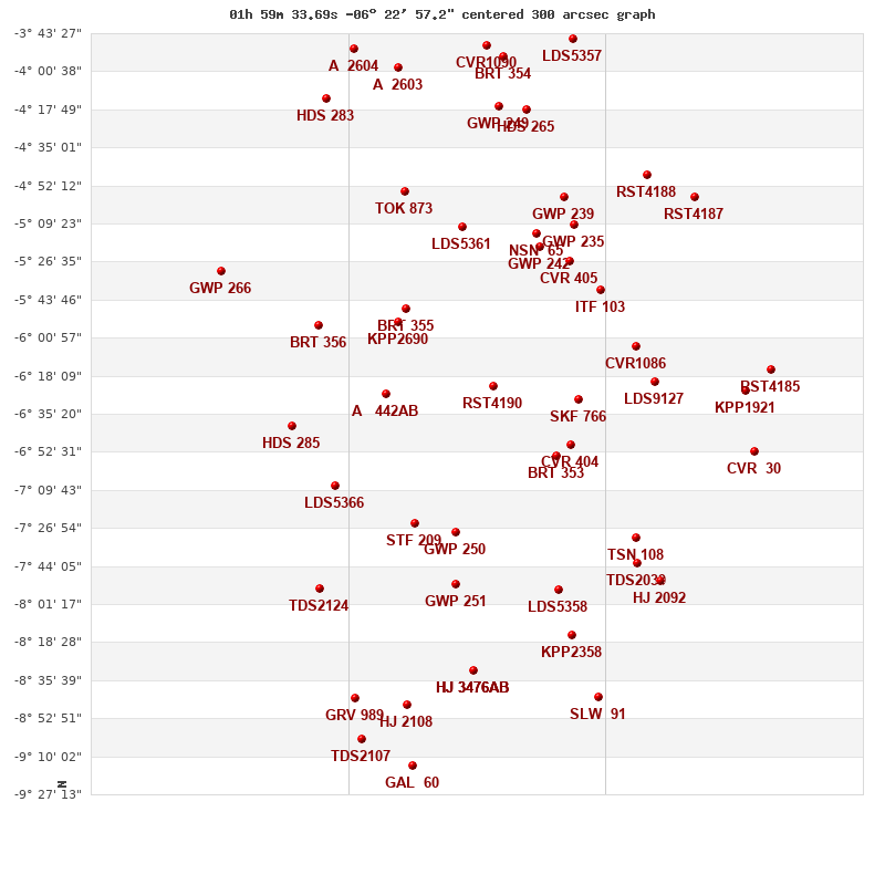
Click on the map to see the double of your interest.
Pass over with the mouse cursor to display the catalog designation.
|
| Show |
name |
coord_2000 |
discov# |
comp |
pa |
sep |
dist(') |
| Show |
|
01596-0623 |
RST4190 |
|
136 |
0.2 |
0 |
| Show |
|
01568-0655 |
BRT 353 |
|
296 |
4.4 |
53 |
| Show |
|
01558-0629 |
SKF 766 |
|
314 |
16.9 |
57 |
| Show |
|
01562-0650 |
CVR 404 |
|
96 |
27.4 |
58 |
| Show |
|
02035-0548 |
BRT 355 |
|
52 |
3.6 |
69 |
| Show |
|
01575-0520 |
GWP 242 |
|
109 |
9.7 |
70 |
| Show |
|
02038-0554 |
KPP2690 |
|
14 |
7.3 |
71 |
| Show |
|
02012-0729 |
GWP 250 |
|
335 |
259.8 |
71 |
| Show |
|
02044-0627 |
A 442 |
AB |
275 |
1.0 |
72 |
| Show |
|
01577-0514 |
NSN 65 |
|
240 |
5.3 |
75 |
| Show |
|
02009-0510 |
LDS5361 |
|
301 |
33.3 |
76 |
| Show |
|
01562-0527 |
CVR 405 |
|
251 |
9.7 |
76 |
| Show |
|
02031-0725 |
STF 209 |
|
136 |
39.8 |
82 |
| Show |
|
01548-0540 |
ITF 103 |
|
330 |
9.6 |
84 |
| Show |
|
01560-0510 |
GWP 235 |
|
263 |
89.9 |
91 |
| Show |
|
02013-0752 |
GWP 251 |
|
17 |
47.1 |
93 |
| Show |
|
01532-0605 |
CVR1086 |
|
138 |
4.1 |
97 |
| Show |
|
01564-0457 |
GWP 239 |
|
57 |
52.3 |
98 |
| Show |
|
01567-0754 |
LDS5358 |
|
98 |
69.2 |
102 |
| Show |
|
02035-0455 |
TOK 873 |
|
346 |
0.2 |
107 |
| Show |
|
01523-0620 |
LDS9127 |
|
315 |
2.1 |
107 |
| Show |
|
02066-0706 |
LDS5366 |
|
343 |
23.2 |
115 |
| Show |
|
01532-0731 |
TSN 108 |
|
342 |
55.0 |
117 |
| Show |
|
02074-0555 |
BRT 356 |
|
90 |
4.8 |
120 |
| Show |
|
01561-0815 |
KPP2358 |
|
278 |
20.2 |
124 |
| Show |
|
01532-0743 |
TDS2039 |
|
207 |
2.8 |
124 |
| Show |
|
01593-0417 |
GWP 249 |
AB |
200 |
40.4 |
127 |
| Show |
|
01593-0417 |
GKM9039 |
Aa,Ab |
209 |
0.2 |
127 |
| Show |
|
01581-0418 |
HDS 265 |
|
102 |
0.6 |
127 |
| Show |
|
02004-0831 |
HJ 3476 |
AB |
202 |
61.5 |
130 |
| Show |
|
02004-0831 |
STU 15 |
AC |
61 |
384.4 |
130 |
| Show |
|
02004-0831 |
ARN 29 |
AD |
26 |
368.9 |
130 |
| Show |
|
02085-0641 |
HDS 285 |
|
122 |
0.2 |
135 |
| Show |
|
01528-0447 |
RST4188 |
|
54 |
0.3 |
140 |
| Show |
|
01518-0750 |
HJ 2092 |
|
78 |
13.5 |
142 |
| Show |
|
02073-0754 |
TDS2124 |
|
147 |
1.5 |
148 |
| Show |
|
01591-0354 |
BRT 354 |
|
124 |
4.4 |
149 |
| Show |
|
01599-0349 |
CVR1090 |
|
111 |
3.5 |
155 |
| Show |
|
02034-0847 |
HJ 2108 |
|
253 |
25.0 |
156 |
| Show |
|
01549-0843 |
SLW 91 |
|
162 |
18.2 |
157 |
| Show |
|
02038-0359 |
A 2603 |
|
206 |
4.6 |
158 |
| Show |
|
01506-0457 |
RST4187 |
|
157 |
5.5 |
159 |
| Show |
|
01560-0346 |
LDS5357 |
|
175 |
78.4 |
166 |
| Show |
|
01483-0625 |
KPP1921 |
|
336 |
15.1 |
168 |
| Show |
|
02050-0843 |
GRV 989 |
|
5 |
10.0 |
169 |
| Show |
|
02070-0413 |
HDS 283 |
|
269 |
1.0 |
172 |
| Show |
|
01478-0652 |
CVR 30 |
|
166 |
11.0 |
176 |
| Show |
|
02058-0351 |
A 2604 |
|
127 |
5.0 |
179 |
| Show |
|
02032-0914 |
GAL 60 |
|
129 |
4.6 |
180 |
| Show |
|
02054-0902 |
TDS2107 |
|
94 |
0.4 |
182 |
| Show |
|
01472-0615 |
RST4185 |
|
255 |
1.2 |
184 |
|
|
WDS 01596-0623 : COMPONENTS
01596-0623 A
| Name |
HD 12188 |
|
Coord arcsec 2000 |
015933.69-062257.2 |
|
Mag |
9.74 |
|
Spectral class |
F8 (yellow-white) |
|
| PmRA |
33.00 |
|
PmDE |
-26.0 |
|
HIP |
9304 |
|
Tycho2 |
4688-00668-1 |
|
| HD |
12188 |
|
BD |
BD-07 337 |
|
| Tycho2 |
4688-00668-1 |
|
Pflag |
|
|
RAmdeg |
29.89045112 |
|
DEmdeg |
-6.38260432 |
|
| PmRA |
34.1 |
|
PmDE |
-25.3 |
|
E RAmdeg |
9 |
|
E DEmdeg |
12 |
|
| E pmRA |
1.1 |
|
E pmDE |
1.2 |
|
EpRAm |
1989.58 |
|
EpDEm |
1988.30 |
|
| Num |
12 |
|
Q RAmdeg |
0.7 |
|
Q DEmdeg |
1.1 |
|
Q pmRA |
0.6 |
|
| Q pmDE |
1.1 |
|
BTmag |
9.646 |
|
E BTmag |
0.024 |
|
VTmag |
9.171 |
|
| E VTmag |
0.020 |
|
Prox |
999 |
|
TYC |
T |
|
HIP |
9304 |
|
| CCDM |
AB |
|
RAdeg |
29.89037222 |
|
DEdeg |
-6.38254111 |
|
EpRA 1990 |
1.70 |
|
| EpDE 1990 |
1.47 |
|
E RAdeg |
10.0 |
|
E DEdeg |
13.2 |
|
Posflg |
P |
|
| Corr |
-0.2 |
|
| Catalog |
H |
|
HIP |
9304 |
|
Proxy |
H |
|
RAhms |
01 59 33.69 |
|
| DEdms |
-06 22 57.2 |
|
Vmag |
9.15 |
|
VarFlag |
|
|
R Vmag |
H |
|
| RAdeg |
29.8904 |
|
DEdeg |
-6.38254 |
|
AstroRef |
* |
|
Plx |
6.56 |
|
| CCDM |
36.14 |
|
N CCDM |
I |
|
Nsys |
1 |
|
Ncomp |
2 |
|
| MultFlag |
C |
|
Source |
S |
|
Qual |
A |
|
M HIP |
AB |
|
| Theta |
134 |
|
Rho |
0.174 |
|
HD |
|
|
BD |
BD-07 337 |
|
| CD |
|
|
CP |
|
|
Dm number |
-07 337 |
|
VIred |
0.47 |
|
| SpType |
F8 |
|
R SpType |
|
|
Coord arcsec 2000 |
015933.69-062257.2 |
|
| HIP |
9304 |
|
Sn |
55 |
|
So |
3 |
|
Nc |
2 |
|
| RArad |
0.5216853261 |
|
DErad |
-0.1113963726 |
|
Plx |
8.07 |
|
PmRA |
35.68 |
|
| PmDE |
-26.59 |
|
E RArad |
1.33 |
|
E DErad |
0.87 |
|
E Plx |
1.43 |
|
| E pmRA |
1.63 |
|
E pmDE |
1.01 |
|
Hpmag |
|
|
E Hpmag |
0.0025 |
|
| SHp |
0.017 |
|
VA |
0 |
|
BV |
0.466 |
|
E BV |
0.026 |
|
| VI |
0.54 |
|
| Ccdm |
01596-0623 |
|
RComp |
|
|
Comp |
A |
|
Note1 |
|
|
| Note2 |
|
|
Discov num |
|
|
DRAs |
-2.37 |
|
DDEs |
3.3 |
|
| R dRAs |
10 |
|
Year |
|
|
Theta |
|
|
Rho |
|
|
| Obs |
2 |
|
Vmag |
9.5 |
|
Sp |
F8 |
|
PmNote |
* |
|
| PmRA |
18 |
|
PmDE |
-15 |
|
Dm number |
-07 337 |
|
Cat1 |
BD |
|
| Name2 |
129610 |
|
Cat2 |
SAO |
|
HD |
12188 |
|
M HD |
|
|
| ADS BDS |
|
|
M ADS BDS |
|
|
N IDS |
|
|
IDS |
01546S0652A |
|
| HIC |
9304 |
|
01596-0623 B
| Coord arcsec 2000 |
015933.70-062257.3 |
|
Mag |
10.37 |
|
Delta magnitude |
0.63 |
|
Coordinate calculated |
yes |
|
| Ccdm |
01596-0623 |
|
RComp |
|
|
Comp |
B |
|
Note1 |
|
|
| Note2 |
|
|
Discov num |
RST4190 |
|
DRAs |
|
|
DDEs |
|
|
| R dRAs |
|
|
Year |
1938 |
|
Theta |
112 |
|
Rho |
0.2 |
|
| Obs |
6 |
|
Vmag |
9.5 |
|
Sp |
|
|
PmNote |
|
|
| PmRA |
|
|
PmDE |
|
|
Dm number |
|
|
Cat1 |
|
|
| Name2 |
|
|
Cat2 |
|
|
HD |
|
|
M HD |
|
|
| ADS BDS |
|
|
M ADS BDS |
|
|
N IDS |
|
|
IDS |
01546S0652B |
|
| HIC |
9304 |
|