17290-5134 BRT 972
17h 28m 58.79s -51° 34' 14.3" P.A. 108.00 sep 5.7 mag 10.94,12.40
| Coord 2000 |
17290-5134 |
|
Discov num |
BRT 972 |
|
Comp |
|
|
Coord arcsec 2000 |
17 28 58.79 -51 34 14.3 |
|
| Date first |
1904 |
|
Date last |
2015 |
|
Obs |
5 |
|
| Pa first |
110 |
|
Pa last |
107.6 |
|
P.A. Now (θ) |
107.6° |
|
| Sep first |
4.3 |
|
Sep last |
5.697 |
|
Sep. Now (ρ) |
5.697" |
|
| Mag pri |
10.94 |
|
Mag sec |
12.40 |
|
delta mag (ΔM) |
1.46 |
|
Spectral class |
|
|
| Pri motion ra |
-002 |
|
Sec motion ra |
|
|
| Pri motion dec |
-006 |
|
Sec motion dec |
|
|
| Notes |
|
|
Nature of this double is uncertain.
OTHER CATALOGS AND DESIGNATIONS
| Constellation |
Ara |
|
Gaia DR2 |
5925214324697347584 |
|
WDS 17290-5134 BRT 972 : NOTES
No records found.
DISCOVERER
| discov |
author |
| BRT |
Barton, S.G. |
WDS HISTORIC DATA
| coord_2000 |
discov_num |
comp |
epoch |
obs |
pa |
sep |
mag_pri |
mag_sec |
spectr |
dm_number |
notes |
coord_arcsec_2000 |
| 17290-5134 |
BRT 972 |
|
1904 |
1 |
110 |
4.2 |
10.94 |
12.40 |
|
|
|
172857.85-513304.1 |
| 17290-5134 |
BRT 972 |
|
2000 |
4 |
109 |
5.5 |
10.94 |
12.40 |
|
|
|
172858.79-513414.3 |
| 17290-5134 |
BRT 972 |
|
2015 |
6 |
108 |
5.7 |
10.94 |
12.40 |
|
|
|
172858.79-513414.3 |
If you need more information about this double, apply for a
data request form to the WDS.
WDS 17290-5134 BRT 972 : VISUAL OBSERVATIONS REPORTS
No records found.
WDS 17290-5134 BRT 972 : MEASURES
No records found.
WDS 17290-5134 : VIRTUAL EYEPIECE

Click on the map to see the double of your interest.
Pass over with the mouse cursor to display the catalog designation.
|
|
WDS 17290-5134 : ALADIN DSS IMAGE @ 17h 28m 58.79s -51° 34' 14.3"
WDS 17290-5134 BRT 972 : NEIGHBORHOODS
|
|
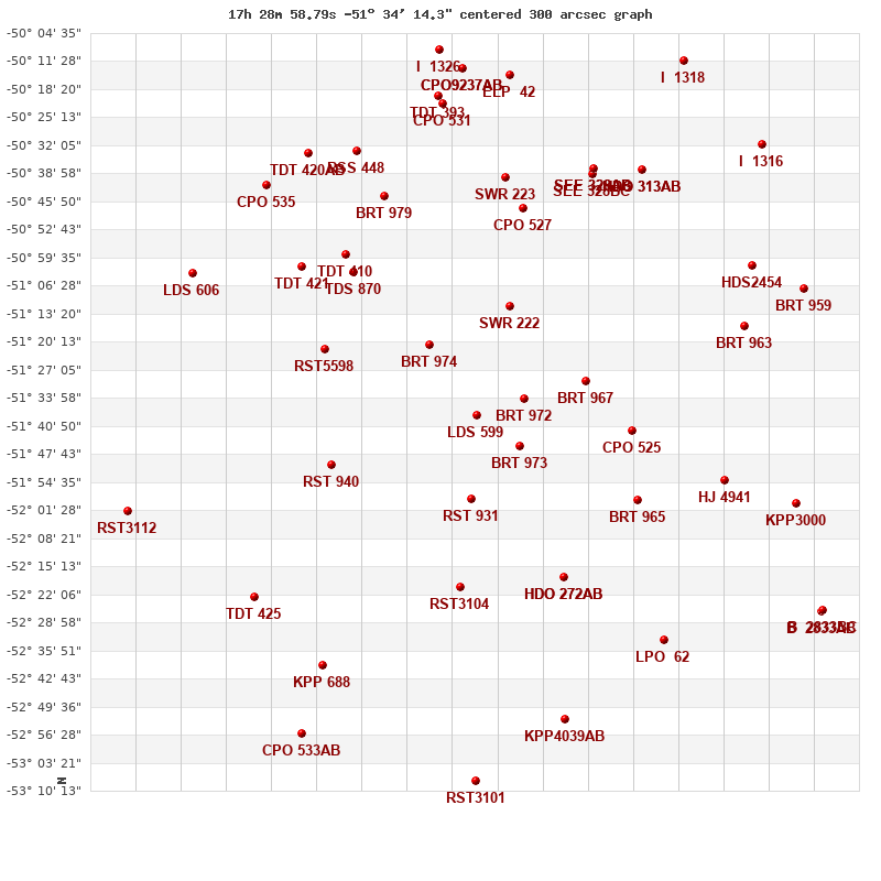
Click on the map to see the double of your interest.
Pass over with the mouse cursor to display the catalog designation.
|
| Show |
name |
coord_2000 |
discov# |
comp |
pa |
sep |
dist(') |
| Show |
|
17290-5134 |
BRT 972 |
|
108 |
5.7 |
0 |
| Show |
|
17291-5146 |
BRT 973 |
|
43 |
4.2 |
12 |
| Show |
|
17302-5138 |
LDS 599 |
|
101 |
47.6 |
12 |
| Show |
|
17274-5129 |
BRT 967 |
|
141 |
3.5 |
16 |
| Show |
|
17293-5111 |
SWR 222 |
|
36 |
24.2 |
24 |
| Show |
|
17314-5121 |
BRT 974 |
|
325 |
4.0 |
27 |
| Show |
|
17262-5142 |
CPO 525 |
|
176 |
5.5 |
27 |
| Show |
|
17303-5159 |
RST 931 |
|
340 |
0.5 |
28 |
| Show |
|
17261-5159 |
BRT 965 |
|
134 |
8.1 |
37 |
| Show |
|
17280-5218 |
HDO 272 |
AB |
356 |
31.2 |
45 |
| Show |
|
17280-5218 |
HDO 272 |
AC |
336 |
37.7 |
45 |
| Show |
|
17290-5048 |
CPO 527 |
|
34 |
4.0 |
47 |
| Show |
|
17339-5150 |
RST 940 |
|
325 |
0.1 |
49 |
| Show |
|
17306-5220 |
RST3104 |
|
54 |
1.1 |
49 |
| Show |
|
17340-5122 |
RST5598 |
|
217 |
3.8 |
49 |
| Show |
|
17333-5103 |
TDS 870 |
|
286 |
0.9 |
52 |
| Show |
|
17239-5154 |
HJ 4941 |
|
315 |
5.7 |
52 |
| Show |
|
17295-5040 |
SWR 223 |
|
209 |
13.1 |
55 |
| Show |
|
17235-5116 |
BRT 963 |
|
135 |
4.6 |
56 |
| Show |
|
17335-5059 |
TDT 410 |
|
128 |
1.1 |
56 |
| Show |
|
17272-5038 |
SEE 328 |
BC |
272 |
4.2 |
58 |
| Show |
|
17272-5038 |
SEE 328 |
AB |
159 |
75.5 |
59 |
| Show |
|
17272-5038 |
SEE 328 |
AD |
166 |
40.6 |
59 |
| Show |
|
17325-5045 |
BRT 979 |
|
234 |
5.8 |
60 |
| Show |
|
17346-5102 |
TDT 421 |
|
0 |
2.3 |
63 |
| Show |
|
17260-5038 |
HDO 313 |
AB |
187 |
47.7 |
63 |
| Show |
|
17260-5038 |
HDO 313 |
AC |
110 |
41.3 |
63 |
| Show |
|
17232-5101 |
HDS2454 |
|
150 |
0.3 |
64 |
| Show |
|
17254-5233 |
LPO 62 |
|
90 |
10.1 |
68 |
| Show |
|
17221-5200 |
KPP3000 |
|
95 |
2.9 |
69 |
| Show |
|
17218-5107 |
BRT 959 |
|
99 |
5.1 |
72 |
| Show |
|
17332-5033 |
RSS 448 |
|
338 |
30.3 |
73 |
| Show |
|
17310-5022 |
CPO 531 |
|
298 |
19.2 |
76 |
| Show |
|
17311-5020 |
TDT 393 |
|
144 |
4.1 |
78 |
| Show |
|
17279-5253 |
KPP4039 |
AB |
309 |
9.5 |
80 |
| Show |
|
17344-5034 |
TDT 420 |
AB |
115 |
0.7 |
80 |
| Show |
|
17293-5015 |
ELP 42 |
|
16 |
0.7 |
80 |
| Show |
|
17358-5223 |
TDT 425 |
|
74 |
3.6 |
80 |
| Show |
|
17341-5240 |
KPP 688 |
|
164 |
6.1 |
81 |
| Show |
|
17355-5042 |
CPO 535 |
|
158 |
4.0 |
81 |
| Show |
|
17305-5013 |
CPO9237 |
AB |
126 |
4.4 |
83 |
| Show |
|
17305-5013 |
CPO9237 |
AC |
245 |
7.4 |
83 |
| Show |
|
17230-5032 |
I 1316 |
|
193 |
1.1 |
85 |
| Show |
|
17374-5103 |
LDS 606 |
|
266 |
12.9 |
85 |
| Show |
|
17214-5226 |
B 2833 |
AB |
308 |
23.9 |
87 |
| Show |
|
17214-5226 |
B 2833 |
BC |
14 |
4.8 |
87 |
| Show |
|
17311-5009 |
I 1326 |
|
81 |
0.3 |
88 |
| Show |
|
17249-5011 |
I 1318 |
|
194 |
2.1 |
92 |
| Show |
|
17303-5308 |
RST3101 |
|
169 |
1.6 |
95 |
| Show |
|
17346-5256 |
CPO 533 |
AB |
197 |
13.6 |
97 |
| Show |
|
17391-5202 |
RST3112 |
|
80 |
2.0 |
98 |
|
|
WDS 17290-5134 : COMPONENTS
17290-5134 A
| Coord arcsec 2000 |
172858.79-513414.3 |
|
Mag |
10.94 |
|
PmRA |
-2.00 |
|
PmDE |
-6.0 |
|
17290-5134 B
| Coord arcsec 2000 |
172859.37-513416.0 |
|
Mag |
12.4 |
|
Delta magnitude |
1.46 |
|
Coordinate calculated |
yes |
|