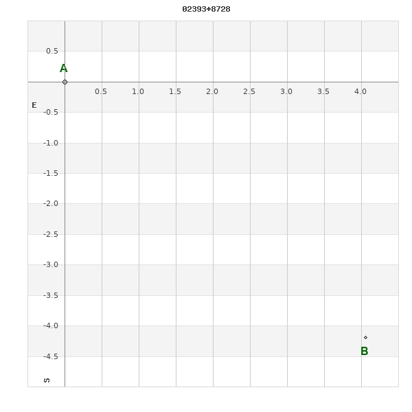
02393+8728 LOC 48
02h 39m 16.46s +87° 28' 23.1" P.A. 224.00 sep 5.8 mag 12.70,14.30
| Coord 2000 |
02393+8728 |
|
Discov num |
LOC 48 |
|
Comp |
|
|
Coord arcsec 2000 |
02 39 16.46 +87 28 23.1 |
|
| Date first |
2000 |
|
Date last |
2016 |
|
Obs |
6 |
|
| Pa first |
224 |
|
Pa last |
224 |
|
P.A. Now (θ) |
224° |
|
| Sep first |
5.8 |
|
Sep last |
5.831 |
|
Sep. Now (ρ) |
5.831" |
|
| Mag pri |
12.70 |
|
Mag sec |
14.30 |
|
delta mag (ΔM) |
1.6 |
|
Spectral class |
|
|
| Pri motion ra |
+048 |
|
Sec motion ra |
+048 |
|
| Pri motion dec |
-054 |
|
Sec motion dec |
-054 |
|
| Notes |
T
(Parallax indicates physical) |
|
This double is physical.
OTHER CATALOGS AND DESIGNATIONS
| Constellation |
Cepheus |
|
SAO |
130038 |
|
WDS 02393+8728 LOC 48 : NOTES
No records found.
DISCOVERER
| discov |
author |
| LOC |
Locatelli, G. |
WDS HISTORIC DATA
| coord_2000 |
discov_num |
comp |
epoch |
obs |
pa |
sep |
mag_pri |
mag_sec |
spectr |
dm_number |
notes |
coord_arcsec_2000 |
| 02393+8728 |
LOC 48 |
|
2015 |
2 |
224 |
5.8 |
12.70 |
14.30 |
|
|
T |
023916.46+872823.1 |
| 02393+8728 |
LOC 48 |
|
2016 |
6 |
224 |
5.8 |
12.70 |
14.30 |
|
|
T |
023916.46+872823.1 |
If you need more information about this double, apply for a
data request form to the WDS.
WDS 02393+8728 LOC 48 : VISUAL OBSERVATIONS REPORTS
No records found.
WDS 02393+8728 LOC 48 : MEASURES
No records found.
WDS 02393+8728 : VIRTUAL EYEPIECE
Click on the map to see the double of your interest.
Pass over with the mouse cursor to display the catalog designation.
|
|
WDS 02393+8728 : ALADIN DSS IMAGE @ 02h 39m 16.46s +87° 28' 23.1"
WDS 02393+8728 LOC 48 : NEIGHBORHOODS
|
|
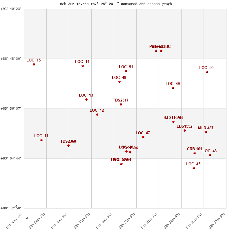
Click on the map to see the double of your interest.
Pass over with the mouse cursor to display the catalog designation.
|
| Show |
name |
coord_2000 |
discov# |
comp |
pa |
sep |
dist(') |
| Show |
|
02393+8728 |
LOC 48 |
|
224 |
5.8 |
1 |
| Show |
|
02283+8708 |
LOC 49 |
|
65 |
3.8 |
23 |
| Show |
|
02215+8803 |
LOC 50 |
|
213 |
3.1 |
37 |
| Show |
|
02379+8806 |
LOC 51 |
|
296 |
3.4 |
38 |
| Show |
|
02468+8824 |
LOC 14 |
|
194 |
6.2 |
56 |
| Show |
|
02460+8628 |
LOC 13 |
|
180 |
4.7 |
61 |
| Show |
|
02567+8829 |
LOC 15 |
|
232 |
4.3 |
62 |
| Show |
|
02390+8611 |
TDS2317 |
|
190 |
0.6 |
78 |
| Show |
|
02318+8916 |
STF 93 |
BC |
83 |
53.1 |
108 |
| Show |
|
02318+8916 |
STF 93 |
BD |
179 |
69.3 |
108 |
| Show |
Polaris |
02318+8916 |
WRH 39 |
Aa,Ab |
293 |
0.1 |
108 |
| Show |
Polaris |
02318+8916 |
STF 93 |
AB |
236 |
18.4 |
108 |
| Show |
Polaris |
02318+8916 |
STF 93 |
AC |
103 |
39.0 |
108 |
| Show |
Polaris |
02318+8916 |
STF 93 |
AD |
194 |
83.2 |
108 |
| Show |
|
02438+8536 |
LOC 12 |
|
183 |
35.0 |
113 |
| Show |
|
02282+8511 |
HJ 2110 |
AB |
324 |
5.1 |
138 |
| Show |
|
02282+8511 |
HJ 2110 |
AC |
315 |
41.2 |
138 |
| Show |
|
02260+8441 |
LDS1552 |
|
146 |
3.7 |
168 |
| Show |
|
02217+8435 |
MLR 487 |
|
270 |
1.6 |
175 |
| Show |
|
02344+8418 |
LOC 47 |
|
200 |
8.2 |
191 |
| Show |
|
02552+8408 |
LOC 11 |
|
243 |
53.1 |
201 |
| Show |
|
02497+8349 |
TDS2368 |
|
22 |
0.8 |
220 |
| Show |
|
02379+8329 |
LOC 46 |
|
236 |
49.8 |
240 |
| Show |
|
02371+8326 |
TDS2304 |
|
327 |
0.7 |
243 |
| Show |
|
02239+8323 |
CRB 161 |
|
170 |
25.9 |
246 |
| Show |
|
02208+8316 |
LOC 43 |
|
348 |
2.5 |
254 |
| Show |
|
02389+8246 |
DVG 52 |
BC |
39 |
18.3 |
283 |
| Show |
|
02389+8246 |
DVG 52 |
AB |
246 |
9.6 |
283 |
| Show |
|
02389+8246 |
DVG 52 |
AC |
14 |
10.7 |
283 |
| Show |
|
02241+8230 |
LOC 45 |
|
41 |
2.9 |
299 |
|
|
WDS 02393+8728 : COMPONENTS
02393+8728 A
| Coord arcsec 2000 |
023916.46+872823.1 |
|
Mag |
12.7 |
|
PmRA |
48.00 |
|
PmDE |
-54.0 |
|
| SAO |
130038 |
|
| SAO |
130038 |
|
DelFlag |
|
|
RA1950 |
|
|
PmRA1950 |
0.0046 |
|
| DE1950 |
|
|
PmDE1950 |
-0.009 |
|
Vmag |
8.3 |
|
SpType |
G0 |
|
| Double code |
|
|
Source |
70 |
|
CatNum |
3184 |
|
DM |
BD-02 462 |
|
| DMcomp |
|
|
BDsup |
|
|
HD |
16560 |
|
M HD |
0 |
|
| GC |
3184 |
|
RA1950rad |
0.68403172 |
|
DE1950rad |
-0.03693184 |
|
PmRA2000 |
0.0049 |
|
| PmDE2000 |
-0.013 |
|
02393+8728 B
| Coord arcsec 2000 |
023910.34+872818.9 |
|
Mag |
14.3 |
|
PmRA |
48.00 |
|
PmDE |
-54.0 |
|
| Delta magnitude |
1.6 |
|
Coordinate calculated |
yes |
|