03151+1704 TDS 2499
03h 15m 05.77s +17° 03' 58.3" P.A. 196.00 sep 0.4 mag 10.28,10.54
| Coord 2000 |
03151+1704 |
|
Discov num |
TDS2499 |
|
Comp |
|
|
Coord arcsec 2000 |
03 15 05.77 +17 03 58.3 |
|
| Date first |
1991 |
|
Date last |
1991 |
|
Obs |
1 |
|
| Pa first |
196 |
|
Pa last |
196.3 |
|
P.A. Now (θ) |
196.3° |
|
| Sep first |
0.4 |
|
Sep last |
0.42 |
|
Sep. Now (ρ) |
0.42" |
|
| Mag pri |
10.28 |
|
Mag sec |
10.54 |
|
delta mag (ΔM) |
0.26 |
|
Spectral class |
|
|
| Pri motion ra |
+017 |
|
Sec motion ra |
+017 |
|
| Pri motion dec |
-004 |
|
Sec motion dec |
-004 |
|
| Notes |
X
(Dubious double) |
|
Nature of this double is uncertain.
OTHER CATALOGS AND DESIGNATIONS
| Constellation |
Aries |
|
Tycho2 |
1236-00559-1 |
|
Gaia DR2 |
55516648484066816 |
|
WDS 03151+1704 TDS 2499 : NOTES
No records found.
DISCOVERER
| discov |
author |
| TDS |
Tycho Double Star (from additional DD list) |
WDS HISTORIC DATA
| coord_2000 |
discov_num |
comp |
epoch |
obs |
pa |
sep |
mag_pri |
mag_sec |
spectr |
dm_number |
notes |
coord_arcsec_2000 |
| 03151+1704 |
TDS2499 |
|
1991 |
1 |
196 |
0.4 |
10.28 |
10.54 |
|
|
|
031505.77+170358.3 |
If you need more information about this double, apply for a
data request form to the WDS.
WDS 03151+1704 TDS 2499 : VISUAL OBSERVATIONS REPORTS
No records found.
WDS 03151+1704 TDS 2499 : MEASURES
No records found.
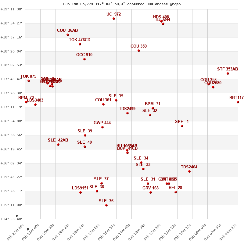
WDS 03151+1704 : VIRTUAL EYEPIECE

Click on the map to see the double of your interest.
Pass over with the mouse cursor to display the catalog designation.
|
|
WDS 03151+1704 : ALADIN DSS IMAGE @ 03h 15m 05.77s +17° 03' 58.3"
WDS 03151+1704 TDS 2499 : NEIGHBORHOODS
|
|
Click on the map to see the double of your interest.
Pass over with the mouse cursor to display the catalog designation.
|
| Show |
name |
coord_2000 |
discov# |
comp |
pa |
sep |
dist(') |
| Show |
|
03151+1704 |
TDS2499 |
|
196 |
0.4 |
1 |
| Show |
|
03160+1720 |
SLE 35 |
|
171 |
13.7 |
21 |
| Show |
|
03134+1701 |
SLE 32 |
|
257 |
15.1 |
25 |
| Show |
|
03132+1710 |
BPM 71 |
|
169 |
107.1 |
28 |
| Show |
|
03169+1715 |
COU 361 |
|
16 |
1.8 |
29 |
| Show |
|
03170+1647 |
GWP 444 |
|
294 |
22.2 |
33 |
| Show |
|
03151+1618 |
HU 1055 |
AB |
117 |
0.6 |
46 |
| Show |
|
03151+1618 |
ENG 13 |
AB,C |
186 |
174.0 |
46 |
| Show |
|
03151+1618 |
JRN 2 |
AB,E |
263 |
251.1 |
46 |
| Show |
|
03151+1618 |
BUP 41 |
AB,D |
240 |
189.7 |
46 |
| Show |
|
03151+1618 |
BUP 41 |
CD |
298 |
163.7 |
49 |
| Show |
|
03183+1637 |
SLE 39 |
|
99 |
9.5 |
54 |
| Show |
|
03110+1648 |
SPF 1 |
|
222 |
0.2 |
61 |
| Show |
|
03183+1623 |
SLE 40 |
|
320 |
12.3 |
62 |
| Show |
|
03142+1603 |
SLE 34 |
|
48 |
9.0 |
63 |
| Show |
|
03139+1555 |
SLE 33 |
|
58 |
9.8 |
71 |
| Show |
|
03143+1821 |
COU 359 |
|
174 |
0.2 |
78 |
| Show |
|
03183+1810 |
OCC 910 |
|
142 |
0.4 |
81 |
| Show |
|
03203+1625 |
SLE 42 |
AB |
164 |
20.5 |
85 |
| Show |
|
03203+1625 |
SLE 42 |
Aa,Ab |
230 |
0.0 |
85 |
| Show |
|
03207+1736 |
HJ 3245 |
BE |
103 |
10.8 |
88 |
| Show |
|
03207+1736 |
HJ 3246 |
BC |
80 |
154.1 |
88 |
| Show |
|
03207+1736 |
HJ 3246 |
AB |
194 |
159.8 |
89 |
| Show |
|
03207+1736 |
HJ 3246 |
AD |
226 |
9.3 |
89 |
| Show |
|
03207+1736 |
HJ 3246 |
AC |
138 |
172.5 |
89 |
| Show |
|
03136+1537 |
SLE 31 |
|
254 |
11.3 |
90 |
| Show |
|
03207+1736 |
HJ 3246 |
CR |
158 |
15.6 |
90 |
| Show |
|
03171+1537 |
SLE 37 |
|
70 |
18.1 |
91 |
| Show |
|
03211+1741 |
XMI 6 |
|
254 |
29.6 |
94 |
| Show |
|
03090+1740 |
COU 358 |
|
112 |
2.1 |
95 |
| Show |
|
03121+1537 |
GWP 431 |
|
276 |
13.4 |
97 |
| Show |
|
03120+1538 |
BRT1175 |
|
143 |
2.4 |
98 |
| Show |
|
03087+1736 |
COU2680 |
|
245 |
1.5 |
98 |
| Show |
|
03104+1552 |
TDS2464 |
|
78 |
1.6 |
99 |
| Show |
|
03196+1841 |
TOK 476 |
CD |
235 |
416.2 |
99 |
| Show |
|
03220+1715 |
LDS3483 |
|
330 |
26.0 |
101 |
| Show |
|
03133+1526 |
GRV 168 |
|
95 |
22.3 |
101 |
| Show |
|
03174+1528 |
SLE 38 |
|
196 |
14.1 |
102 |
| Show |
|
03187+1527 |
LDS9151 |
|
61 |
8.8 |
111 |
| Show |
|
03227+1717 |
BPM 72 |
|
99 |
89.9 |
111 |
| Show |
|
03115+1527 |
HEI 28 |
|
43 |
5.6 |
111 |
| Show |
|
03225+1744 |
TOK 875 |
|
239 |
1.7 |
114 |
| Show |
|
03167+1511 |
SLE 36 |
|
204 |
14.3 |
116 |
| Show |
|
03196+1841 |
COU 36 |
AB |
143 |
1.0 |
116 |
| Show |
|
03196+1841 |
TOK 476 |
AC |
227 |
999.9 |
116 |
| Show |
|
03124+1855 |
HJ 3244 |
|
97 |
8.6 |
117 |
| Show |
|
03161+1900 |
UC 972 |
|
62 |
24.0 |
118 |
| Show |
|
03075+1753 |
STF 353 |
AB |
52 |
12.7 |
119 |
| Show |
|
03075+1753 |
FOX 128 |
AC |
17 |
30.1 |
119 |
| Show |
|
03125+1857 |
HDS 408 |
|
315 |
0.0 |
119 |
| Show |
|
03068+1717 |
BRT1174 |
|
152 |
4.2 |
120 |
|
|
WDS 03151+1704 : COMPONENTS
03151+1704 A
| Coord arcsec 2000 |
031505.77+170358.3 |
|
Mag |
10.28 |
|
PmRA |
17.00 |
|
PmDE |
-4.0 |
|
| Tycho2 |
1236-00559-1 |
|
| Tycho2 |
1236-00559-1 |
|
Pflag |
|
|
RAmdeg |
48.77403911 |
|
DEmdeg |
17.06615269 |
|
| PmRA |
16.8 |
|
PmDE |
-4.1 |
|
E RAmdeg |
18 |
|
E DEmdeg |
21 |
|
| E pmRA |
1.3 |
|
E pmDE |
1.3 |
|
EpRAm |
1988.64 |
|
EpDEm |
1986.09 |
|
| Num |
6 |
|
Q RAmdeg |
1.1 |
|
Q DEmdeg |
0.6 |
|
Q pmRA |
1.1 |
|
| Q pmDE |
0.5 |
|
BTmag |
10.942 |
|
E BTmag |
0.051 |
|
VTmag |
9.751 |
|
| E VTmag |
0.027 |
|
Prox |
999 |
|
TYC |
T |
|
HIP |
|
|
| CCDM |
|
|
RAdeg |
48.77399750 |
|
DEdeg |
17.06616306 |
|
EpRA 1990 |
1.75 |
|
| EpDE 1990 |
1.66 |
|
E RAdeg |
19.1 |
|
E DEdeg |
23.8 |
|
Posflg |
|
|
| Corr |
-0.3 |
|
03151+1704 B
| Coord arcsec 2000 |
031505.76+170357.9 |
|
Mag |
10.54 |
|
PmRA |
17.00 |
|
PmDE |
-4.0 |
|
| Delta magnitude |
0.26 |
|
Coordinate calculated |
yes |
|