10577-0540 RST 4469
10h 57m 43.37s -05° 39' 45.9" P.A. 130.00 sep 0.3 mag 10.60,10.60 Sp F2
| Coord 2000 |
10577-0540 |
|
Discov num |
RST4469 |
|
Comp |
|
|
Coord arcsec 2000 |
10 57 43.37 -05 39 45.9 |
|
| Date first |
1940 |
|
Date last |
1981 |
|
Obs |
3 |
|
| Pa first |
148 |
|
Pa last |
130.3 |
|
P.A. Now (θ) |
130.3° |
|
| Sep first |
0.2 |
|
Sep last |
0.31 |
|
Sep. Now (ρ) |
0.31" |
|
| Mag pri |
10.60 |
|
Mag sec |
10.60 |
|
delta mag (ΔM) |
0 |
|
Spectral class |
F2 (yellow-white) |
|
| Pri motion ra |
+007 |
|
Sec motion ra |
|
|
| Pri motion dec |
-003 |
|
Sec motion dec |
|
|
| Notes |
|
|
Nature of this double is uncertain.
OTHER CATALOGS AND DESIGNATIONS
| Constellation |
Leo |
|
Tycho2 |
4920-01384-1 |
|
Gaia DR2 |
3788674700016681088 |
|
WDS 10577-0540 RST 4469 : NOTES
No records found.
REFERENCES
| refcode |
metd |
author |
reference |
| Rst1933 |
T - |
Rossiter, R.A. |
1933MmRAS..65...27R |
| Rst1933 |
|
MemRAS 65, 27, 1933 |
|
| Rst1937 |
Ma - |
Rossiter, R.A. |
1937MmRAS..65...51R |
| Rst1937 |
|
MemRAS 65, 51, 1937 |
|
| Rst1943 |
Ma - |
Rossiter, R.A. |
1943POMic...8..133R |
| Rst1943 |
|
Pub. Univ. Michigan Obs. 8, 133, 1943 |
|
| Rst1944 |
- |
Rossiter, R.A. |
1944POMic...9....1R |
| Rst1944 |
|
Pub. Univ. Michigan Obs. 9, 1, 1944 |
|
| Rst1947 |
Ma - |
Rossiter, R.A. |
1947POMic...9....7R |
| Rst1947 |
|
Pub. Univ. Michigan Obs. 9, 7, 1947 |
|
| Rst1955 |
Ma j |
Rossiter, R.A. |
1955POMic..11....1R |
| Rst1955 |
+P+ |
Pub. Univ. Michigan Obs. 11, 1, 1955 |
|
| Rst1964 |
Ma - |
Rossiter, R.A. |
1964POMic...9...73R |
| Rst1964 |
|
Pub. Univ. Michigan Obs. 9, 73, 1964 |
|
WDS HISTORIC DATA
| coord_2000 |
discov_num |
comp |
epoch |
obs |
pa |
sep |
mag_pri |
mag_sec |
spectr |
notes |
coord_arcsec_2000 |
| 10577-0540 |
RST4469 |
|
1981 |
3 |
130 |
0.3 |
10.60 |
10.60 |
F2 |
|
105743.37-053945.9 |
If you need more information about this double, apply for a
data request form to the WDS.
WDS 10577-0540 RST 4469 : VISUAL OBSERVATIONS REPORTS
No records found.
WDS 10577-0540 RST 4469 : MEASURES
No records found.
WDS 10577-0540 : VIRTUAL EYEPIECE
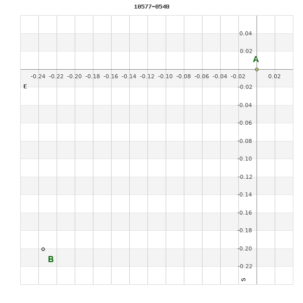
Click on the map to see the double of your interest.
Pass over with the mouse cursor to display the catalog designation.
|
|
WDS 10577-0540 : ALADIN DSS IMAGE @ 10h 57m 43.37s -05° 39' 45.9"
WDS 10577-0540 RST 4469 : NEIGHBORHOODS
|
|

Click on the map to see the double of your interest.
Pass over with the mouse cursor to display the catalog designation.
|
| Show |
name |
coord_2000 |
discov# |
comp |
pa |
sep |
dist(') |
| Show |
|
10577-0540 |
RST4469 |
|
130 |
0.3 |
|
| Show |
|
10567-0542 |
GWP1501 |
|
85 |
9.2 |
16 |
| Show |
|
10578-0555 |
GWP1510 |
|
350 |
7.6 |
16 |
| Show |
|
10528-0516 |
GWP1481 |
|
229 |
15.1 |
78 |
| Show |
|
11029-0528 |
KPP1395 |
|
106 |
10.4 |
79 |
| Show |
|
10598-0653 |
NSN 127 |
|
233 |
2.5 |
80 |
| Show |
|
11001-0657 |
A 134 |
|
329 |
1.9 |
86 |
| Show |
|
11023-0448 |
GWP1526 |
|
225 |
25.4 |
86 |
| Show |
|
10594-0721 |
A 133 |
|
44 |
0.3 |
104 |
| Show |
|
11036-0442 |
GWP1532 |
|
315 |
16.4 |
105 |
| Show |
|
10509-0516 |
RST4465 |
|
218 |
0.9 |
105 |
| Show |
|
11004-0718 |
GWP1518 |
|
278 |
31.2 |
106 |
| Show |
|
10510-0506 |
RST4466 |
|
318 |
0.5 |
106 |
| Show |
|
10547-0719 |
CRC 62 |
|
78 |
0.9 |
109 |
| Show |
|
10506-0611 |
GWP1472 |
|
52 |
90.2 |
112 |
| Show |
|
10594-0729 |
KPP2752 |
|
183 |
6.6 |
113 |
| Show |
|
10528-0709 |
KPP 232 |
|
356 |
4.9 |
116 |
| Show |
|
10527-0412 |
DAM1233 |
|
268 |
63.6 |
116 |
| Show |
|
10597-0735 |
HDS1569 |
|
247 |
15.2 |
119 |
| Show |
|
11053-0621 |
LDS4056 |
|
43 |
14.2 |
120 |
| Show |
|
10505-0641 |
UC 2009 |
|
6 |
49.9 |
125 |
| Show |
|
11054-0626 |
A 69 |
|
53 |
1.4 |
125 |
| Show |
|
11057-0505 |
WSP 106 |
AB |
245 |
13.2 |
125 |
| Show |
|
11057-0505 |
WSP 106 |
AC |
125 |
18.2 |
125 |
| Show |
|
10499-0453 |
GWP1469 |
|
19 |
18.0 |
126 |
| Show |
|
10519-0711 |
D 14 |
AB |
196 |
6.0 |
127 |
| Show |
|
10519-0711 |
STF1481 |
AC |
344 |
30.0 |
127 |
| Show |
|
10519-0407 |
DAM1439 |
|
308 |
1.9 |
128 |
| Show |
|
10553-0336 |
NSN 130 |
|
299 |
1.3 |
130 |
| Show |
|
10509-0410 |
HJ 169 |
AB |
70 |
2.0 |
133 |
| Show |
|
10509-0410 |
HJ 169 |
AC |
331 |
12.8 |
133 |
| Show |
|
11047-0413 |
A 676 |
BC |
248 |
0.3 |
136 |
| Show |
|
11047-0413 |
STF1506 |
A,BC |
221 |
11.8 |
136 |
| Show |
|
11047-0413 |
LAF 43 |
AD |
30 |
4.7 |
136 |
| Show |
|
11047-0413 |
LAF 43 |
AE |
213 |
5.6 |
136 |
| Show |
|
11047-0413 |
LAF 43 |
AF |
214 |
6.1 |
136 |
| Show |
|
11047-0413 |
LAF 43 |
AG |
330 |
8.9 |
136 |
| Show |
|
11000-0328 |
STF1500 |
|
299 |
1.3 |
136 |
| Show |
|
10536-0742 |
J 90 |
BC |
195 |
12.9 |
137 |
| Show |
|
10536-0742 |
J 90 |
AB |
39 |
1.9 |
138 |
| Show |
|
10536-0742 |
J 90 |
AC |
192 |
11.4 |
138 |
| Show |
|
10540-0747 |
GWP1489 |
|
72 |
68.2 |
139 |
| Show |
|
11022-0335 |
BRT 548 |
|
89 |
4.5 |
142 |
| Show |
|
10500-0416 |
DAM1437 |
|
162 |
20.7 |
143 |
| Show |
|
10501-0408 |
DAM1438 |
|
330 |
8.2 |
147 |
| Show |
|
11026-0331 |
HJ 173 |
|
177 |
35.5 |
149 |
| Show |
|
10517-0340 |
HDS1551 |
|
332 |
2.0 |
151 |
| Show |
|
10476-0601 |
GWP1457 |
|
130 |
28.1 |
154 |
| Show |
|
11081-0553 |
GWP1540 |
|
249 |
17.8 |
156 |
| Show |
|
10555-0813 |
GWP1497 |
|
202 |
16.6 |
158 |
| Show |
|
11080-0509 |
LDS 852 |
|
339 |
279.0 |
158 |
|
|
WDS 10577-0540 : COMPONENTS
10577-0540 A
| Componente originario normalizzato |
AB |
|
Coord arcsec 2000 |
105743.37-053945.9 |
|
Mag |
10.6 |
|
Spectral class |
F2 (yellow-white) |
|
| PmRA |
7.00 |
|
PmDE |
-3.0 |
|
Tycho2 |
4920-01384-1 |
|
DM |
BD-04 2982 |
|
| Tycho2 |
4920-01384-1 |
|
Pflag |
|
|
RAmdeg |
164.43073713 |
|
DEmdeg |
-5.66276832 |
|
| PmRA |
7.2 |
|
PmDE |
-7.3 |
|
E RAmdeg |
18 |
|
E DEmdeg |
20 |
|
| E pmRA |
1.3 |
|
E pmDE |
1.5 |
|
EpRAm |
1985.19 |
|
EpDEm |
1985.31 |
|
| Num |
9 |
|
Q RAmdeg |
0.9 |
|
Q DEmdeg |
1.5 |
|
Q pmRA |
1.0 |
|
| Q pmDE |
1.4 |
|
BTmag |
10.320 |
|
E BTmag |
0.039 |
|
VTmag |
9.877 |
|
| E VTmag |
0.039 |
|
Prox |
999 |
|
TYC |
T |
|
HIP |
|
|
| CCDM |
|
|
RAdeg |
164.43072139 |
|
DEdeg |
-5.66274444 |
|
EpRA 1990 |
1.64 |
|
| EpDE 1990 |
1.69 |
|
E RAdeg |
23.2 |
|
E DEdeg |
25.8 |
|
Posflg |
|
|
| Corr |
0.1 |
|
| Ccdm |
10577-0540 |
|
RComp |
|
|
Comp |
A |
|
Note1 |
|
|
| Note2 |
|
|
Discov num |
|
|
DRAs |
1.22 |
|
DDEs |
14.5 |
|
| R dRAs |
10 |
|
Year |
|
|
Theta |
|
|
Rho |
|
|
| Obs |
2 |
|
Vmag |
10.4 |
|
Sp |
F2 |
|
PmNote |
* |
|
| PmRA |
-15 |
|
PmDE |
0 |
|
Dm number |
-04 2982 |
|
Cat1 |
BD |
|
| Name2 |
137911 |
|
Cat2 |
SAO |
|
HD |
|
|
M HD |
|
|
| ADS BDS |
|
|
M ADS BDS |
|
|
N IDS |
|
|
IDS |
10527S0508A |
|
| HIC |
|
|
10577-0540 B
| Componente originario normalizzato |
AB |
|
Coord arcsec 2000 |
105743.39-053946.1 |
|
Mag |
10.6 |
|
Calc coord |
yes |
|
| Ccdm |
10577-0540 |
|
RComp |
|
|
Comp |
B |
|
Note1 |
|
|
| Note2 |
|
|
Discov num |
RST4469 |
|
DRAs |
|
|
DDEs |
|
|
| R dRAs |
|
|
Year |
1939 |
|
Theta |
145 |
|
Rho |
0.2 |
|
| Obs |
3 |
|
Vmag |
10.4 |
|
Sp |
|
|
PmNote |
|
|
| PmRA |
|
|
PmDE |
|
|
Dm number |
|
|
Cat1 |
|
|
| Name2 |
|
|
Cat2 |
|
|
HD |
|
|
M HD |
|
|
| ADS BDS |
|
|
M ADS BDS |
|
|
N IDS |
|
|
IDS |
10527S0508B |
|
| HIC |
|
|