10400-1802 RST 2700
10h 40m 02.28s -18° 01' 32.0" P.A. 155.00 sep 0.4 mag 10.40,10.60
| Coord 2000 |
10400-1802 |
|
Discov num |
RST2700 |
|
Comp |
|
|
Coord arcsec 2000 |
10 40 02.28 -18 01 32.0 |
|
| Date first |
1935 |
|
Date last |
1951 |
|
Obs |
3 |
|
| Pa first |
159 |
|
Pa last |
154.9 |
|
P.A. Now (θ) |
154.9° |
|
| Sep first |
0.3 |
|
Sep last |
0.35 |
|
Sep. Now (ρ) |
0.35" |
|
| Mag pri |
10.40 |
|
Mag sec |
10.60 |
|
delta mag (ΔM) |
0.2 |
|
Spectral class |
|
|
| Pri motion ra |
-034 |
|
Sec motion ra |
|
|
| Pri motion dec |
+006 |
|
Sec motion dec |
|
|
| Notes |
|
|
Nature of this double is uncertain.
OTHER CATALOGS AND DESIGNATIONS
| Constellation |
Hydra |
|
Tycho2 |
6078-00775-1 |
|
Gaia DR2 |
3555375821710568448 |
|
WDS 10400-1802 RST 2700 : NOTES
No records found.
REFERENCES
| refcode |
metd |
author |
reference |
| Rst1933 |
T - |
Rossiter, R.A. |
1933MmRAS..65...27R |
| Rst1933 |
|
MemRAS 65, 27, 1933 |
|
| Rst1937 |
Ma - |
Rossiter, R.A. |
1937MmRAS..65...51R |
| Rst1937 |
|
MemRAS 65, 51, 1937 |
|
| Rst1943 |
Ma - |
Rossiter, R.A. |
1943POMic...8..133R |
| Rst1943 |
|
Pub. Univ. Michigan Obs. 8, 133, 1943 |
|
| Rst1944 |
- |
Rossiter, R.A. |
1944POMic...9....1R |
| Rst1944 |
|
Pub. Univ. Michigan Obs. 9, 1, 1944 |
|
| Rst1947 |
Ma - |
Rossiter, R.A. |
1947POMic...9....7R |
| Rst1947 |
|
Pub. Univ. Michigan Obs. 9, 7, 1947 |
|
| Rst1955 |
Ma j |
Rossiter, R.A. |
1955POMic..11....1R |
| Rst1955 |
+P+ |
Pub. Univ. Michigan Obs. 11, 1, 1955 |
|
| Rst1964 |
Ma - |
Rossiter, R.A. |
1964POMic...9...73R |
| Rst1964 |
|
Pub. Univ. Michigan Obs. 9, 73, 1964 |
|
WDS HISTORIC DATA
| coord_2000 |
discov_num |
comp |
epoch |
obs |
pa |
sep |
mag_pri |
mag_sec |
spectr |
notes |
coord_arcsec_2000 |
| 10400-1802 |
RST2700 |
|
1951 |
3 |
155 |
0.4 |
10.40 |
10.60 |
|
|
104002.28-180132.0 |
If you need more information about this double, apply for a
data request form to the WDS.
WDS 10400-1802 RST 2700 : VISUAL OBSERVATIONS REPORTS
No records found.
WDS 10400-1802 RST 2700 : MEASURES
No records found.
WDS 10400-1802 : VIRTUAL EYEPIECE

Click on the map to see the double of your interest.
Pass over with the mouse cursor to display the catalog designation.
|
|
WDS 10400-1802 : ALADIN DSS IMAGE @ 10h 40m 02.28s -18° 01' 32.0"
WDS 10400-1802 RST 2700 : NEIGHBORHOODS
|
|
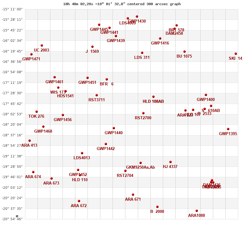
Click on the map to see the double of your interest.
Pass over with the mouse cursor to display the catalog designation.
|
| Show |
name |
coord_2000 |
discov# |
comp |
pa |
sep |
dist(') |
| Show |
|
10400-1802 |
RST2700 |
|
155 |
0.4 |
|
| Show |
|
10391-1735 |
HLD 108 |
AB |
23 |
1.0 |
30 |
| Show |
|
10391-1735 |
HO 373 |
AC |
238 |
49.6 |
30 |
| Show |
|
10427-1826 |
GWP1440 |
|
94 |
10.9 |
46 |
| Show |
|
10362-1757 |
ARA 223 |
|
181 |
6.3 |
56 |
| Show |
|
10355-1756 |
HLD 107 |
|
307 |
1.6 |
65 |
| Show |
|
10443-1731 |
RST3711 |
|
98 |
2.4 |
69 |
| Show |
|
10435-1852 |
GWP1442 |
|
229 |
43.4 |
71 |
| Show |
|
10434-1706 |
BFR 6 |
|
104 |
17.0 |
74 |
| Show |
|
10345-1753 |
B 2533 |
|
104 |
1.7 |
81 |
| Show |
|
10406-1922 |
LDS 312 |
|
165 |
16.3 |
82 |
| Show |
|
10343-1732 |
GWP1400 |
|
72 |
32.4 |
87 |
| Show |
|
10376-1921 |
HJ 4337 |
|
71 |
9.8 |
88 |
| Show |
|
10339-1750 |
S 610 |
AB |
51 |
114.0 |
90 |
| Show |
|
10451-1704 |
GWP1451 |
|
329 |
89.5 |
94 |
| Show |
|
10417-1936 |
RST2704 |
|
121 |
0.4 |
98 |
| Show |
|
10402-1622 |
LDS 311 |
|
317 |
214.4 |
100 |
| Show |
|
10457-1907 |
LDS4013 |
|
354 |
6.7 |
104 |
| Show |
|
10474-1804 |
GWP1456 |
|
320 |
41.2 |
106 |
| Show |
|
10472-1725 |
HDS1541 |
|
299 |
0.2 |
109 |
| Show |
|
10323-1827 |
GWP1395 |
|
268 |
106.0 |
114 |
| Show |
|
10363-1621 |
BU 1075 |
|
280 |
3.5 |
115 |
| Show |
|
10478-1720 |
WIS 173 |
|
128 |
999.9 |
119 |
| Show |
|
10385-1559 |
GWP1416 |
|
313 |
23.9 |
125 |
| Show |
|
10460-1934 |
GWP1452 |
|
97 |
16.3 |
126 |
| Show |
|
10447-1613 |
J 1569 |
|
19 |
9.3 |
129 |
| Show |
|
10482-1702 |
GWP1461 |
|
24 |
16.6 |
131 |
| Show |
|
10459-1942 |
HLD 110 |
|
281 |
2.6 |
131 |
| Show |
|
10426-1555 |
GWP1439 |
|
291 |
7.5 |
132 |
| Show |
|
10492-1823 |
GWP1468 |
|
251 |
32.0 |
133 |
| Show |
|
10410-2014 |
ARA 671 |
|
55 |
10.4 |
134 |
| Show |
|
10498-1759 |
TOK 276 |
|
222 |
67.7 |
140 |
| Show |
|
10338-1951 |
DAM2426 |
|
|
17.4 |
142 |
| Show |
|
10339-1954 |
DAM2428 |
|
161 |
37.3 |
143 |
| Show |
|
10372-1543 |
DAM2458 |
|
232 |
3.0 |
145 |
| Show |
|
10336-1955 |
RST2695 |
|
137 |
2.7 |
146 |
| Show |
|
10432-1542 |
GWP1441 |
|
39 |
56.5 |
147 |
| Show |
|
10370-1538 |
BRT 578 |
|
92 |
3.0 |
151 |
| Show |
|
10388-2035 |
B 2000 |
|
128 |
0.4 |
155 |
| Show |
|
10505-1847 |
ARA 413 |
|
132 |
12.7 |
155 |
| Show |
|
10316-1624 |
SKI 14 |
|
82 |
7.0 |
156 |
| Show |
|
10441-1536 |
GWP1445 |
|
254 |
76.4 |
157 |
| Show |
|
10414-1525 |
LDS4009 |
|
303 |
17.2 |
158 |
| Show |
|
10406-1523 |
GWP1430 |
|
229 |
58.9 |
159 |
| Show |
|
10485-1948 |
ARA 673 |
|
136 |
14.4 |
161 |
| Show |
|
10459-2025 |
ARA 672 |
|
270 |
7.4 |
167 |
| Show |
|
10502-1938 |
ARA 674 |
|
268 |
12.7 |
173 |
| Show |
|
10493-1610 |
UC 2003 |
|
7 |
13.6 |
174 |
| Show |
|
10351-2041 |
ARA1088 |
|
302 |
9.4 |
175 |
| Show |
|
10503-1625 |
GWP1471 |
|
275 |
29.1 |
176 |
| Show |
|
10484-2014 |
LDS 315 |
|
296 |
25.9 |
178 |
|
|
WDS 10400-1802 : COMPONENTS
10400-1802 A
| Componente originario normalizzato |
AB |
|
Coord arcsec 2000 |
104002.28-180132.0 |
|
Mag |
10.4 |
|
PmRA |
-34.00 |
|
| PmDE |
6.0 |
|
Tycho2 |
6078-00775-1 |
|
| Tycho2 |
6078-00775-1 |
|
Pflag |
|
|
RAmdeg |
160.00953344 |
|
DEmdeg |
-18.02557484 |
|
| PmRA |
-29.5 |
|
PmDE |
2.0 |
|
E RAmdeg |
15 |
|
E DEmdeg |
18 |
|
| E pmRA |
1.7 |
|
E pmDE |
2.1 |
|
EpRAm |
1988.71 |
|
EpDEm |
1988.66 |
|
| Num |
6 |
|
Q RAmdeg |
1.2 |
|
Q DEmdeg |
1.3 |
|
Q pmRA |
1.3 |
|
| Q pmDE |
1.4 |
|
BTmag |
10.240 |
|
E BTmag |
0.031 |
|
VTmag |
9.773 |
|
| E VTmag |
0.028 |
|
Prox |
999 |
|
TYC |
T |
|
HIP |
|
|
| CCDM |
|
|
RAdeg |
160.00960750 |
|
DEdeg |
-18.02557611 |
|
EpRA 1990 |
1.63 |
|
| EpDE 1990 |
1.59 |
|
E RAdeg |
15.5 |
|
E DEdeg |
19.8 |
|
Posflg |
|
|
| Corr |
0.0 |
|
| Ccdm |
10400-1802 |
|
RComp |
|
|
Comp |
A |
|
Note1 |
|
|
| Note2 |
|
|
Discov num |
|
|
DRAs |
2.29 |
|
DDEs |
27.5 |
|
| R dRAs |
66 |
|
Year |
|
|
Theta |
|
|
Rho |
|
|
| Obs |
2 |
|
Vmag |
10.1 |
|
Sp |
|
|
PmNote |
|
|
| PmRA |
|
|
PmDE |
|
|
Dm number |
-17 3206 |
|
Cat1 |
BD |
|
| Name2 |
|
|
Cat2 |
|
|
HD |
|
|
M HD |
|
|
| ADS BDS |
|
|
M ADS BDS |
|
|
N IDS |
|
|
IDS |
10352S1730A |
|
| HIC |
|
|
10400-1802 B
| Componente originario normalizzato |
AB |
|
Coord arcsec 2000 |
104002.29-180132.3 |
|
Mag |
10.6 |
|
Calc delta mag |
0.2 |
|
| Calc coord |
yes |
|
| Ccdm |
10400-1802 |
|
RComp |
|
|
Comp |
B |
|
Note1 |
|
|
| Note2 |
|
|
Discov num |
RST2700 |
|
DRAs |
|
|
DDEs |
|
|
| R dRAs |
|
|
Year |
1934 |
|
Theta |
158 |
|
Rho |
0.4 |
|
| Obs |
4 |
|
Vmag |
10.3 |
|
Sp |
|
|
PmNote |
|
|
| PmRA |
|
|
PmDE |
|
|
Dm number |
|
|
Cat1 |
|
|
| Name2 |
|
|
Cat2 |
|
|
HD |
|
|
M HD |
|
|
| ADS BDS |
|
|
M ADS BDS |
|
|
N IDS |
|
|
IDS |
10352S1730B |
|
| HIC |
|
|