00218+1329 ROE 83
00h 21m 48.48s +13° 29' 22.0" P.A. 218.00 sep 8.5 mag 10.00,10.80 Sp F5
| Coord 2000 |
00218+1329 |
|
Discov num |
ROE 83 |
|
Comp |
|
|
Coord arcsec 2000 |
00 21 48.48 +13 29 22.0 |
|
| Date first |
1908 |
|
Date last |
2016 |
|
Obs |
15 |
|
| Pa first |
216 |
|
Pa last |
217.7 |
|
P.A. Now (θ) |
217.7° |
|
| Sep first |
8.4 |
|
Sep last |
8.513 |
|
Sep. Now (ρ) |
8.513" |
|
| Mag pri |
10.00 |
|
Mag sec |
10.80 |
|
delta mag (ΔM) |
0.8 |
|
Spectral class |
F5 (yellow-white) |
|
| Pri motion ra |
+011 |
|
Sec motion ra |
+000 |
|
| Pri motion dec |
-013 |
|
Sec motion dec |
-020 |
|
| Notes |
|
|
rPM=0.652
Nature of this double is uncertain.
OTHER CATALOGS AND DESIGNATIONS
| Constellation |
Pisces |
|
Tycho2 |
0602-00888-1 |
|
Gaia DR2 |
2756081480211536768 |
|
WDS 00218+1329 ROE 83 : NOTES
No records found.
REFERENCES
| refcode |
metd |
author |
reference |
| Roe1908 |
Ma - |
Roe, E.D. |
1908AN....178..169R |
| Roe1908 |
|
AN 178, 169, 1908 |
|
| Roe1909 |
Ma - |
Roe, E.D. |
1909AN....181..285R |
| Roe1909 |
|
AN 181, 285, 1909 |
|
| Roe1910a |
Ma - |
Roe, E.D. |
1910AJ.....26...93R |
| Roe1910a |
|
AJ 26, 93, 1910 |
|
| Roe1910b |
Ma j |
Roe, E.D. |
................... |
| Roe1910b |
|
Journal Astronomique 1, no. 4, 25, 1910 |
|
| Roe1910c |
Ma - |
Roe, E.D. |
1910AN....183..197R |
| Roe1910c |
|
AN 183, 197, 1910 |
|
| Roe1910d |
Ma j |
Roe, E.D. |
1910PA.....18..354R |
| Roe1910d |
|
Popular Astronomy 18, 354, 1910 |
|
| Roe1910e |
Ma j |
Roe, E.D. |
1910PA.....18..554R |
| Roe1910e |
|
Popular Astronomy 18, 554, 1910 |
|
| Roe1911a |
Ma - |
Roe, E.D. |
1911AN....187...39R |
| Roe1911a |
|
AN 187, 39, 1911 |
|
| Roe1911b |
Ma - |
Roe, E.D. |
1911AN....188..373R |
| Roe1911b |
|
AN 188, 373, 1911 |
|
| Roe1911c |
Ma - |
Roe, E.D. |
1911AN....190..137R |
| Roe1911c |
|
AN 190, 137, 1911 |
|
| Roe1911d |
Ma j |
Roe, E.D. |
1911PA.....19..383R |
| Roe1911d |
|
Popular Astronomy 19, 383, 1911 |
|
| Roe1914 |
Ma j |
Roe, E.D. |
1914AN....199..169R |
| Roe1914 |
|
AN 199, 169, 1914 |
|
| Roe1915 |
Ma - |
Roe, E.D. |
1915AN....202..99R |
| Roe1915 |
|
AN 202, 99, 1915 |
|
| Roe1917 |
Ma j |
Roe, E.D. |
1917AN....204...21R |
| Roe1917 |
|
AN 204, 21, 1917 |
|
| Roe1918 |
Ma - |
Roe, E.D. |
1918AJ.....31..149R |
| Roe1918 |
|
AJ 31, 149, 1918 |
|
| Roe1919a |
Ma j |
Roe, E.D. |
1919AJ.....32....6R |
| Roe1919a |
|
AJ 32, 6, 1919 |
|
| Roe1919b |
Ma j |
Roe, E.D. |
1919AJ.....32...25R |
| Roe1919b |
|
AJ 32, 25, 1919 |
|
| Roe1932A |
- |
Roe, E.D. |
1932QB821.A43...... |
| Roe1932A |
|
cited in ADS (Aitken Double Star Cat.), 1932 |
|
WDS HISTORIC DATA
| coord_2000 |
discov_num |
comp |
epoch |
obs |
pa |
sep |
mag_pri |
mag_sec |
spectr |
notes |
coord_arcsec_2000 |
| 00218+1329 |
ROE 83 |
|
2003 |
7 |
218 |
8.5 |
10.00 |
10.80 |
F5 |
D |
002148.48+132922.0 |
| 00218+1329 |
ROE 83 |
|
2015 |
9 |
219 |
8.7 |
10.00 |
10.80 |
F5 |
|
002148.48+132922.0 |
| 00218+1329 |
ROE 83 |
|
2016 |
15 |
218 |
8.5 |
10.00 |
10.80 |
F5 |
|
002148.48+132922.0 |
If you need more information about this double, apply for a
data request form to the WDS.
WDS 00218+1329 ROE 83 : VISUAL OBSERVATIONS REPORTS
No records found.
WDS 00218+1329 ROE 83 : MEASURES
No records found.
WDS 00218+1329 : VIRTUAL EYEPIECE
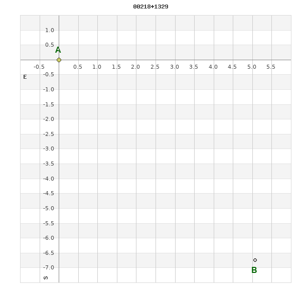
Click on the map to see the double of your interest.
Pass over with the mouse cursor to display the catalog designation.
|
|
WDS 00218+1329 : ALADIN DSS IMAGE @ 00h 21m 48.48s +13° 29' 22.0"
WDS 00218+1329 ROE 83 : NEIGHBORHOODS
|
|

Click on the map to see the double of your interest.
Pass over with the mouse cursor to display the catalog designation.
|
| Show |
name |
coord_2000 |
discov# |
comp |
pa |
sep |
dist(') |
| Show |
|
00218+1329 |
ROE 83 |
|
218 |
8.5 |
|
| Show |
|
00224+1329 |
STF 27 |
|
315 |
28.9 |
10 |
| Show |
|
00217+1301 |
BPM 9 |
|
266 |
103.5 |
29 |
| Show |
|
00244+1322 |
BPM 11 |
|
41 |
117.7 |
40 |
| Show |
|
00249+1355 |
GWP 45 |
|
222 |
51.4 |
52 |
| Show |
|
00248+1358 |
HEI 199 |
|
122 |
3.0 |
52 |
| Show |
|
00200+1419 |
CHE 5 |
AB |
205 |
6.5 |
57 |
| Show |
|
00200+1419 |
CHE 5 |
AC |
100 |
46.1 |
57 |
| Show |
|
00232+1233 |
NSN 505 |
|
2 |
1.2 |
60 |
| Show |
|
00236+1229 |
J 583 |
|
251 |
3.6 |
67 |
| Show |
|
00176+1300 |
HJ 3 |
|
262 |
12.0 |
68 |
| Show |
|
00172+1308 |
FOX 1 |
|
110 |
4.9 |
71 |
| Show |
|
00208+1219 |
UC 353 |
|
249 |
74.3 |
73 |
| Show |
|
00206+1219 |
BU 1015 |
|
110 |
0.5 |
73 |
| Show |
|
00167+1334 |
TDS1377 |
|
290 |
1.4 |
75 |
| Show |
|
00170+1233 |
HJ 2 |
|
169 |
19.9 |
91 |
| Show |
|
00246+1205 |
CVR 318 |
|
101 |
7.5 |
94 |
| Show |
|
00177+1217 |
LDS1076 |
|
231 |
2.0 |
95 |
| Show |
|
00182+1209 |
GWP 38 |
|
39 |
7.2 |
96 |
| Show |
|
00242+1505 |
GWP 44 |
|
341 |
30.5 |
102 |
| Show |
|
00151+1358 |
LDS1075 |
AB |
170 |
8.7 |
105 |
| Show |
|
00168+1202 |
HEI 300 |
|
177 |
1.5 |
114 |
| Show |
|
00140+1401 |
BRT1165 |
|
141 |
3.7 |
119 |
| Show |
|
00295+1413 |
BPM 15 |
|
283 |
91.8 |
121 |
| Show |
|
00136+1356 |
LDS1073 |
AB |
252 |
21.5 |
122 |
| Show |
|
00136+1356 |
LDS1073 |
AC |
6 |
25.2 |
122 |
| Show |
|
00274+1502 |
YSC 169 |
|
87 |
0.6 |
124 |
| Show |
|
00307+1339 |
HDS 66 |
|
268 |
1.0 |
131 |
| Show |
|
00222+1114 |
HEI 301 |
|
280 |
1.7 |
136 |
| Show |
|
00287+1502 |
ALP 3 |
AB |
147 |
16.9 |
136 |
| Show |
|
00287+1502 |
WIS 10 |
AC |
298 |
917.3 |
136 |
| Show |
|
00316+1344 |
LDS9091 |
|
180 |
3.0 |
138 |
| Show |
|
00129+1416 |
GRV 14 |
|
177 |
36.6 |
138 |
| Show |
|
00178+1535 |
SLW 15 |
|
171 |
37.1 |
139 |
| Show |
|
00256+1536 |
LDS9089 |
|
141 |
3.4 |
139 |
| Show |
|
00141+1207 |
A 1802 |
|
148 |
2.0 |
140 |
| Show |
|
00244+1115 |
UC 359 |
|
151 |
9.2 |
140 |
| Show |
|
00307+1429 |
OSW 39 |
|
286 |
53.2 |
144 |
| Show |
|
00290+1152 |
CVR 324 |
|
153 |
23.0 |
144 |
| Show |
|
00295+1501 |
HEI 200 |
|
62 |
0.8 |
144 |
| Show |
|
00306+1442 |
OSO 6 |
|
22 |
19.6 |
148 |
| Show |
|
00163+1537 |
J 1321 |
|
104 |
2.6 |
152 |
| Show |
|
00209+1059 |
BU 1093 |
|
119 |
0.8 |
152 |
| Show |
|
00283+1131 |
BPM 13 |
AB |
75 |
48.7 |
152 |
| Show |
|
00264+1549 |
ITF 196 |
|
234 |
7.8 |
156 |
| Show |
|
00187+1559 |
STF 25 |
AB |
195 |
1.0 |
157 |
| Show |
|
00187+1559 |
STF 25 |
AB,C |
202 |
171.5 |
157 |
| Show |
|
00298+1142 |
KPP 56 |
|
213 |
5.0 |
160 |
| Show |
|
00111+1402 |
DAM 828 |
|
123 |
9.9 |
160 |
| Show |
Algenib |
00132+1511 |
BUP 3 |
AB |
286 |
164.1 |
161 |
| Show |
|
00325+1408 |
CVR 330 |
|
276 |
29.3 |
161 |
|
|
WDS 00218+1329 : COMPONENTS
00218+1329 A
| Componente originario normalizzato |
AB |
|
Coord arcsec 2000 |
002148.48+132922.0 |
|
Mag |
10 |
|
Spectral class |
F5 (yellow-white) |
|
| PmRA |
11.00 |
|
PmDE |
-13.0 |
|
Tycho2 |
0602-00888-1 |
|
| Tycho2 |
0602-00888-1 |
|
Pflag |
|
|
RAmdeg |
5.45203497 |
|
DEmdeg |
13.48946818 |
|
| PmRA |
12.3 |
|
PmDE |
-12.8 |
|
E RAmdeg |
14 |
|
E DEmdeg |
18 |
|
| E pmRA |
1.2 |
|
E pmDE |
1.1 |
|
EpRAm |
1989.77 |
|
EpDEm |
1987.99 |
|
| Num |
7 |
|
Q RAmdeg |
1.0 |
|
Q DEmdeg |
0.5 |
|
Q pmRA |
1.0 |
|
| Q pmDE |
0.5 |
|
BTmag |
10.023 |
|
E BTmag |
0.028 |
|
VTmag |
9.527 |
|
| E VTmag |
0.025 |
|
Prox |
999 |
|
TYC |
T |
|
HIP |
|
|
| CCDM |
|
|
RAdeg |
5.45200583 |
|
DEdeg |
13.48949778 |
|
EpRA 1990 |
1.74 |
|
| EpDE 1990 |
1.69 |
|
E RAdeg |
13.7 |
|
E DEdeg |
17.6 |
|
Posflg |
|
|
| Corr |
-0.1 |
|
| Ccdm |
00218+1329 |
|
RComp |
|
|
Comp |
A |
|
Note1 |
|
|
| Note2 |
|
|
Discov num |
|
|
DRAs |
0.46 |
|
DDEs |
22.5 |
|
| R dRAs |
10 |
|
Year |
|
|
Theta |
|
|
Rho |
|
|
| Obs |
2 |
|
Vmag |
10.0 |
|
Sp |
F5 |
|
PmNote |
* |
|
| PmRA |
11 |
|
PmDE |
-6 |
|
Dm number |
+12 22 |
|
Cat1 |
BD |
|
| Name2 |
+13 30 |
|
Cat2 |
AGK2/3 |
|
HD |
|
|
M HD |
|
|
| ADS BDS |
|
|
M ADS BDS |
|
|
N IDS |
|
|
IDS |
00166N1257A |
|
| HIC |
|
|
00218+1329 B
| Componente originario normalizzato |
AB |
|
Coord arcsec 2000 |
002148.13+132915.3 |
|
Mag |
10.8 |
|
PmRA |
0.00 |
|
| PmDE |
-20.0 |
|
Calc delta mag |
0.8 |
|
Calc coord |
yes |
|
| Ccdm |
00218+1329 |
|
RComp |
|
|
Comp |
B |
|
Note1 |
|
|
| Note2 |
|
|
Discov num |
ROE 83 |
|
DRAs |
0.90 |
|
DDEs |
22.1 |
|
| R dRAs |
10 |
|
Year |
1915 |
|
Theta |
219 |
|
Rho |
7.9 |
|
| Obs |
1 |
|
Vmag |
10.8 |
|
Sp |
|
|
PmNote |
* |
|
| PmRA |
178 |
|
PmDE |
80 |
|
Dm number |
|
|
Cat1 |
|
|
| Name2 |
+13 29 |
|
Cat2 |
AGK2/3 |
|
HD |
|
|
M HD |
|
|
| ADS BDS |
|
|
M ADS BDS |
|
|
N IDS |
|
|
IDS |
00166N1257B |
|
| HIC |
|
|