10236-1721 UC 1922 BC
10h 23m 36.05s -17° 20' 25.0" P.A. 38.00 sep 46.4 mag 11.51,15.90
| Coord 2000 |
10236-1721 |
|
Discov num |
UC 1922 |
|
Comp |
BC |
|
Coord arcsec 2000 |
10 23 36.05 -17 20 25.0 |
|
| Date first |
1996 |
|
Date last |
2017 |
|
Obs |
4 |
|
| Pa first |
38 |
|
Pa last |
38.3 |
|
P.A. Now (θ) |
38.3° |
|
| Sep first |
46.7 |
|
Sep last |
46.4 |
|
Sep. Now (ρ) |
46.4" |
|
| Mag pri |
11.51 |
|
Mag sec |
15.90 |
|
delta mag (ΔM) |
4.39 |
|
Spectral class |
|
|
| Pri motion ra |
-053 |
|
Sec motion ra |
-065 |
|
| Pri motion dec |
+019 |
|
Sec motion dec |
+011 |
|
| Notes |
N
V
W
(See Notes, Proper motion indicates physical, ) |
|
rPM=0.219 (< 0.3, Physical double)
This double is physical.
10236-1721 SYSTEM COMPONENTS
| Show |
name |
SAO |
coord |
wds_name |
last |
obs |
pa |
sep |
mag1 |
mag2 |
d_mag |
orb |
current |
| Show |
HD 90084 |
155951 |
10 23 38 -17 20 39 |
GWP 1359 AB |
2017 |
6 |
294 |
34.0 |
9.50 |
11.51 |
2.01 |
|
|
| Show |
|
155951 |
10 23 38 -17 20 39 |
UC 1922 AC |
2017 |
3 |
0 |
50.5 |
9.50 |
15.90 |
6.40 |
|
|
| Show |
|
|
10 23 36 -17 20 25 |
UC 1922 BC |
2017 |
4 |
38 |
46.4 |
11.51 |
15.90 |
4.39 |
|
<=== |
Triple system
3 estimated visually detectable stars in this system
OTHER CATALOGS AND DESIGNATIONS
| Constellation |
Hydra |
|
Gaia DR2 |
3748245279507073152 |
|
WDS 10236-1721 UC 1922 BC : NOTES
| discov_num |
notes |
refcode |
| GWP1359 |
ABL 329. |
Tob2012b |
REFERENCES
| refcode |
metd |
author |
reference |
| Tob2012b |
not - |
Tobal, T. |
................... |
| Tob2012b |
|
private communication, 2012 |
|
DISCOVERER
| idgroup |
discov |
author |
| 1 |
GWP |
Garraf Wide Pairs: CPM wide pairs (>50mas/y) discovered in the Garraf Astronomical |
| 6 |
UC |
USNO CCD Astrographic Catalog (UCAC1, UCAC2, UCAC3, UCAC4) |
| 6 |
UC |
Zacharias, N., Finch, C.T., Girard, T.M., Henden, A., Bartlett, J.L., Monet, D.G., |
| 6 |
UC |
& Zacharias, M.I. (UCAC4 Catalog) |
| 17 |
UC |
Zacharias, N., Finch, C.T., Subasavage, J.P., Bredthauer, G., Crockett, C., |
| 17 |
UC |
DiVittorio, M., Ferguson, E., Harris, F., Harris, H.C., Hendon, A., Kilian, C., |
| 17 |
UC |
Munn, J., Rafferty, T., Rhodes, A., Schultheis, M., Tilleman, T., & Wieder, G. |
WDS HISTORIC DATA
| coord_2000 |
discov_num |
comp |
epoch |
obs |
pa |
sep |
mag_pri |
mag_sec |
spectr |
notes |
coord_arcsec_2000 |
| 10236-1721 |
UC 1922 |
BC |
1999 |
2 |
38 |
46.8 |
11.50 |
15.90 |
|
V |
102336.05-172025.0 |
| 10236-1721 |
UC 1922 |
BC |
2000 |
2 |
38 |
46.9 |
11.50 |
15.90 |
|
V |
102336.05-172025.0 |
| 10236-1721 |
UC 1922 |
BC |
2017 |
4 |
38 |
46.4 |
11.51 |
15.90 |
|
NV |
102336.05-172025.0 |
If you need more information about this double, apply for a
data request form to the WDS.
WDS 10236-1721 UC 1922 BC : VISUAL OBSERVATIONS REPORTS
No records found.
WDS 10236-1721 UC 1922 BC : MEASURES
No records found.
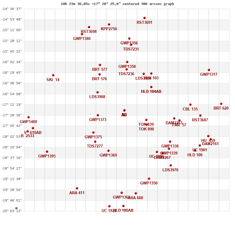
WDS 10236-1721 : VIRTUAL EYEPIECE

Click on the map to see the double of your interest.
Pass over with the mouse cursor to display the catalog designation.
|
|
WDS 10236-1721 : ALADIN DSS IMAGE @ 10h 23m 36.05s -17° 20' 25.0"
WDS 10236-1721 UC 1922 BC : NEIGHBORHOODS
|
|
Click on the map to see the double of your interest.
Pass over with the mouse cursor to display the catalog designation.
|
| Show |
name |
coord_2000 |
discov# |
comp |
pa |
sep |
dist(') |
| Show |
|
10236-1721 |
UC 1922 |
BC |
38 |
46.4 |
|
| Show |
|
10236-1721 |
GWP1359 |
AB |
294 |
34.0 |
1 |
| Show |
|
10236-1721 |
UC 1922 |
AC |
|
50.5 |
1 |
| Show |
|
10212-1736 |
TOK 839 |
|
110 |
1.1 |
38 |
| Show |
|
10211-1744 |
TOK 890 |
|
252 |
0.6 |
43 |
| Show |
|
10266-1728 |
GWP1373 |
|
251 |
97.5 |
44 |
| Show |
|
10267-1652 |
LDS3988 |
|
54 |
3.3 |
53 |
| Show |
|
10206-1643 |
HLD 104 |
AB |
197 |
3.4 |
57 |
| Show |
|
10206-1643 |
HLD 104 |
AC |
271 |
152.4 |
57 |
| Show |
|
10271-1756 |
GWP1375 |
|
76 |
31.5 |
62 |
| Show |
|
10234-1614 |
TDS7236 |
|
92 |
0.4 |
67 |
| Show |
|
10215-1621 |
LDS3984 |
|
297 |
24.9 |
67 |
| Show |
|
10269-1811 |
TDS7277 |
|
223 |
0.7 |
70 |
| Show |
|
10254-1826 |
GWP1369 |
|
247 |
21.2 |
71 |
| Show |
|
10265-1623 |
BRT 576 |
|
254 |
4.6 |
71 |
| Show |
|
10206-1621 |
HLD 103 |
|
343 |
1.7 |
74 |
| Show |
|
10233-1603 |
GWP1358 |
|
205 |
86.7 |
78 |
| Show |
|
10180-1734 |
DAM2263 |
|
225 |
1.9 |
81 |
| Show |
|
10265-1608 |
BRT 577 |
|
222 |
4.5 |
84 |
| Show |
|
10200-1828 |
UC 1916 |
|
301 |
6.6 |
85 |
| Show |
|
10185-1811 |
GWP1338 |
|
320 |
20.5 |
89 |
| Show |
|
10175-1737 |
FAR 57 |
|
131 |
0.1 |
90 |
| Show |
|
10194-1830 |
DAM2267 |
|
57 |
1.6 |
92 |
| Show |
|
10187-1823 |
GWP1339 |
|
17 |
38.7 |
95 |
| Show |
|
10163-1711 |
CBL 135 |
|
283 |
41.7 |
106 |
| Show |
|
10229-1535 |
TDS7231 |
|
285 |
1.7 |
107 |
| Show |
|
10184-1849 |
LDS3976 |
|
276 |
53.8 |
116 |
| Show |
|
10231-1525 |
GWP1356 |
|
108 |
45.2 |
116 |
| Show |
|
10209-1911 |
GWP1350 |
|
87 |
26.1 |
117 |
| Show |
|
10152-1729 |
RST3687 |
|
208 |
3.8 |
122 |
| Show |
|
10316-1624 |
SKI 14 |
|
82 |
7.0 |
128 |
| Show |
|
10157-1825 |
HLD 100 |
|
206 |
1.8 |
131 |
| Show |
|
10152-1817 |
UC 1901 |
|
218 |
31.3 |
133 |
| Show |
|
10239-1934 |
GWP1361 |
|
68 |
69.8 |
134 |
| Show |
|
10224-1935 |
ARA 668 |
|
87 |
12.3 |
136 |
| Show |
|
10143-1802 |
HU 459 |
|
95 |
1.3 |
140 |
| Show |
|
10323-1827 |
GWP1395 |
|
268 |
106.0 |
141 |
| Show |
|
10284-1517 |
GWP1380 |
|
63 |
57.1 |
141 |
| Show |
|
10254-1502 |
KPP2750 |
|
284 |
5.8 |
142 |
| Show |
|
10140-1807 |
DAM2161 |
|
198 |
22.9 |
146 |
| Show |
|
10276-1506 |
RST3698 |
|
273 |
1.1 |
146 |
| Show |
|
10289-1927 |
ARA 411 |
|
329 |
12.7 |
148 |
| Show |
|
10339-1750 |
S 610 |
AB |
51 |
114.0 |
150 |
| Show |
|
10142-1615 |
GWP1317 |
|
117 |
91.2 |
151 |
| Show |
|
10214-1452 |
RST3691 |
|
263 |
0.7 |
153 |
| Show |
|
10343-1732 |
GWP1400 |
|
72 |
32.4 |
155 |
| Show |
|
10237-1955 |
HLD 105 |
AB |
103 |
0.9 |
155 |
| Show |
|
10237-1955 |
HLD 105 |
AC |
288 |
6.3 |
155 |
| Show |
|
10128-1710 |
BRT 620 |
|
110 |
2.9 |
156 |
| Show |
|
10253-1956 |
UC 1926 |
|
324 |
38.4 |
158 |
| Show |
|
10345-1753 |
B 2533 |
|
104 |
1.7 |
159 |
|
|
WDS 10236-1721 : COMPONENTS
| |
A |
B |
| B |
pa=294.4°
sep=34.12"
| |
| C |
pa=359.7°
sep=50.50"
| pa=40.3°
sep=47.69"
|
10236-1721 A
| Name |
HD 90084 |
|
Coord arcsec 2000 |
102338.22-172039.1 |
|
Mag |
9.5 |
|
Spectral class |
K0III (yellow-orange) |
|
| PmRA |
-50.00 |
|
PmDE |
11.0 |
|
SAO |
155951 |
|
Tycho2 |
6064-00250-1 |
|
| HD |
90084 |
|
DM |
BD-16 3040 |
|
| Tycho2 |
6064-00250-1 |
|
Pflag |
|
|
RAmdeg |
155.90926440 |
|
DEmdeg |
-17.34420444 |
|
| PmRA |
-56.8 |
|
PmDE |
7.0 |
|
E RAmdeg |
15 |
|
E DEmdeg |
17 |
|
| E pmRA |
1.5 |
|
E pmDE |
1.4 |
|
EpRAm |
1988.38 |
|
EpDEm |
1987.18 |
|
| Num |
8 |
|
Q RAmdeg |
0.8 |
|
Q DEmdeg |
0.8 |
|
Q pmRA |
0.8 |
|
| Q pmDE |
0.8 |
|
BTmag |
10.659 |
|
E BTmag |
0.040 |
|
VTmag |
9.500 |
|
| E VTmag |
0.023 |
|
Prox |
999 |
|
TYC |
T |
|
HIP |
|
|
| CCDM |
|
|
RAdeg |
155.90940194 |
|
DEdeg |
-17.34422111 |
|
EpRA 1990 |
1.67 |
|
| EpDE 1990 |
1.67 |
|
E RAdeg |
15.6 |
|
E DEdeg |
18.8 |
|
Posflg |
|
|
| Corr |
0.1 |
|
| SAO |
155951 |
|
DelFlag |
|
|
RA1950 |
|
|
PmRA1950 |
-0.0035 |
|
| DE1950 |
|
|
PmDE1950 |
0.005 |
|
Vmag |
9 |
|
SpType |
K0 |
|
| Double code |
|
|
Source |
21 |
|
CatNum |
4161 |
|
DM |
BD-16 3040 |
|
| DMcomp |
|
|
BDsup |
|
|
HD |
90084 |
|
M HD |
0 |
|
| GC |
|
|
RA1950rad |
2.7105853 |
|
DE1950rad |
-0.29828919 |
|
PmRA2000 |
-0.0032 |
|
| PmDE2000 |
0.01 |
|
10236-1721 B
| Coord arcsec 2000 |
102336.05-172025.0 |
|
Coord calc |
102336.05-172025.0 |
|
Mag |
11.51 |
|
PmRA |
-53.00 |
|
| PmDE |
19.0 |
|
Calc delta mag |
2.01 |
|
10236-1721 C
| Coord arcsec 2000 |
102338.20-171948.6 |
|
Mag |
15.9 |
|
PmRA |
-65.00 |
|
PmDE |
11.0 |
|
| Calc delta mag |
6.4 |
|
Calc coord |
yes |
|