13529+1818 GWP 2117 AB
13h 52m 56.97s +18° 18' 23.1" P.A. 115.00 sep 394.9 mag 12.20,16.60 Sp A
| Coord 2000 |
13529+1818 |
|
Discov num |
GWP2117 |
|
Comp |
AB |
|
Coord arcsec 2000 |
13 52 56.97 +18 18 23.1 |
|
| Date first |
1954 |
|
Date last |
2015 |
|
Obs |
8 |
|
| Pa first |
115 |
|
Pa last |
115.2 |
|
P.A. Now (θ) |
115.2° |
|
| Sep first |
394.8 |
|
Sep last |
394.933 |
|
Sep. Now (ρ) |
394.933" |
|
| Mag pri |
12.20 |
|
Mag sec |
16.60 |
|
delta mag (ΔM) |
4.4 |
|
Spectral class |
A (white) |
|
| Pri motion ra |
-094 |
|
Sec motion ra |
-090 |
|
| Pri motion dec |
-036 |
|
Sec motion dec |
-030 |
|
| Notes |
V
R
(Proper motion indicates physical, Red magnitudes) |
|
rPM=0.072 (< 0.3, Physical double)
This double is physical.
13529+1818 SYSTEM COMPONENTS
| Show |
name |
SAO |
coord |
wds_name |
last |
obs |
pa |
sep |
mag1 |
mag2 |
d_mag |
orb |
current |
| Show |
|
|
13 52 57 +18 18 23 |
GWP 2117 AB |
2015 |
8 |
115 |
394.9 |
12.20 |
16.60 |
4.40 |
|
<=== |
| Show |
|
|
13 52 57 +18 18 23 |
GWP 2118 AC |
2015 |
8 |
351 |
253.6 |
12.20 |
15.50 |
3.30 |
|
|
Triple system
3 estimated visually detectable stars in this system
OTHER CATALOGS AND DESIGNATIONS
| Constellation |
Bootes |
|
Gaia DR2 |
1244919124267663488 |
|
WDS 13529+1818 GWP 2117 AB : NOTES
No records found.
REFERENCES
| refcode |
metd |
author |
reference |
| GWP |
|
Garraf Wide Pairs: CPM wide pairs (>50mas/y) discovered in the Garraf Astronomical |
|
| GWP |
|
Observatory (OAG) CPMWP Survey |
|
| GWP |
|
Part I (2012): Measures of 1725 pairs. Equatorial zone |
|
| GWP |
|
(RA 00h00m to 11h59m, DEC +20 to -20 deg) |
|
| GWP |
|
Garraf Wide Pairs: CPM wide pairs (>50mas/y) discovered in the Garraf Astronomical |
|
| GWP |
|
Observatory (OAG) CPMWP Survey |
|
| GWP |
|
Part II (2016): Measures of 1657 pairs. Equatorial zone |
|
| GWP |
|
(RA 12h00m to 23h59m, DEC +20 to -20 deg) |
|
WDS HISTORIC DATA
| coord_2000 |
discov_num |
comp |
epoch |
obs |
pa |
sep |
mag_pri |
mag_sec |
spectr |
notes |
coord_arcsec_2000 |
| 13529+1818 |
GWP2117 |
AB |
2000 |
2 |
115 |
394.5 |
12.20 |
16.60 |
|
V R |
135256.97+181823.1 |
| 13529+1818 |
GWP2117 |
AB |
2015 |
3 |
115 |
394.9 |
12.20 |
16.60 |
|
V R |
135256.97+181823.1 |
If you need more information about this double, apply for a
data request form to the WDS.
WDS 13529+1818 GWP 2117 AB : VISUAL OBSERVATIONS REPORTS
No records found.
WDS 13529+1818 GWP 2117 AB : MEASURES
No records found.
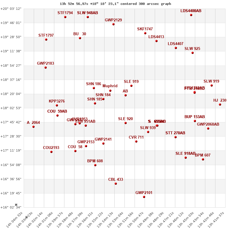
WDS 13529+1818 : VIRTUAL EYEPIECE

Click on the map to see the double of your interest.
Pass over with the mouse cursor to display the catalog designation.
|
|
WDS 13529+1818 : ALADIN DSS IMAGE @ 13h 52m 56.97s +18° 18' 23.1"
WDS 13529+1818 GWP 2117 AB : NEIGHBORHOODS
|
|
Click on the map to see the double of your interest.
Pass over with the mouse cursor to display the catalog designation.
|
| Show |
name |
coord_2000 |
discov# |
comp |
pa |
sep |
dist(') |
| Show |
|
13529+1818 |
GWP2117 |
AB |
115 |
394.9 |
|
| Show |
|
13529+1818 |
GWP2118 |
AC |
351 |
253.6 |
|
| Show |
|
13523+1830 |
SLE 919 |
|
147 |
6.7 |
15 |
| Show |
Muphrid |
13547+1824 |
SHJ 169 |
|
85 |
114.9 |
26 |
| Show |
|
13530+1745 |
SLE 920 |
|
111 |
7.7 |
34 |
| Show |
|
13555+1813 |
SHN 184 |
|
-1 |
0.3 |
37 |
| Show |
|
13564+1808 |
SHN 185 |
|
223 |
0.4 |
51 |
| Show |
|
13566+1826 |
SHN 186 |
|
-1 |
0.3 |
53 |
| Show |
|
13504+1734 |
SLW 939 |
|
266 |
159.1 |
58 |
| Show |
|
13517+1722 |
CVR 711 |
|
212 |
24.7 |
59 |
| Show |
|
13493+1742 |
S 655 |
BC |
326 |
63.6 |
63 |
| Show |
|
13493+1742 |
S 655 |
AB |
86 |
46.3 |
64 |
| Show |
|
13493+1742 |
S 655 |
AC |
11 |
57.4 |
64 |
| Show |
|
13555+1720 |
GWP2141 |
|
288 |
332.2 |
69 |
| Show |
|
13577+1744 |
LDS 951 |
AB |
266 |
20.5 |
75 |
| Show |
|
13507+1934 |
SKF1747 |
|
70 |
1.7 |
82 |
| Show |
|
13582+1744 |
CVR1553 |
|
311 |
3.3 |
82 |
| Show |
|
13494+1924 |
LDS4413 |
|
239 |
130.9 |
83 |
| Show |
|
13543+1944 |
GWP2129 |
|
229 |
508.7 |
89 |
| Show |
|
13587+1743 |
GWP2157 |
|
150 |
174.2 |
89 |
| Show |
|
13575+1717 |
GWP2153 |
|
312 |
249.6 |
90 |
| Show |
|
13473+1727 |
STT 270 |
AB |
76 |
1.5 |
96 |
| Show |
|
13473+1727 |
PIN 9 |
AC |
187 |
42.6 |
96 |
| Show |
|
13564+1654 |
BPM 608 |
|
162 |
79.0 |
98 |
| Show |
|
13473+1915 |
LDS4407 |
|
313 |
16.5 |
100 |
| Show |
|
13581+1928 |
BU 30 |
|
199 |
8.1 |
101 |
| Show |
|
13587+1711 |
COU 58 |
|
2 |
1.4 |
106 |
| Show |
|
13541+1631 |
CBL 433 |
|
9 |
36.2 |
109 |
| Show |
|
13451+1822 |
STF1782 |
AB |
185 |
30.4 |
112 |
| Show |
|
13451+1822 |
FYM 240 |
BD |
278 |
18.1 |
112 |
| Show |
|
14008+1806 |
KPP3276 |
|
149 |
1.6 |
112 |
| Show |
|
13572+1953 |
SLW 948 |
AB |
212 |
13.9 |
113 |
| Show |
|
13572+1953 |
SLW 948 |
AC |
220 |
35.9 |
113 |
| Show |
|
14008+1754 |
COU 59 |
AB |
169 |
8.2 |
114 |
| Show |
|
14008+1754 |
GRV 877 |
AC |
230 |
35.3 |
114 |
| Show |
|
13451+1747 |
BUP 153 |
AB |
335 |
111.5 |
117 |
| Show |
|
13451+1747 |
BUP 153 |
AC |
107 |
446.9 |
117 |
| Show |
|
13453+1910 |
SLW 925 |
|
190 |
11.1 |
120 |
| Show |
|
13461+1703 |
SLE 918 |
AB |
3 |
13.1 |
124 |
| Show |
|
13461+1703 |
SLE 918 |
AC |
206 |
24.4 |
124 |
| Show |
|
13509+1615 |
GWP2101 |
|
26 |
14.9 |
127 |
| Show |
|
14021+1852 |
GWP2183 |
|
197 |
481.2 |
134 |
| Show |
|
13598+1953 |
STF1794 |
|
125 |
1.8 |
136 |
| Show |
|
14014+1710 |
COU2193 |
|
316 |
2.2 |
139 |
| Show |
|
13436+1738 |
GWP2068 |
AB |
349 |
222.6 |
140 |
| Show |
|
13431+1830 |
SLW 919 |
|
236 |
56.2 |
140 |
| Show |
|
13455+1956 |
LDS4400 |
AB |
86 |
37.5 |
144 |
| Show |
|
13455+1956 |
LDS4400 |
AC |
183 |
69.4 |
144 |
| Show |
|
14020+1926 |
STF1797 |
|
158 |
20.8 |
145 |
| Show |
|
13441+1701 |
BPM 607 |
|
249 |
109.0 |
148 |
| Show |
|
13422+1807 |
HJ 230 |
|
320 |
64.2 |
154 |
|
|
WDS 13529+1818 : COMPONENTS
| |
A |
B |
| B |
pa=116.4°
sep=378.69"
| |
| C |
pa=351.2°
sep=253.24"
| pa=317.9°
sep=563.95"
|
13529+1818 A
| Coord arcsec 2000 |
135256.97+181823.1 |
|
Mag |
12.2 |
|
Spectral class |
A (white) |
|
PmRA |
-94.00 |
|
| PmDE |
-36.0 |
|
13529+1818 B
| Coord arcsec 2000 |
135320.79+181534.9 |
|
Mag |
16.6 |
|
PmRA |
-90.00 |
|
PmDE |
-30.0 |
|
| Calc delta mag |
4.4 |
|
Calc coord |
yes |
|
13529+1818 C
| Coord arcsec 2000 |
135254.24+182233.3 |
|
Mag |
15.5 |
|
PmRA |
-110.00 |
|
PmDE |
-22.0 |
|
| Calc delta mag |
3.3 |
|
Calc coord |
yes |
|