12277+1213 GWP 1813 AB (HD 108469)
12h 27m 39.62s +12° 13' 08.8" P.A. 243.00 sep 225.0 mag 9.10,11.80 Sp G5
| Coord 2000 |
12277+1213 |
|
Discov num |
GWP1813 |
|
Comp |
AB |
|
Coord arcsec 2000 |
12 27 39.62 +12 13 08.8 |
|
| Date first |
1909 |
|
Date last |
2015 |
|
Obs |
14 |
|
| Pa first |
243 |
|
Pa last |
243 |
|
P.A. Now (θ) |
243° |
|
| Sep first |
225.5 |
|
Sep last |
225.014 |
|
Sep. Now (ρ) |
225.014" |
|
| Mag pri |
9.10 |
|
Mag sec |
11.80 |
|
delta mag (ΔM) |
2.7 |
|
Spectral class |
G5 (yellow) |
|
| Pri motion ra |
+105 |
|
Sec motion ra |
+106 |
|
| Pri motion dec |
-026 |
|
Sec motion dec |
-026 |
|
| Notes |
V
(Proper motion indicates physical) |
|
rPM=0.009 (< 0.3, Physical double)
This double is physical.
12277+1213 SYSTEM COMPONENTS
| Show |
name |
SAO |
coord |
wds_name |
last |
obs |
pa |
sep |
mag1 |
mag2 |
d_mag |
orb |
current |
| Show |
HD 108469 |
100106 |
12 27 40 +12 13 09 |
GWP 1813 AB |
2015 |
14 |
243 |
225.0 |
9.10 |
11.80 |
2.70 |
|
<=== |
| Show |
|
|
12 27 26 +12 11 27 |
TDS 663 BC |
2015 |
4 |
285 |
3.4 |
10.50 |
11.89 |
1.39 |
|
|
Triple system
3 estimated visually detectable stars in this system
OTHER CATALOGS AND DESIGNATIONS
| Name |
HD 108469 |
|
Constellation |
Virgo |
|
SAO |
100106 |
|
Tycho2 |
0877-00537-1 |
|
| HD |
108469 |
|
WDS 12277+1213 GWP 1813 AB (HD 108469) : NOTES
No records found.
REFERENCES
| refcode |
metd |
author |
reference |
| GWP |
|
Garraf Wide Pairs: CPM wide pairs (>50mas/y) discovered in the Garraf Astronomical |
|
| GWP |
|
Observatory (OAG) CPMWP Survey |
|
| GWP |
|
Part I (2012): Measures of 1725 pairs. Equatorial zone |
|
| GWP |
|
(RA 00h00m to 11h59m, DEC +20 to -20 deg) |
|
| GWP |
|
Garraf Wide Pairs: CPM wide pairs (>50mas/y) discovered in the Garraf Astronomical |
|
| GWP |
|
Observatory (OAG) CPMWP Survey |
|
| GWP |
|
Part II (2016): Measures of 1657 pairs. Equatorial zone |
|
| GWP |
|
(RA 12h00m to 23h59m, DEC +20 to -20 deg) |
|
| TDS |
|
Tycho Double Star (from additional DD list) |
................... |
| TDT |
|
Tycho Double Star (from additional DD list) |
................... |
WDS HISTORIC DATA
| coord_2000 |
discov_num |
comp |
epoch |
obs |
pa |
sep |
mag_pri |
mag_sec |
spectr |
notes |
coord_arcsec_2000 |
| 12277+1213 |
GWP1813 |
AB |
2015 |
14 |
243 |
225.0 |
9.10 |
11.80 |
G5 |
V |
122739.62+121308.8 |
If you need more information about this double, apply for a
data request form to the WDS.
WDS 12277+1213 GWP 1813 AB (HD 108469) : VISUAL OBSERVATIONS REPORTS
No records found.
WDS 12277+1213 GWP 1813 AB (HD 108469) : MEASURES
No records found.
WDS 12277+1213 (HD 108469) : VIRTUAL EYEPIECE
Click on the map to see the double of your interest.
Pass over with the mouse cursor to display the catalog designation.
|
|
WDS 12277+1213 (HD 108469) : ALADIN DSS IMAGE @ 12h 27m 39.62s +12° 13' 08.8"
WDS 12277+1213 GWP 1813 AB (HD 108469) : NEIGHBORHOODS
|
|

Click on the map to see the double of your interest.
Pass over with the mouse cursor to display the catalog designation.
|
| Show |
name |
coord_2000 |
discov# |
comp |
pa |
sep |
dist(') |
| Show |
|
12277+1213 |
GWP1813 |
AB |
243 |
225.0 |
|
| Show |
|
12277+1213 |
TDS 663 |
BC |
285 |
3.4 |
4 |
| Show |
|
12284+1223 |
LDS1311 |
|
25 |
15.9 |
14 |
| Show |
|
12299+1157 |
SKF1348 |
|
320 |
30.1 |
37 |
| Show |
|
12310+1228 |
SHN 161 |
|
-1 |
0.3 |
51 |
| Show |
|
12250+1248 |
SHN 23 |
|
219 |
0.3 |
53 |
| Show |
|
12305+1142 |
BRT1278 |
|
26 |
2.8 |
53 |
| Show |
|
12286+1117 |
UC 2345 |
|
|
22.0 |
58 |
| Show |
|
12317+1208 |
SHY 607 |
AB |
46 |
999.9 |
59 |
| Show |
|
12324+1211 |
LDS 937 |
|
122 |
42.3 |
68 |
| Show |
|
12332+1200 |
LDS1318 |
|
163 |
7.9 |
80 |
| Show |
|
12278+1335 |
LDS1309 |
|
16 |
146.6 |
82 |
| Show |
|
12214+1223 |
LDS1295 |
BC |
119 |
75.0 |
84 |
| Show |
|
12319+1310 |
UC 2354 |
|
38 |
8.8 |
85 |
| Show |
|
12214+1223 |
LDS1295 |
AB |
118 |
556.7 |
93 |
| Show |
|
12345+1206 |
BPM 593 |
|
132 |
118.3 |
101 |
| Show |
|
12205+1227 |
GWP1790 |
|
290 |
93.4 |
107 |
| Show |
|
12323+1335 |
LEP 57 |
AB |
91 |
5.2 |
107 |
| Show |
|
12323+1335 |
LDS1317 |
AC |
351 |
12.3 |
107 |
| Show |
|
12290+1400 |
LDS1313 |
|
138 |
50.5 |
109 |
| Show |
|
12286+1021 |
TDS8401 |
|
105 |
0.7 |
114 |
| Show |
|
12235+1355 |
HO 53 |
AB |
305 |
2.9 |
119 |
| Show |
|
12360+1224 |
SHN 24 |
|
234 |
0.4 |
124 |
| Show |
|
12350+1319 |
SKF1852 |
|
20 |
1.0 |
126 |
| Show |
|
12208+1332 |
UC 2321 |
|
164 |
17.4 |
128 |
| Show |
|
12353+1318 |
LAW 1 |
|
237 |
0.3 |
130 |
| Show |
|
12205+1058 |
BRT1277 |
|
325 |
3.2 |
130 |
| Show |
|
12360+1124 |
STF1661 |
|
253 |
2.3 |
132 |
| Show |
|
12187+1148 |
STF1628 |
AB |
239 |
9.5 |
134 |
| Show |
|
12187+1148 |
STF1628 |
AC |
344 |
45.2 |
134 |
| Show |
|
12364+1131 |
LDS1327 |
|
35 |
8.6 |
135 |
| Show |
|
12252+1424 |
TDS8372 |
|
107 |
0.4 |
137 |
| Show |
|
12357+1326 |
CVR1452 |
|
146 |
4.6 |
139 |
| Show |
|
12241+1004 |
CVR 653 |
|
124 |
13.7 |
140 |
| Show |
|
12337+1026 |
BRT3298 |
|
189 |
9.6 |
142 |
| Show |
|
12321+1420 |
GRV1156 |
|
207 |
30.4 |
143 |
| Show |
|
12321+1423 |
SKF1584 |
|
258 |
2.0 |
146 |
| Show |
|
12179+1147 |
HU 1138 |
|
1 |
1.3 |
146 |
| Show |
|
12351+1349 |
CVR1448 |
|
195 |
3.3 |
146 |
| Show |
|
12201+1351 |
BU 27 |
|
104 |
3.6 |
148 |
| Show |
|
12335+1012 |
HJ 212 |
|
264 |
21.7 |
149 |
| Show |
|
12333+1417 |
LDS1319 |
|
263 |
35.1 |
149 |
| Show |
|
12180+1127 |
GWP1786 |
|
262 |
87.0 |
150 |
| Show |
|
12303+0949 |
CVR1442 |
|
355 |
4.1 |
150 |
| Show |
|
12337+1415 |
NSN 630 |
|
292 |
2.2 |
151 |
| Show |
|
12200+1032 |
HJ 847 |
|
82 |
26.1 |
153 |
| Show |
|
12306+0943 |
STF1647 |
|
249 |
1.3 |
157 |
| Show |
|
12278+0935 |
CBL 595 |
|
303 |
11.0 |
158 |
| Show |
|
12277+1452 |
KPP3254 |
|
244 |
2.3 |
159 |
| Show |
|
12191+1036 |
BPM 590 |
|
249 |
97.7 |
160 |
| Show |
|
12166+1200 |
BPM 589 |
|
95 |
113.3 |
163 |
|
|
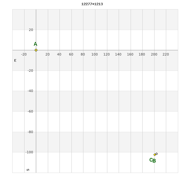
WDS 12277+1213 : COMPONENTS
| |
A |
B |
| B |
pa=243.0°
sep=224.97"
| |
| C |
pa=243.6°
sep=227.47"
| pa=285.2°
sep=3.37"
|
12277+1213 A
| Name |
HD 108469 |
|
Coord arcsec 2000 |
122739.62+121308.8 |
|
Mag |
9.1 |
|
Spectral class |
G5 (yellow) |
|
| PmRA |
105.00 |
|
PmDE |
-26.0 |
|
SAO |
100106 |
|
Tycho2 |
0877-00537-1 |
|
| HD |
108469 |
|
DM |
BD+13 2536 |
|
| Tycho2 |
0877-00537-1 |
|
Pflag |
|
|
RAmdeg |
186.91506635 |
|
DEmdeg |
12.21911791 |
|
| PmRA |
105.8 |
|
PmDE |
-24.9 |
|
E RAmdeg |
10 |
|
E DEmdeg |
13 |
|
| E pmRA |
1.3 |
|
E pmDE |
1.2 |
|
EpRAm |
1990.16 |
|
EpDEm |
1988.95 |
|
| Num |
9 |
|
Q RAmdeg |
0.7 |
|
Q DEmdeg |
0.9 |
|
Q pmRA |
0.7 |
|
| Q pmDE |
1.0 |
|
BTmag |
9.958 |
|
E BTmag |
0.026 |
|
VTmag |
9.259 |
|
| E VTmag |
0.019 |
|
Prox |
999 |
|
TYC |
T |
|
HIP |
|
|
| CCDM |
|
|
RAdeg |
186.91481611 |
|
DEdeg |
12.21917667 |
|
EpRA 1990 |
1.69 |
|
| EpDE 1990 |
1.49 |
|
E RAdeg |
11.3 |
|
E DEdeg |
13.9 |
|
Posflg |
|
|
| Corr |
0.2 |
|
| SAO |
100106 |
|
DelFlag |
|
|
RA1950 |
|
|
PmRA1950 |
0.0055 |
|
| DE1950 |
|
|
PmDE1950 |
-0.04 |
|
Vmag |
8.6 |
|
SpType |
G5 |
|
| Double code |
|
|
Source |
29 |
|
CatNum |
4582 |
|
DM |
BD+13 2536 |
|
| DMcomp |
|
|
BDsup |
|
|
HD |
108469 |
|
M HD |
0 |
|
| GC |
|
|
RA1950rad |
3.25119428 |
|
DE1950rad |
0.21809411 |
|
PmRA2000 |
0.0056 |
|
| PmDE2000 |
-0.035 |
|
12277+1213 B
| Coord arcsec 2000 |
122725.95+121126.6 |
|
Coord calc |
122725.95+121126.6 |
|
Mag |
10.5 |
|
Spectral class |
G5 (yellow) |
|
| PmRA |
106.00 |
|
PmDE |
-26.0 |
|
Tycho2 |
0877-00732-1 |
|
HD |
108422 |
|
| Calc delta mag |
1.4 |
|
| Tycho2 |
0877-00732-1 |
|
Pflag |
P |
|
RAmdeg |
186.85814289 |
|
DEmdeg |
12.19072606 |
|
| PmRA |
113.2 |
|
PmDE |
-26.7 |
|
E RAmdeg |
29 |
|
E DEmdeg |
40 |
|
| E pmRA |
2.1 |
|
E pmDE |
2.1 |
|
EpRAm |
1989.44 |
|
EpDEm |
1986.79 |
|
| Num |
3 |
|
Q RAmdeg |
0.6 |
|
Q DEmdeg |
1.5 |
|
Q pmRA |
0.6 |
|
| Q pmDE |
1.5 |
|
BTmag |
11.300 |
|
E BTmag |
0.068 |
|
VTmag |
10.498 |
|
| E VTmag |
0.048 |
|
Prox |
13 |
|
TYC |
T |
|
HIP |
|
|
| CCDM |
|
|
RAdeg |
186.85782361 |
|
DEdeg |
12.19083306 |
|
EpRA 1990 |
1.77 |
|
| EpDE 1990 |
1.48 |
|
E RAdeg |
29.3 |
|
E DEdeg |
40.6 |
|
Posflg |
D |
|
| Corr |
0.1 |
|
12277+1213 C
| Coord arcsec 2000 |
122725.73+121127.5 |
|
Mag |
11.89 |
|
PmRA |
105.00 |
|
PmDE |
-26.0 |
|
| Tycho2 |
0877-00732-2 |
|
Calc delta mag |
2.79 |
|
Calc coord |
yes |
|
| Tycho2 |
0877-00732-2 |
|
Pflag |
P |
|
RAmdeg |
186.85814289 |
|
DEmdeg |
12.19072606 |
|
| PmRA |
113.2 |
|
PmDE |
-26.7 |
|
E RAmdeg |
29 |
|
E DEmdeg |
40 |
|
| E pmRA |
2.1 |
|
E pmDE |
2.1 |
|
EpRAm |
1989.44 |
|
EpDEm |
1986.79 |
|
| Num |
3 |
|
Q RAmdeg |
0.6 |
|
Q DEmdeg |
1.5 |
|
Q pmRA |
0.6 |
|
| Q pmDE |
1.5 |
|
BTmag |
12.368 |
|
E BTmag |
0.199 |
|
VTmag |
11.892 |
|
| E VTmag |
0.185 |
|
Prox |
13 |
|
TYC |
|
|
HIP |
|
|
| CCDM |
|
|
RAdeg |
186.85811472 |
|
DEdeg |
12.19059889 |
|
EpRA 1990 |
1.77 |
|
| EpDE 1990 |
1.47 |
|
E RAdeg |
76.0 |
|
E DEdeg |
105.1 |
|
Posflg |
D |
|
| Corr |
0.1 |
|