01028-0407 GWP 120 AB
01h 02m 49.87s -04° 07' 16.1" P.A. 322.00 sep 123.3 mag 13.05,14.79
| Coord 2000 |
01028-0407 |
|
Discov num |
GWP 120 |
|
Comp |
AB |
|
Coord arcsec 2000 |
01 02 49.87 -04 07 16.1 |
|
| Date first |
1954 |
|
Date last |
2015 |
|
Obs |
7 |
|
| Pa first |
322 |
|
Pa last |
322 |
|
P.A. Now (θ) |
322° |
|
| Sep first |
125.0 |
|
Sep last |
123.262 |
|
Sep. Now (ρ) |
123.262" |
|
| Mag pri |
13.05 |
|
Mag sec |
14.79 |
|
delta mag (ΔM) |
1.74 |
|
Spectral class |
|
|
| Pri motion ra |
-001 |
|
Sec motion ra |
+002 |
|
| Pri motion dec |
-055 |
|
Sec motion dec |
-070 |
|
| Notes |
V
(Proper motion indicates physical) |
|
rPM=0.218 (< 0.3, Physical double)
This double is physical.
01028-0407 SYSTEM COMPONENTS
| Show |
name |
SAO |
coord |
wds_name |
last |
obs |
pa |
sep |
mag1 |
mag2 |
d_mag |
orb |
current |
| Show |
|
|
01 02 50 -04 07 16 |
GWP 120 AB |
2015 |
7 |
322 |
123.3 |
13.05 |
14.79 |
1.74 |
|
<=== |
| Show |
|
|
01 02 45 -04 05 39 |
GWP 120 BC |
2016 |
7 |
259 |
4.0 |
14.60 |
16.00 |
1.40 |
|
|
Triple system
3 estimated visually detectable stars in this system
OTHER CATALOGS AND DESIGNATIONS
| Constellation |
Cetus |
|
Gaia DR2 |
2525312818678099968 |
|
WDS 01028-0407 GWP 120 AB : NOTES
No records found.
REFERENCES
| refcode |
metd |
author |
reference |
| GWP |
|
Garraf Wide Pairs: CPM wide pairs (>50mas/y) discovered in the Garraf Astronomical |
|
| GWP |
|
Observatory (OAG) CPMWP Survey |
|
| GWP |
|
Part I (2012): Measures of 1725 pairs. Equatorial zone |
|
| GWP |
|
(RA 00h00m to 11h59m, DEC +20 to -20 deg) |
|
| GWP |
|
Garraf Wide Pairs: CPM wide pairs (>50mas/y) discovered in the Garraf Astronomical |
|
| GWP |
|
Observatory (OAG) CPMWP Survey |
|
| GWP |
|
Part II (2016): Measures of 1657 pairs. Equatorial zone |
|
| GWP |
|
(RA 12h00m to 23h59m, DEC +20 to -20 deg) |
|
WDS HISTORIC DATA
| coord_2000 |
discov_num |
comp |
epoch |
obs |
pa |
sep |
mag_pri |
mag_sec |
spectr |
notes |
coord_arcsec_2000 |
| 01028-0407 |
GWP 120 |
AB |
1998 |
2 |
322 |
123.6 |
13.30 |
14.60 |
|
V |
010249.87-040716.1 |
| 01028-0407 |
GWP 120 |
AB |
1999 |
3 |
322 |
123.6 |
13.30 |
14.60 |
|
V |
010249.87-040716.1 |
| 01028-0407 |
GWP 120 |
AB |
2010 |
5 |
322 |
123.9 |
13.30 |
14.60 |
|
V |
010249.87-040716.1 |
| 01028-0407 |
GWP 120 |
AB |
2015 |
7 |
322 |
123.3 |
13.05 |
14.79 |
|
V |
010249.87-040716.1 |
If you need more information about this double, apply for a
data request form to the WDS.
WDS 01028-0407 GWP 120 AB : VISUAL OBSERVATIONS REPORTS
No records found.
WDS 01028-0407 GWP 120 AB : MEASURES
No records found.
WDS 01028-0407 : VIRTUAL EYEPIECE

Click on the map to see the double of your interest.
Pass over with the mouse cursor to display the catalog designation.
|
|
WDS 01028-0407 : ALADIN DSS IMAGE @ 01h 02m 49.87s -04° 07' 16.1"
WDS 01028-0407 GWP 120 AB : NEIGHBORHOODS
|
|
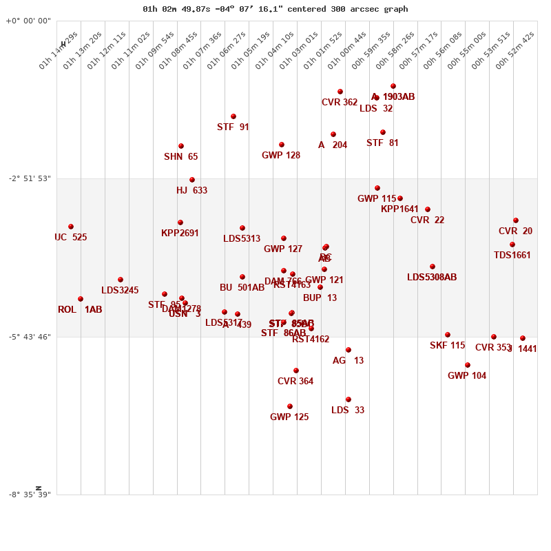
Click on the map to see the double of your interest.
Pass over with the mouse cursor to display the catalog designation.
|
| Show |
name |
coord_2000 |
discov# |
comp |
pa |
sep |
dist(') |
| Show |
|
01028-0407 |
GWP 120 |
AB |
322 |
123.3 |
1 |
| Show |
|
01028-0407 |
GWP 120 |
BC |
259 |
4.0 |
3 |
| Show |
|
01029-0430 |
GWP 121 |
|
299 |
58.9 |
24 |
| Show |
|
01048-0357 |
GWP 127 |
|
149 |
35.5 |
32 |
| Show |
|
01044-0436 |
RST4163 |
|
256 |
2.1 |
37 |
| Show |
|
01048-0432 |
DAM 766 |
|
261 |
6.6 |
39 |
| Show |
|
01030-0450 |
BUP 13 |
|
243 |
89.1 |
44 |
| Show |
|
01068-0345 |
LDS5313 |
|
118 |
171.6 |
63 |
| Show |
|
01068-0439 |
BU 501 |
AB |
28 |
2.6 |
67 |
| Show |
|
01044-0518 |
STF 85 |
AB |
159 |
37.0 |
75 |
| Show |
|
01044-0518 |
STF 85 |
AC |
122 |
38.1 |
75 |
| Show |
|
01003-0302 |
GWP 115 |
|
182 |
176.4 |
76 |
| Show |
|
01044-0518 |
STF 85 |
BC |
53 |
23.3 |
76 |
| Show |
|
00592-0314 |
KPP1641 |
|
2 |
12.6 |
77 |
| Show |
|
00578-0428 |
LDS5308 |
AB |
284 |
18.8 |
80 |
| Show |
|
00578-0428 |
KPP4346 |
AC |
10 |
2.9 |
80 |
| Show |
|
00579-0325 |
CVR 22 |
|
115 |
27.8 |
85 |
| Show |
|
01048-0528 |
STF 86 |
AB |
137 |
16.9 |
86 |
| Show |
|
01048-0528 |
BU 1356 |
AC |
37 |
107.5 |
86 |
| Show |
|
01035-0535 |
RST4162 |
|
191 |
6.0 |
89 |
| Show |
|
01070-0519 |
A 439 |
|
178 |
1.8 |
96 |
| Show |
|
01077-0516 |
LDS5317 |
|
325 |
16.2 |
100 |
| Show |
|
01097-0340 |
KPP2691 |
|
168 |
1.9 |
107 |
| Show |
|
01017-0559 |
AG 13 |
|
155 |
2.6 |
113 |
| Show |
|
01097-0502 |
DAM1278 |
|
77 |
10.8 |
116 |
| Show |
|
01095-0507 |
USN 3 |
|
134 |
7.9 |
117 |
| Show |
|
01096-0507 |
LDS9114 |
|
133 |
7.9 |
117 |
| Show |
|
01049-0215 |
GWP 128 |
|
341 |
6.1 |
117 |
| Show |
|
01092-0253 |
HJ 633 |
|
143 |
9.5 |
121 |
| Show |
|
01024-0203 |
A 204 |
|
232 |
1.2 |
124 |
| Show |
|
01105-0458 |
STF 95 |
|
311 |
14.0 |
126 |
| Show |
|
00570-0542 |
SKF 115 |
|
109 |
4.5 |
129 |
| Show |
|
01001-0201 |
STF 81 |
|
68 |
18.0 |
133 |
| Show |
|
00539-0403 |
TDS1661 |
|
289 |
1.9 |
134 |
| Show |
|
01042-0620 |
CVR 364 |
|
327 |
12.5 |
135 |
| Show |
|
00537-0337 |
CVR 20 |
|
302 |
7.2 |
140 |
| Show |
|
01126-0442 |
LDS3245 |
|
173 |
47.6 |
150 |
| Show |
|
01097-0216 |
SHN 65 |
|
-1 |
0.1 |
151 |
| Show |
|
00548-0544 |
CVR 353 |
|
185 |
10.8 |
155 |
| Show |
|
01072-0144 |
STF 91 |
|
314 |
4.3 |
158 |
| Show |
|
00560-0615 |
GWP 104 |
|
78 |
29.3 |
164 |
| Show |
|
01018-0652 |
LDS 33 |
|
153 |
30.0 |
167 |
| Show |
|
01003-0125 |
LDS 32 |
|
23 |
12.2 |
168 |
| Show |
|
01021-0117 |
CVR 362 |
|
289 |
13.4 |
171 |
| Show |
|
00534-0545 |
J 1441 |
|
335 |
7.8 |
172 |
| Show |
|
01045-0700 |
GWP 125 |
|
321 |
15.8 |
175 |
| Show |
|
00596-0111 |
A 1903 |
AB |
35 |
0.4 |
183 |
| Show |
|
00596-0111 |
A 1903 |
AB,C |
32 |
6.3 |
183 |
| Show |
|
01149-0344 |
UC 525 |
|
175 |
17.0 |
183 |
| Show |
|
01145-0503 |
ROL 1 |
AB |
271 |
60.2 |
183 |
| Show |
|
01145-0503 |
RGS 1 |
Aa,Ab |
342 |
0.5 |
183 |
|
|
WDS 01028-0407 : COMPONENTS
| |
A |
B |
| B |
pa=322.0°
sep=123.47"
| |
| C |
pa=320.4°
sep=125.36"
| pa=259.4°
sep=4.01"
|
01028-0407 A
| Coord arcsec 2000 |
010249.87-040716.1 |
|
Mag |
13.05 |
|
PmRA |
-1.00 |
|
PmDE |
-55.0 |
|
01028-0407 B
| Coord arcsec 2000 |
010244.79-040538.8 |
|
Coord calc |
010244.79-040538.8 |
|
Mag |
14.6 |
|
PmRA |
2.00 |
|
| PmDE |
-70.0 |
|
Calc delta mag |
1.55 |
|
01028-0407 C
| Coord arcsec 2000 |
010244.53-040539.5 |
|
Mag |
16 |
|
Calc delta mag |
2.95 |
|
Calc coord |
yes |
|