21099+3517 TDT 2797
21h 09m 56.45s +35° 17' 11.3" P.A. 143.00 sep 2.2 mag 10.67,12.11
| Coord 2000 |
21099+3517 |
|
Discov num |
TDT2797 |
|
Comp |
|
|
Coord arcsec 2000 |
21 09 56.45 +35 17 11.3 |
|
| Date first |
1991 |
|
Date last |
1991 |
|
Obs |
1 |
|
| Pa first |
143 |
|
Pa last |
142.7 |
|
P.A. Now (θ) |
142.7° |
|
| Sep first |
2.2 |
|
Sep last |
2.16 |
|
Sep. Now (ρ) |
2.16" |
|
| Mag pri |
10.67 |
|
Mag sec |
12.11 |
|
delta mag (ΔM) |
1.44 |
|
Spectral class |
|
|
| Pri motion ra |
+003 |
|
Sec motion ra |
+003 |
|
| Pri motion dec |
-018 |
|
Sec motion dec |
-018 |
|
| Notes |
|
|
Nature of this double is uncertain.
OTHER CATALOGS AND DESIGNATIONS
| Constellation |
Cygnus |
|
Tycho2 |
2710-02086-1 |
|
Gaia DR2 |
1867269506195502208 |
|
WDS 21099+3517 TDT 2797 : NOTES
No records found.
REFERENCES
No records found.
WDS HISTORIC DATA
| coord_2000 |
discov_num |
comp |
epoch |
obs |
pa |
sep |
mag_pri |
mag_sec |
spectr |
notes |
coord_arcsec_2000 |
| 21099+3517 |
TDT2797 |
|
1991 |
1 |
143 |
2.2 |
10.67 |
12.11 |
|
|
210956.45+351711.3 |
If you need more information about this double, apply for a
data request form to the WDS.
WDS 21099+3517 TDT 2797 : VISUAL OBSERVATIONS REPORTS
No records found.
WDS 21099+3517 TDT 2797 : MEASURES
No records found.
WDS 21099+3517 : VIRTUAL EYEPIECE

Click on the map to see the double of your interest.
Pass over with the mouse cursor to display the catalog designation.
|
|
WDS 21099+3517 : ALADIN DSS IMAGE @ 21h 09m 56.45s +35° 17' 11.3"
WDS 21099+3517 TDT 2797 : NEIGHBORHOODS
|
|
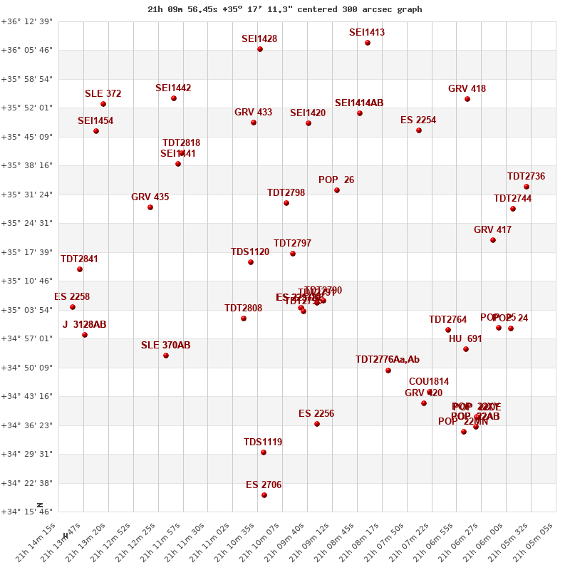
Click on the map to see the double of your interest.
Pass over with the mouse cursor to display the catalog designation.
|
| Show |
name |
coord_2000 |
discov# |
comp |
pa |
sep |
dist(') |
| Show |
|
21099+3517 |
TDT2797 |
|
143 |
2.2 |
|
| Show |
|
21107+3515 |
TDS1120 |
|
244 |
2.0 |
10 |
| Show |
|
21100+3529 |
TDT2798 |
|
51 |
0.8 |
13 |
| Show |
|
21095+3506 |
TDT2791 |
|
252 |
2.0 |
13 |
| Show |
|
21098+3504 |
ES 2257 |
AB |
268 |
15.2 |
13 |
| Show |
|
21098+3504 |
ES 2257 |
BC |
260 |
5.5 |
13 |
| Show |
|
21094+3506 |
TDT2790 |
|
118 |
0.4 |
14 |
| Show |
|
21097+3504 |
TDT2795 |
|
252 |
2.5 |
14 |
| Show |
|
21091+3531 |
POP 26 |
|
242 |
4.8 |
19 |
| Show |
|
21108+3502 |
TDT2808 |
|
215 |
2.8 |
20 |
| Show |
|
21096+3548 |
SEI1420 |
|
122 |
6.4 |
32 |
| Show |
|
21106+3548 |
GRV 433 |
|
345 |
73.4 |
33 |
| Show |
|
21121+3539 |
SEI1441 |
|
158 |
13.9 |
34 |
| Show |
|
21125+3528 |
GRV 435 |
|
206 |
61.8 |
34 |
| Show |
|
21120+3541 |
TDT2818 |
|
115 |
0.7 |
35 |
| Show |
|
21082+3449 |
TDT2776 |
Aa,Ab |
103 |
0.5 |
36 |
| Show |
|
21082+3449 |
ES 2255 |
AB |
249 |
5.0 |
36 |
| Show |
|
21087+3551 |
SEI1414 |
AB |
34 |
10.4 |
37 |
| Show |
|
21087+3551 |
TOB 211 |
AC |
355 |
23.5 |
37 |
| Show |
|
21123+3453 |
SLE 370 |
AB |
266 |
9.8 |
38 |
| Show |
|
21123+3453 |
SLE 370 |
AC |
199 |
16.2 |
38 |
| Show |
|
21071+3459 |
TDT2764 |
|
25 |
1.7 |
40 |
| Show |
|
21095+3437 |
ES 2256 |
|
102 |
4.7 |
41 |
| Show |
|
21076+3546 |
ES 2254 |
|
275 |
8.6 |
42 |
| Show |
|
21074+3444 |
COU1814 |
|
195 |
0.3 |
46 |
| Show |
|
21067+3455 |
HU 691 |
|
313 |
0.4 |
46 |
| Show |
|
21062+3520 |
GRV 417 |
|
143 |
41.2 |
46 |
| Show |
|
21121+3554 |
SEI1442 |
|
86 |
12.8 |
46 |
| Show |
|
21075+3441 |
GRV 420 |
|
145 |
22.3 |
47 |
| Show |
|
21105+3430 |
TDS1119 |
|
297 |
0.9 |
48 |
| Show |
|
21139+3513 |
TDT2841 |
|
302 |
1.9 |
49 |
| Show |
|
21105+3606 |
SEI1428 |
|
144 |
19.1 |
50 |
| Show |
|
21061+3459 |
POP 25 |
|
303 |
5.5 |
50 |
| Show |
|
21138+3500 |
J 3128 |
AB |
51 |
5.0 |
51 |
| Show |
|
21138+3500 |
J 3128 |
AC |
93 |
15.0 |
51 |
| Show |
|
21059+3528 |
TDT2744 |
|
36 |
0.6 |
51 |
| Show |
|
21140+3504 |
ES 2258 |
|
178 |
3.0 |
52 |
| Show |
|
21059+3459 |
POP 24 |
|
247 |
8.2 |
53 |
| Show |
|
21085+3608 |
SEI1413 |
|
111 |
29.6 |
54 |
| Show |
|
21136+3547 |
SEI1454 |
|
155 |
19.1 |
54 |
| Show |
|
21067+3554 |
GRV 418 |
|
216 |
58.1 |
54 |
| Show |
|
21056+3533 |
TDT2736 |
|
282 |
0.4 |
56 |
| Show |
|
21134+3553 |
SLE 372 |
|
59 |
11.1 |
56 |
| Show |
|
21066+3436 |
POP 22 |
XY |
352 |
6.1 |
58 |
| Show |
|
21066+3436 |
POP 22 |
DE |
283 |
7.9 |
58 |
| Show |
|
21066+3436 |
POP 22 |
MN |
272 |
8.9 |
58 |
| Show |
|
21105+3418 |
ES 2706 |
|
33 |
13.7 |
58 |
| Show |
|
21066+3436 |
POP 22 |
AB |
110 |
6.3 |
59 |
| Show |
|
21066+3436 |
POP 22 |
AC |
16 |
29.8 |
59 |
| Show |
|
21066+3436 |
POP 22 |
AD |
347 |
135.5 |
59 |
| Show |
|
21066+3436 |
POP 22 |
AF |
303 |
55.9 |
59 |
|
|
WDS 21099+3517 : COMPONENTS
21099+3517 A
| Componente originario normalizzato |
AB |
|
Coord arcsec 2000 |
210956.45+351711.3 |
|
Mag |
10.67 |
|
PmRA |
3.00 |
|
| PmDE |
-18.0 |
|
Tycho2 |
2710-02086-1 |
|
| Tycho2 |
2710-02086-1 |
|
Pflag |
|
|
RAmdeg |
317.48523136 |
|
DEmdeg |
35.28646766 |
|
| PmRA |
2.9 |
|
PmDE |
-18.4 |
|
E RAmdeg |
33 |
|
E DEmdeg |
35 |
|
| E pmRA |
4.3 |
|
E pmDE |
5.2 |
|
EpRAm |
1988.64 |
|
EpDEm |
1989.87 |
|
| Num |
4 |
|
Q RAmdeg |
1.8 |
|
Q DEmdeg |
0.2 |
|
Q pmRA |
1.9 |
|
| Q pmDE |
0.2 |
|
BTmag |
12.659 |
|
E BTmag |
0.179 |
|
VTmag |
10.682 |
|
| E VTmag |
0.045 |
|
Prox |
999 |
|
TYC |
T |
|
HIP |
|
|
| CCDM |
|
|
RAdeg |
317.48520917 |
|
DEdeg |
35.28651056 |
|
EpRA 1990 |
1.67 |
|
| EpDE 1990 |
1.71 |
|
E RAdeg |
38.7 |
|
E DEdeg |
37.7 |
|
Posflg |
|
|
| Corr |
0.1 |
|
21099+3517 B
| Componente originario normalizzato |
AB |
|
Coord arcsec 2000 |
210956.54+351709.6 |
|
Mag |
12.11 |
|
PmRA |
3.00 |
|
| PmDE |
-18.0 |
|
Calc delta mag |
1.44 |
|
Calc coord |
yes |
|