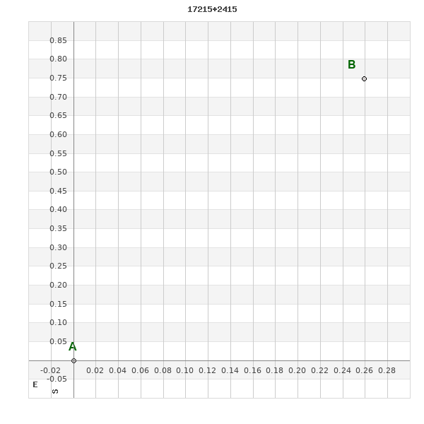
17215+2415 TDT 319
17h 21m 27.03s +24° 14' 36.4" P.A. 339.00 sep 0.8 mag 12.19,12.42
| Coord 2000 |
17215+2415 |
|
Discov num |
TDT 319 |
|
Comp |
|
|
Coord arcsec 2000 |
17 21 27.03 +24 14 36.4 |
|
| Date first |
1991 |
|
Date last |
1991 |
|
Obs |
1 |
|
| Pa first |
339 |
|
Pa last |
339.2 |
|
P.A. Now (θ) |
339.2° |
|
| Sep first |
0.8 |
|
Sep last |
0.8 |
|
Sep. Now (ρ) |
0.8" |
|
| Mag pri |
12.19 |
|
Mag sec |
12.42 |
|
delta mag (ΔM) |
0.23 |
|
Spectral class |
|
|
| Pri motion ra |
+003 |
|
Sec motion ra |
+003 |
|
| Pri motion dec |
+003 |
|
Sec motion dec |
+003 |
|
| Notes |
|
|
Nature of this double is uncertain.
OTHER CATALOGS AND DESIGNATIONS
| Constellation |
Hercules |
|
Tycho2 |
2074-00630-1 |
|
Gaia DR2 |
4570143862088528896 |
|
WDS 17215+2415 TDT 319 : NOTES
No records found.
REFERENCES
No records found.
WDS HISTORIC DATA
| coord_2000 |
discov_num |
comp |
epoch |
obs |
pa |
sep |
mag_pri |
mag_sec |
spectr |
notes |
coord_arcsec_2000 |
| 17215+2415 |
TDT 319 |
|
1991 |
1 |
339 |
0.8 |
12.19 |
12.42 |
|
|
172127.03+241436.4 |
If you need more information about this double, apply for a
data request form to the WDS.
WDS 17215+2415 TDT 319 : VISUAL OBSERVATIONS REPORTS
No records found.
WDS 17215+2415 TDT 319 : MEASURES
No records found.
WDS 17215+2415 : VIRTUAL EYEPIECE
Click on the map to see the double of your interest.
Pass over with the mouse cursor to display the catalog designation.
|
|
WDS 17215+2415 : ALADIN DSS IMAGE @ 17h 21m 27.03s +24° 14' 36.4"
WDS 17215+2415 TDT 319 : NEIGHBORHOODS
|
|
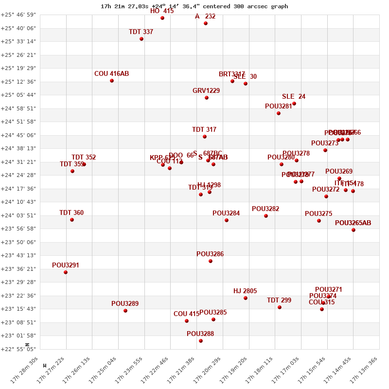
Click on the map to see the double of your interest.
Pass over with the mouse cursor to display the catalog designation.
|
| Show |
name |
coord_2000 |
discov# |
comp |
pa |
sep |
dist(') |
| Show |
|
17215+2415 |
TDT 319 |
|
339 |
0.8 |
|
| Show |
|
17210+2416 |
HJ 1298 |
|
229 |
9.5 |
6 |
| Show |
|
17209+2430 |
S 687 |
AB |
56 |
223.6 |
18 |
| Show |
|
17209+2430 |
GUI 41 |
AD |
223 |
221.7 |
18 |
| Show |
|
17209+2430 |
SLE 689 |
AE |
29 |
550.2 |
18 |
| Show |
|
17209+2430 |
S 687 |
AC |
20 |
240.3 |
18 |
| Show |
|
17209+2430 |
S 687 |
BC |
314 |
146.5 |
18 |
| Show |
|
17209+2429 |
DOO 66 |
|
16 |
9.9 |
21 |
| Show |
|
17203+2401 |
POU3284 |
|
300 |
11.0 |
21 |
| Show |
|
17228+2428 |
COU 112 |
|
23 |
1.4 |
23 |
| Show |
|
17231+2430 |
KPP 625 |
|
163 |
5.7 |
28 |
| Show |
|
17213+2444 |
TDT 317 |
|
146 |
0.6 |
30 |
| Show |
|
17211+2340 |
POU3286 |
|
8 |
15.1 |
35 |
| Show |
|
17185+2404 |
POU3282 |
|
99 |
14.2 |
41 |
| Show |
|
17212+2504 |
GRV1229 |
|
194 |
15.5 |
50 |
| Show |
|
17179+2430 |
POU3280 |
|
17 |
6.3 |
51 |
| Show |
|
17172+2421 |
POU3279 |
|
169 |
13.4 |
58 |
| Show |
|
17195+2321 |
HJ 2805 |
|
156 |
16.8 |
60 |
| Show |
|
17172+2433 |
POU3278 |
|
81 |
9.4 |
61 |
| Show |
|
17170+2421 |
POU3277 |
|
168 |
7.3 |
61 |
| Show |
|
17201+2513 |
BRT3317 |
|
61 |
6.7 |
62 |
| Show |
|
17180+2457 |
POU3281 |
|
229 |
15.9 |
63 |
| Show |
|
17195+2511 |
SLE 30 |
|
106 |
14.5 |
63 |
| Show |
|
17209+2310 |
POU3285 |
|
161 |
4.4 |
65 |
| Show |
|
17221+2310 |
COU 415 |
|
236 |
0.2 |
66 |
| Show |
|
17266+2430 |
TDT 352 |
|
348 |
0.6 |
72 |
| Show |
|
17162+2401 |
POU3275 |
|
85 |
8.8 |
73 |
| Show |
|
17174+2501 |
SLE 24 |
|
16 |
40.1 |
73 |
| Show |
|
17180+2317 |
TDT 299 |
|
14 |
1.4 |
75 |
| Show |
|
17248+2315 |
POU3289 |
|
236 |
6.1 |
76 |
| Show |
|
17214+2259 |
POU3288 |
|
70 |
3.3 |
76 |
| Show |
|
17159+2413 |
POU3272 |
|
211 |
7.2 |
76 |
| Show |
|
17160+2437 |
POU3273 |
|
252 |
8.4 |
78 |
| Show |
|
17271+2427 |
TDT 359 |
|
147 |
0.5 |
78 |
| Show |
|
17271+2402 |
TDT 360 |
|
179 |
0.7 |
79 |
| Show |
|
17254+2513 |
COU 416 |
AB |
150 |
2.2 |
79 |
| Show |
|
17153+2423 |
POU3269 |
|
132 |
11.6 |
84 |
| Show |
|
17151+2417 |
ITF 154 |
|
211 |
2.9 |
88 |
| Show |
|
17154+2442 |
POU3270 |
|
47 |
5.2 |
88 |
| Show |
|
17240+2534 |
TDT 337 |
|
202 |
0.6 |
88 |
| Show |
|
17212+2542 |
A 232 |
|
130 |
0.4 |
88 |
| Show |
|
17152+2443 |
POU3267 |
|
152 |
12.1 |
90 |
| Show |
|
17274+2335 |
POU3291 |
|
22 |
9.8 |
91 |
| Show |
|
17148+2416 |
ITF 178 |
|
142 |
2.0 |
92 |
| Show |
|
17150+2443 |
POU3266 |
|
90 |
11.1 |
93 |
| Show |
|
17161+2318 |
POU3274 |
|
297 |
9.3 |
93 |
| Show |
|
17158+2322 |
POU3271 |
|
259 |
3.3 |
94 |
| Show |
|
17231+2545 |
HO 415 |
|
345 |
0.9 |
94 |
| Show |
|
17148+2356 |
POU3265 |
AB |
170 |
3.9 |
94 |
| Show |
|
17148+2356 |
WSI 159 |
AC |
220 |
4.6 |
94 |
| Show |
|
17161+2316 |
COU 315 |
|
117 |
0.1 |
94 |
|
|
WDS 17215+2415 : COMPONENTS
17215+2415 A
| Componente originario normalizzato |
AB |
|
Coord arcsec 2000 |
172127.03+241436.4 |
|
Mag |
12.19 |
|
PmRA |
3.00 |
|
| PmDE |
3.0 |
|
Tycho2 |
2074-00630-1 |
|
| Tycho2 |
2074-00630-1 |
|
Pflag |
|
|
RAmdeg |
260.36259347 |
|
DEmdeg |
24.24351215 |
|
| PmRA |
3.3 |
|
PmDE |
2.9 |
|
E RAmdeg |
56 |
|
E DEmdeg |
42 |
|
| E pmRA |
2.0 |
|
E pmDE |
1.9 |
|
EpRAm |
1981.95 |
|
EpDEm |
1986.40 |
|
| Num |
3 |
|
Q RAmdeg |
0.4 |
|
Q DEmdeg |
1.9 |
|
Q pmRA |
0.3 |
|
| Q pmDE |
1.9 |
|
BTmag |
12.674 |
|
E BTmag |
0.152 |
|
VTmag |
11.619 |
|
| E VTmag |
0.080 |
|
Prox |
999 |
|
TYC |
|
|
HIP |
|
|
| CCDM |
|
|
RAdeg |
260.36258500 |
|
DEdeg |
24.24350583 |
|
EpRA 1990 |
1.40 |
|
| EpDE 1990 |
1.74 |
|
E RAdeg |
58.5 |
|
E DEdeg |
42.6 |
|
Posflg |
|
|
| Corr |
-0.1 |
|
17215+2415 B
| Componente originario normalizzato |
AB |
|
Coord arcsec 2000 |
172127.01+241437.1 |
|
Mag |
12.42 |
|
PmRA |
3.00 |
|
| PmDE |
3.0 |
|
Calc delta mag |
0.23 |
|
Calc coord |
yes |
|