10214-1452 RST 3691
10h 21m 22.56s -14° 51' 33.0" P.A. 263.00 sep 0.7 mag 10.61,11.11
| Coord 2000 |
10214-1452 |
|
Discov num |
RST3691 |
|
Comp |
|
|
Coord arcsec 2000 |
10 21 22.56 -14 51 33.0 |
|
| Date first |
1937 |
|
Date last |
1991 |
|
Obs |
5 |
|
| Pa first |
261 |
|
Pa last |
262.6 |
|
P.A. Now (θ) |
262.6° |
|
| Sep first |
0.8 |
|
Sep last |
0.69 |
|
Sep. Now (ρ) |
0.69" |
|
| Mag pri |
10.61 |
|
Mag sec |
11.11 |
|
delta mag (ΔM) |
0.5 |
|
Spectral class |
|
|
| Pri motion ra |
+013 |
|
Sec motion ra |
+013 |
|
| Pri motion dec |
-039 |
|
Sec motion dec |
-039 |
|
| Notes |
|
|
Nature of this double is uncertain.
OTHER CATALOGS AND DESIGNATIONS
| Constellation |
Hydra |
|
Tycho2 |
5496-01776-1 |
|
Gaia DR2 |
3752351023428249344 |
|
WDS 10214-1452 RST 3691 : NOTES
No records found.
REFERENCES
| refcode |
metd |
author |
reference |
| Rst1933 |
T - |
Rossiter, R.A. |
1933MmRAS..65...27R |
| Rst1933 |
|
MemRAS 65, 27, 1933 |
|
| Rst1937 |
Ma - |
Rossiter, R.A. |
1937MmRAS..65...51R |
| Rst1937 |
|
MemRAS 65, 51, 1937 |
|
| Rst1943 |
Ma - |
Rossiter, R.A. |
1943POMic...8..133R |
| Rst1943 |
|
Pub. Univ. Michigan Obs. 8, 133, 1943 |
|
| Rst1944 |
- |
Rossiter, R.A. |
1944POMic...9....1R |
| Rst1944 |
|
Pub. Univ. Michigan Obs. 9, 1, 1944 |
|
| Rst1947 |
Ma - |
Rossiter, R.A. |
1947POMic...9....7R |
| Rst1947 |
|
Pub. Univ. Michigan Obs. 9, 7, 1947 |
|
| Rst1955 |
Ma j |
Rossiter, R.A. |
1955POMic..11....1R |
| Rst1955 |
+P+ |
Pub. Univ. Michigan Obs. 11, 1, 1955 |
|
| Rst1964 |
Ma - |
Rossiter, R.A. |
1964POMic...9...73R |
| Rst1964 |
|
Pub. Univ. Michigan Obs. 9, 73, 1964 |
|
WDS HISTORIC DATA
| coord_2000 |
discov_num |
comp |
epoch |
obs |
pa |
sep |
mag_pri |
mag_sec |
spectr |
notes |
coord_arcsec_2000 |
| 10214-1452 |
RST3691 |
|
1991 |
5 |
263 |
0.7 |
10.61 |
11.11 |
|
|
102122.56-145133.0 |
If you need more information about this double, apply for a
data request form to the WDS.
WDS 10214-1452 RST 3691 : VISUAL OBSERVATIONS REPORTS
No records found.
WDS 10214-1452 RST 3691 : MEASURES
No records found.
WDS 10214-1452 : VIRTUAL EYEPIECE
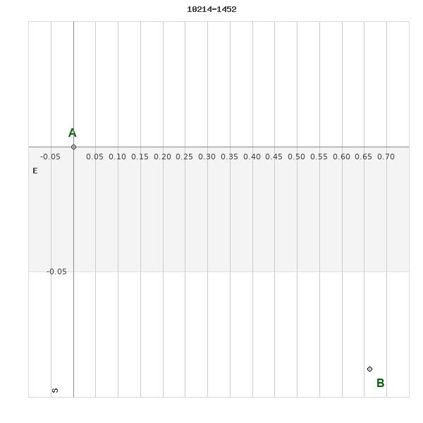
Click on the map to see the double of your interest.
Pass over with the mouse cursor to display the catalog designation.
|
|
WDS 10214-1452 : ALADIN DSS IMAGE @ 10h 21m 22.56s -14° 51' 33.0"
WDS 10214-1452 RST 3691 : NEIGHBORHOODS
|
|

Click on the map to see the double of your interest.
Pass over with the mouse cursor to display the catalog designation.
|
| Show |
name |
coord_2000 |
discov# |
comp |
pa |
sep |
dist(') |
| Show |
|
10214-1452 |
RST3691 |
|
263 |
0.7 |
|
| Show |
|
10228-1427 |
GWP1355 |
|
346 |
115.2 |
33 |
| Show |
|
10219-1419 |
RST3693 |
|
68 |
0.8 |
34 |
| Show |
|
10231-1525 |
GWP1356 |
|
108 |
45.2 |
42 |
| Show |
|
10183-1438 |
UC 1909 |
|
356 |
12.6 |
47 |
| Show |
|
10229-1535 |
TDS7231 |
|
285 |
1.7 |
49 |
| Show |
|
10254-1502 |
KPP2750 |
|
284 |
5.8 |
59 |
| Show |
|
10201-1356 |
TDS 580 |
|
108 |
5.7 |
60 |
| Show |
|
10202-1352 |
RST3690 |
|
41 |
1.7 |
63 |
| Show |
|
10174-1424 |
HJ 831 |
|
129 |
16.9 |
64 |
| Show |
|
10201-1346 |
DAM2301 |
|
123 |
12.2 |
69 |
| Show |
|
10223-1341 |
BU 912 |
|
103 |
1.3 |
73 |
| Show |
|
10233-1603 |
GWP1358 |
|
205 |
86.7 |
77 |
| Show |
|
10234-1614 |
TDS7236 |
|
92 |
0.4 |
88 |
| Show |
|
10215-1621 |
LDS3984 |
|
297 |
24.9 |
91 |
| Show |
|
10206-1621 |
HLD 103 |
|
343 |
1.7 |
91 |
| Show |
|
10276-1506 |
RST3698 |
|
273 |
1.1 |
91 |
| Show |
|
10233-1323 |
HJ 4311 |
|
119 |
4.7 |
94 |
| Show |
|
10183-1321 |
J 2900 |
|
26 |
3.1 |
102 |
| Show |
|
10284-1517 |
GWP1380 |
|
63 |
57.1 |
105 |
| Show |
|
10265-1608 |
BRT 577 |
|
222 |
4.5 |
105 |
| Show |
|
10286-1437 |
GWP1382 |
|
308 |
108.5 |
107 |
| Show |
|
10140-1429 |
GWP1314 |
|
65 |
45.2 |
110 |
| Show |
|
10206-1643 |
HLD 104 |
AB |
197 |
3.4 |
113 |
| Show |
|
10206-1643 |
HLD 104 |
AC |
271 |
152.4 |
113 |
| Show |
|
10265-1623 |
BRT 576 |
|
254 |
4.6 |
117 |
| Show |
|
10296-1504 |
RST3700 |
|
118 |
1.3 |
120 |
| Show |
|
10146-1333 |
CBL 133 |
|
178 |
28.7 |
126 |
| Show |
|
10149-1328 |
GWP1327 |
|
79 |
111.4 |
126 |
| Show |
|
10142-1615 |
GWP1317 |
|
117 |
91.2 |
134 |
| Show |
|
10253-1250 |
GWP1366 |
|
44 |
23.9 |
135 |
| Show |
|
10118-1511 |
DAM2121 |
|
293 |
32.6 |
141 |
| Show |
|
10267-1652 |
LDS3988 |
|
54 |
3.3 |
142 |
| Show |
|
10116-1503 |
RST3685 |
|
97 |
0.5 |
143 |
| Show |
|
10193-1232 |
RST3688 |
|
143 |
0.5 |
144 |
| Show |
|
10236-1229 |
TOK 275 |
|
239 |
59.9 |
146 |
| Show |
|
10297-1327 |
GWP1387 |
|
108 |
24.0 |
148 |
| Show |
|
10123-1605 |
STF1416 |
|
277 |
11.5 |
151 |
| Show |
|
10236-1721 |
UC 1922 |
BC |
38 |
46.4 |
153 |
| Show |
|
10236-1721 |
GWP1359 |
AB |
294 |
34.0 |
153 |
| Show |
|
10236-1721 |
UC 1922 |
AC |
|
50.5 |
153 |
| Show |
|
10319-1423 |
KPP3821 |
|
320 |
1.7 |
156 |
| Show |
|
10163-1711 |
CBL 135 |
|
283 |
41.7 |
158 |
| Show |
|
10102-1438 |
HJ 830 |
|
46 |
6.7 |
164 |
| Show |
|
10149-1238 |
DAM2179 |
|
138 |
13.3 |
164 |
| Show |
|
10212-1736 |
TOK 839 |
|
110 |
1.1 |
165 |
| Show |
|
10180-1734 |
DAM2263 |
|
225 |
1.9 |
170 |
| Show |
|
10098-1424 |
NSN 125 |
|
83 |
5.6 |
171 |
| Show |
|
10143-1235 |
HDS1475 |
|
14 |
0.4 |
171 |
| Show |
|
10211-1744 |
TOK 890 |
|
252 |
0.6 |
173 |
| Show |
|
10266-1728 |
GWP1373 |
|
251 |
97.5 |
174 |
|
|
WDS 10214-1452 : COMPONENTS
10214-1452 A
| Componente originario normalizzato |
AB |
|
Coord arcsec 2000 |
102122.56-145133.0 |
|
Mag |
10.61 |
|
PmRA |
13.00 |
|
| PmDE |
-39.0 |
|
Tycho2 |
5496-01776-1 |
|
| Tycho2 |
5496-01776-1 |
|
Pflag |
|
|
RAmdeg |
155.34392976 |
|
DEmdeg |
-14.85916080 |
|
| PmRA |
12.8 |
|
PmDE |
-38.8 |
|
E RAmdeg |
19 |
|
E DEmdeg |
23 |
|
| E pmRA |
1.5 |
|
E pmDE |
1.5 |
|
EpRAm |
1984.50 |
|
EpDEm |
1982.49 |
|
| Num |
6 |
|
Q RAmdeg |
1.7 |
|
Q DEmdeg |
1.2 |
|
Q pmRA |
1.6 |
|
| Q pmDE |
1.3 |
|
BTmag |
10.936 |
|
E BTmag |
0.053 |
|
VTmag |
10.206 |
|
| E VTmag |
0.040 |
|
Prox |
688 |
|
TYC |
T |
|
HIP |
|
|
| CCDM |
|
|
RAdeg |
155.34390972 |
|
DEdeg |
-14.85906750 |
|
EpRA 1990 |
1.71 |
|
| EpDE 1990 |
1.48 |
|
E RAdeg |
25.2 |
|
E DEdeg |
31.4 |
|
Posflg |
P |
|
| Corr |
0.2 |
|
| Ccdm |
10214-1452 |
|
RComp |
|
|
Comp |
A |
|
Note1 |
|
|
| Note2 |
|
|
Discov num |
|
|
DRAs |
-1.51 |
|
DDEs |
27.8 |
|
| R dRAs |
66 |
|
Year |
|
|
Theta |
|
|
Rho |
|
|
| Obs |
2 |
|
Vmag |
10.0 |
|
Sp |
|
|
PmNote |
|
|
| PmRA |
|
|
PmDE |
|
|
Dm number |
-14 3096 |
|
Cat1 |
BD |
|
| Name2 |
|
|
Cat2 |
|
|
HD |
|
|
M HD |
|
|
| ADS BDS |
|
|
M ADS BDS |
|
|
N IDS |
|
|
IDS |
10165S1421A |
|
| HIC |
|
|
10214-1452 B
| Componente originario normalizzato |
AB |
|
Coord arcsec 2000 |
102122.51-145133.1 |
|
Mag |
11.11 |
|
PmRA |
13.00 |
|
| PmDE |
-39.0 |
|
Calc delta mag |
0.5 |
|
Calc coord |
yes |
|
| Ccdm |
10214-1452 |
|
RComp |
|
|
Comp |
B |
|
Note1 |
|
|
| Note2 |
|
|
Discov num |
RST3691 |
|
DRAs |
|
|
DDEs |
|
|
| R dRAs |
|
|
Year |
1937 |
|
Theta |
260 |
|
Rho |
0.8 |
|
| Obs |
2 |
|
Vmag |
11.0 |
|
Sp |
|
|
PmNote |
|
|
| PmRA |
|
|
PmDE |
|
|
Dm number |
|
|
Cat1 |
|
|
| Name2 |
|
|
Cat2 |
|
|
HD |
|
|
M HD |
|
|
| ADS BDS |
|
|
M ADS BDS |
|
|
N IDS |
|
|
IDS |
10165S1421B |
|
| HIC |
|
|