10055-0535 RST 4449
10h 05m 27.21s -05° 34' 41.3" P.A. 294.00 sep 0.4 mag 10.80,10.80 Sp G2
| Coord 2000 |
10055-0535 |
|
Discov num |
RST4449 |
|
Comp |
|
|
Coord arcsec 2000 |
10 05 27.21 -05 34 41.3 |
|
| Date first |
1940 |
|
Date last |
1977 |
|
Obs |
6 |
|
| Pa first |
317 |
|
Pa last |
293.5 |
|
P.A. Now (θ) |
293.5° |
|
| Sep first |
0.4 |
|
Sep last |
0.41 |
|
Sep. Now (ρ) |
0.41" |
|
| Mag pri |
10.80 |
|
Mag sec |
10.80 |
|
delta mag (ΔM) |
0 |
|
Spectral class |
G2 (yellow) |
|
| Pri motion ra |
-052 |
|
Sec motion ra |
|
|
| Pri motion dec |
+009 |
|
Sec motion dec |
|
|
| Notes |
|
|
Nature of this double is uncertain.
OTHER CATALOGS AND DESIGNATIONS
| Constellation |
Sextans |
|
Tycho2 |
4909-00780-1 |
|
WDS 10055-0535 RST 4449 : NOTES
No records found.
REFERENCES
| refcode |
metd |
author |
reference |
| Rst1933 |
T - |
Rossiter, R.A. |
1933MmRAS..65...27R |
| Rst1933 |
|
MemRAS 65, 27, 1933 |
|
| Rst1937 |
Ma - |
Rossiter, R.A. |
1937MmRAS..65...51R |
| Rst1937 |
|
MemRAS 65, 51, 1937 |
|
| Rst1943 |
Ma - |
Rossiter, R.A. |
1943POMic...8..133R |
| Rst1943 |
|
Pub. Univ. Michigan Obs. 8, 133, 1943 |
|
| Rst1944 |
- |
Rossiter, R.A. |
1944POMic...9....1R |
| Rst1944 |
|
Pub. Univ. Michigan Obs. 9, 1, 1944 |
|
| Rst1947 |
Ma - |
Rossiter, R.A. |
1947POMic...9....7R |
| Rst1947 |
|
Pub. Univ. Michigan Obs. 9, 7, 1947 |
|
| Rst1955 |
Ma j |
Rossiter, R.A. |
1955POMic..11....1R |
| Rst1955 |
+P+ |
Pub. Univ. Michigan Obs. 11, 1, 1955 |
|
| Rst1964 |
Ma - |
Rossiter, R.A. |
1964POMic...9...73R |
| Rst1964 |
|
Pub. Univ. Michigan Obs. 9, 73, 1964 |
|
WDS HISTORIC DATA
| coord_2000 |
discov_num |
comp |
epoch |
obs |
pa |
sep |
mag_pri |
mag_sec |
spectr |
notes |
coord_arcsec_2000 |
| 10055-0535 |
RST4449 |
|
1977 |
6 |
294 |
0.4 |
10.80 |
10.80 |
G2 |
|
100527.21-053441.3 |
If you need more information about this double, apply for a
data request form to the WDS.
WDS 10055-0535 RST 4449 : VISUAL OBSERVATIONS REPORTS
No records found.
WDS 10055-0535 RST 4449 : MEASURES
No records found.
WDS 10055-0535 : VIRTUAL EYEPIECE
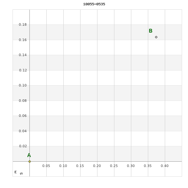
Click on the map to see the double of your interest.
Pass over with the mouse cursor to display the catalog designation.
|
|
WDS 10055-0535 : ALADIN DSS IMAGE @ 10h 05m 27.21s -05° 34' 41.3"
WDS 10055-0535 RST 4449 : NEIGHBORHOODS
|
|

Click on the map to see the double of your interest.
Pass over with the mouse cursor to display the catalog designation.
|
| Show |
name |
coord_2000 |
discov# |
comp |
pa |
sep |
dist(') |
| Show |
|
10055-0535 |
RST4449 |
|
294 |
0.4 |
|
| Show |
|
10050-0540 |
HJ 150 |
|
311 |
12.7 |
9 |
| Show |
|
10066-0519 |
GWP1293 |
|
48 |
87.1 |
23 |
| Show |
|
10036-0600 |
RST4448 |
|
174 |
1.7 |
38 |
| Show |
|
10032-0557 |
GWP1278 |
|
292 |
6.8 |
41 |
| Show |
|
10043-0458 |
GWP1285 |
|
41 |
88.2 |
41 |
| Show |
|
10029-0556 |
A 64 |
AB |
344 |
1.5 |
44 |
| Show |
|
10029-0556 |
DAM 716 |
AB,C |
334 |
48.9 |
44 |
| Show |
|
10063-0626 |
GWP1289 |
|
357 |
558.7 |
54 |
| Show |
|
10021-0613 |
UC 1868 |
|
287 |
39.8 |
63 |
| Show |
|
10017-0606 |
RST4446 |
|
336 |
1.5 |
65 |
| Show |
|
10042-0426 |
GWP1284 |
|
183 |
51.5 |
72 |
| Show |
|
10098-0502 |
GWP1304 |
|
338 |
20.7 |
73 |
| Show |
|
10077-0644 |
GWP1297 |
|
166 |
50.4 |
77 |
| Show |
|
10032-0658 |
GWP1277 |
|
289 |
19.3 |
90 |
| Show |
|
10100-0637 |
A 2980 |
|
180 |
0.8 |
92 |
| Show |
|
09594-0457 |
GWP1265 |
|
259 |
98.0 |
99 |
| Show |
|
10010-0651 |
GWP1270 |
|
92 |
11.7 |
102 |
| Show |
|
10002-0642 |
A 555 |
|
204 |
0.6 |
104 |
| Show |
|
10116-0447 |
GWP1311 |
|
23 |
11.9 |
104 |
| Show |
|
10009-0416 |
RST4445 |
|
113 |
0.2 |
104 |
| Show |
|
10120-0612 |
HO 44 |
|
201 |
0.7 |
105 |
| Show |
|
10114-0642 |
GWP1310 |
|
335 |
35.4 |
111 |
| Show |
|
09581-0554 |
GWP1260 |
|
322 |
26.7 |
111 |
| Show |
|
10130-0548 |
OL 159 |
|
192 |
1.9 |
114 |
| Show |
|
09582-0454 |
GWP1261 |
|
237 |
22.2 |
117 |
| Show |
|
10133-0601 |
DEA 74 |
|
246 |
14.1 |
121 |
| Show |
|
09578-0611 |
GWP1258 |
|
112 |
20.3 |
121 |
| Show |
|
10132-0607 |
DAM2144 |
|
309 |
7.9 |
121 |
| Show |
|
10057-0333 |
J 2073 |
|
320 |
7.6 |
122 |
| Show |
|
10035-0335 |
DAM1974 |
|
203 |
6.5 |
124 |
| Show |
|
10036-0329 |
HDS1453 |
|
345 |
0.2 |
129 |
| Show |
|
09571-0627 |
UC 1849 |
|
190 |
48.2 |
135 |
| Show |
|
10090-0741 |
GWP1302 |
|
293 |
34.1 |
138 |
| Show |
|
10004-0731 |
RST3673 |
|
170 |
0.4 |
139 |
| Show |
|
10056-0307 |
RST4922 |
|
17 |
0.6 |
147 |
| Show |
|
10150-0625 |
J 1563 |
|
4 |
10.0 |
151 |
| Show |
|
09599-0327 |
HJ 148 |
|
38 |
6.9 |
153 |
| Show |
|
10158-0541 |
GWP1330 |
|
94 |
10.4 |
155 |
| Show |
|
09574-0355 |
A 63 |
|
13 |
1.6 |
157 |
| Show |
|
09554-0448 |
HJ 146 |
|
110 |
18.7 |
157 |
| Show |
|
10092-0307 |
UC 1884 |
|
182 |
52.5 |
158 |
| Show |
|
10141-0401 |
GWP1316 |
|
56 |
117.0 |
160 |
| Show |
|
10086-0807 |
XMI 96 |
|
277 |
25.4 |
160 |
| Show |
|
09547-0525 |
LDS 291 |
|
284 |
14.9 |
161 |
| Show |
|
10159-0613 |
GWP1332 |
|
171 |
59.9 |
162 |
| Show |
|
10083-0812 |
XMI 95 |
|
148 |
22.9 |
164 |
| Show |
|
10159-0625 |
J 3320 |
|
108 |
6.2 |
164 |
| Show |
|
10137-0723 |
TOK 133 |
|
168 |
8.7 |
165 |
| Show |
|
10029-0255 |
HJ 827 |
|
98 |
1.4 |
165 |
| Show |
|
10165-0521 |
WSI 115 |
|
195 |
3.2 |
166 |
|
|
WDS 10055-0535 : COMPONENTS
10055-0535 A
| Componente originario normalizzato |
AB |
|
Coord arcsec 2000 |
100527.21-053441.3 |
|
Mag |
10.8 |
|
Spectral class |
G2 (yellow) |
|
| PmRA |
-52.00 |
|
PmDE |
9.0 |
|
Tycho2 |
4909-00780-1 |
|
| Tycho2 |
4909-00780-1 |
|
Pflag |
|
|
RAmdeg |
151.36337022 |
|
DEmdeg |
-5.57816513 |
|
| PmRA |
-42.2 |
|
PmDE |
8.5 |
|
E RAmdeg |
21 |
|
E DEmdeg |
22 |
|
| E pmRA |
1.5 |
|
E pmDE |
1.4 |
|
EpRAm |
1985.53 |
|
EpDEm |
1982.86 |
|
| Num |
8 |
|
Q RAmdeg |
1.1 |
|
Q DEmdeg |
1.5 |
|
Q pmRA |
1.1 |
|
| Q pmDE |
1.5 |
|
BTmag |
10.675 |
|
E BTmag |
0.048 |
|
VTmag |
10.049 |
|
| E VTmag |
0.040 |
|
Prox |
999 |
|
TYC |
T |
|
HIP |
|
|
| CCDM |
|
|
RAdeg |
151.36347111 |
|
DEdeg |
-5.57818083 |
|
EpRA 1990 |
1.68 |
|
| EpDE 1990 |
1.51 |
|
E RAdeg |
26.5 |
|
E DEdeg |
28.6 |
|
Posflg |
|
|
| Corr |
0.1 |
|
| Ccdm |
10055-0535 |
|
RComp |
|
|
Comp |
A |
|
Note1 |
|
|
| Note2 |
|
|
Discov num |
|
|
DRAs |
-2.99 |
|
DDEs |
18.6 |
|
| R dRAs |
10 |
|
Year |
|
|
Theta |
|
|
Rho |
|
|
| Obs |
2 |
|
Vmag |
10.2 |
|
Sp |
G2 |
|
PmNote |
* |
|
| PmRA |
-76 |
|
PmDE |
9 |
|
Dm number |
-04 2794 |
|
Cat1 |
BD |
|
| Name2 |
137345 |
|
Cat2 |
SAO |
|
HD |
|
|
M HD |
|
|
| ADS BDS |
|
|
M ADS BDS |
|
|
N IDS |
|
|
IDS |
10004S0506A |
|
| HIC |
|
|
10055-0535 B
| Componente originario normalizzato |
AB |
|
Coord arcsec 2000 |
100527.18-053441.1 |
|
Mag |
10.8 |
|
Calc coord |
yes |
|
| Ccdm |
10055-0535 |
|
RComp |
|
|
Comp |
B |
|
Note1 |
|
|
| Note2 |
|
|
Discov num |
RST4449 |
|
DRAs |
|
|
DDEs |
|
|
| R dRAs |
|
|
Year |
1939 |
|
Theta |
317 |
|
Rho |
0.4 |
|
| Obs |
2 |
|
Vmag |
10.2 |
|
Sp |
|
|
PmNote |
|
|
| PmRA |
|
|
PmDE |
|
|
Dm number |
|
|
Cat1 |
|
|
| Name2 |
|
|
Cat2 |
|
|
HD |
|
|
M HD |
|
|
| ADS BDS |
|
|
M ADS BDS |
|
|
N IDS |
|
|
IDS |
10004S0506B |
|
| HIC |
|
|